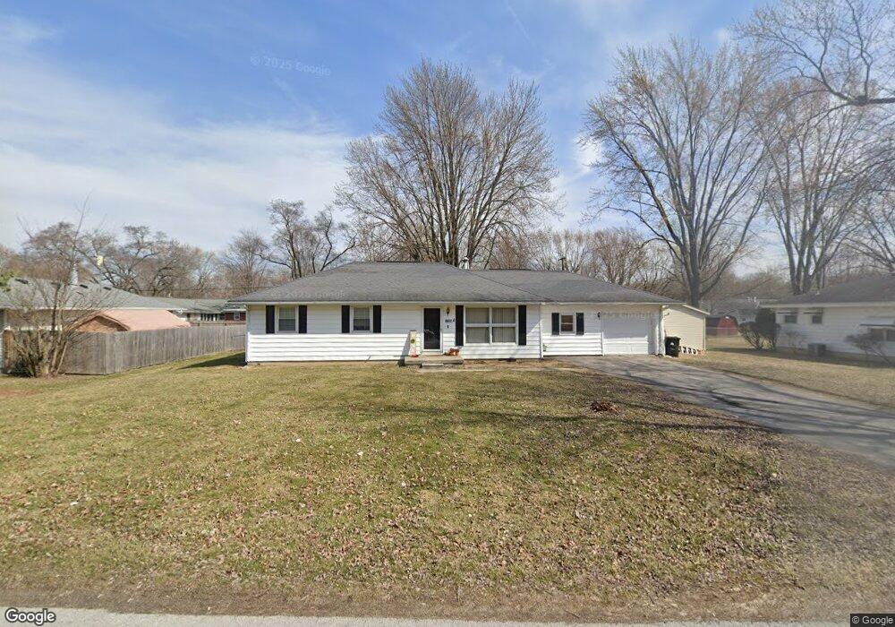
1709 Brookside Dr Findlay, OH 45840
Estimated Value: $194,729 - $218,000
3
Beds
2
Baths
1,644
Sq Ft
$126/Sq Ft
Est. Value
About This Home
This home is located at 1709 Brookside Dr, Findlay, OH 45840 and is currently estimated at $206,432, approximately $125 per square foot. 1709 Brookside Dr is a home located in Hancock County with nearby schools including Jefferson Elementary School, Chamberlin Hill Elementary School, and Donnell Middle School.
Ownership History
Date
Name
Owned For
Owner Type
Purchase Details
Closed on
May 2, 2012
Sold by
Federal National Mortgage Association
Bought by
Alge Jason and Alge Amanda
Current Estimated Value
Purchase Details
Closed on
Nov 16, 2011
Sold by
Smith Kathy J
Bought by
Federal National Mortgage Association
Purchase Details
Closed on
Jul 9, 2004
Sold by
Leass Earl Joseph and Leass Pamela R
Bought by
Smith Scott W and Smith Kathy J
Home Financials for this Owner
Home Financials are based on the most recent Mortgage that was taken out on this home.
Original Mortgage
$106,000
Interest Rate
6.39%
Mortgage Type
Purchase Money Mortgage
Purchase Details
Closed on
Apr 28, 1993
Bought by
Leass Earl Joseph and Leass Pamela
Create a Home Valuation Report for This Property
The Home Valuation Report is an in-depth analysis detailing your home's value as well as a comparison with similar homes in the area
Home Values in the Area
Average Home Value in this Area
Purchase History
| Date | Buyer | Sale Price | Title Company |
|---|---|---|---|
| Alge Jason | $29,000 | Assured Title Agency Inc | |
| Federal National Mortgage Association | $32,000 | None Available | |
| Smith Scott W | $106,000 | Assured Title | |
| Leass Earl Joseph | -- | -- |
Source: Public Records
Mortgage History
| Date | Status | Borrower | Loan Amount |
|---|---|---|---|
| Previous Owner | Smith Scott W | $106,000 |
Source: Public Records
Tax History
| Year | Tax Paid | Tax Assessment Tax Assessment Total Assessment is a certain percentage of the fair market value that is determined by local assessors to be the total taxable value of land and additions on the property. | Land | Improvement |
|---|---|---|---|---|
| 2024 | $1,662 | $45,600 | $7,910 | $37,690 |
| 2023 | $1,665 | $45,600 | $7,910 | $37,690 |
| 2022 | $1,659 | $45,600 | $7,910 | $37,690 |
| 2021 | $1,481 | $35,450 | $7,910 | $27,540 |
| 2020 | $1,481 | $35,450 | $7,910 | $27,540 |
| 2019 | $1,451 | $35,450 | $7,910 | $27,540 |
| 2018 | $1,426 | $31,910 | $7,910 | $24,000 |
| 2017 | $1,425 | $31,910 | $7,910 | $24,000 |
| 2016 | $1,413 | $31,910 | $7,910 | $24,000 |
| 2015 | $1,167 | $25,950 | $9,210 | $16,740 |
| 2014 | $1,167 | $25,950 | $9,210 | $16,740 |
| 2012 | $1,703 | $37,560 | $9,210 | $28,350 |
Source: Public Records
Map
Nearby Homes
- 1726 Eastview Dr
- 1709 Eastview Dr
- 731 5th St
- 1100 Stall Dr
- 0 Blanchard Ave
- 331 Fairlawn Place
- 315 Fairlawn Place
- 242 E Yates Ave
- 209 E Hobart Ave
- 1037 Fishlock Ave
- 136 E Hobart Ave
- 206 Greenlawn Ave
- 225 E Yates Ave
- 1200 1st St
- 0 Township Road 227
- 123 Glendale Ave
- 15591 Canadian Way
- 15586 Canadian Way
- 15615 Canadian Way
- 216 1st St
- 1715 Brookside Dr
- 1701 Brookside Dr
- 1708 Westview Dr
- 1714 Westview Dr
- 1700 Westview Dr
- 1721 Brookside Dr
- 1720 Westview Dr
- 9 Brookside Dr
- 1651 Brookside Dr
- 1650 Westview Dr
- 1726 Westview Dr
- 1709 Westview Dr
- 1701 Westview Dr
- 1715 Westview Dr
- 1638 Westview Dr
- 1801 Brookside Dr
- 1721 Westview Dr
- 1800 Westview Dr
- 1627 Brookside Dr
- 1651 Westview Dr
Your Personal Tour Guide
Ask me questions while you tour the home.