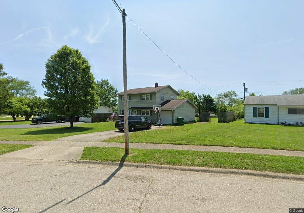
1709 Fernmont Dr New Carlisle, OH 45344
Estimated Value: $169,000 - $225,000
4
Beds
2
Baths
1,550
Sq Ft
$126/Sq Ft
Est. Value
About This Home
This home is located at 1709 Fernmont Dr, New Carlisle, OH 45344 and is currently estimated at $194,633, approximately $125 per square foot. 1709 Fernmont Dr is a home located in Clark County with nearby schools including Park Layne Elementary School, New Carlisle Elementary School, and Donnelsville Elementary School.
Ownership History
Date
Name
Owned For
Owner Type
Purchase Details
Closed on
May 9, 2022
Sold by
Potts Mirinda K
Bought by
Potts Mirinda K
Current Estimated Value
Home Financials for this Owner
Home Financials are based on the most recent Mortgage that was taken out on this home.
Original Mortgage
$90,000
Interest Rate
5%
Mortgage Type
New Conventional
Purchase Details
Closed on
Sep 12, 2007
Sold by
Mitchell Wilmer B and Mitchell Teena K
Bought by
Potts Mirinda K and Potts Ernest G
Home Financials for this Owner
Home Financials are based on the most recent Mortgage that was taken out on this home.
Original Mortgage
$90,578
Interest Rate
6.63%
Mortgage Type
FHA
Purchase Details
Closed on
Mar 1, 1984
Sold by
Layne Howard L and Josephine C
Bought by
Mitchell Wilmer B and Mitchell Teena K
Create a Home Valuation Report for This Property
The Home Valuation Report is an in-depth analysis detailing your home's value as well as a comparison with similar homes in the area
Home Values in the Area
Average Home Value in this Area
Purchase History
| Date | Buyer | Sale Price | Title Company |
|---|---|---|---|
| Potts Mirinda K | -- | Bc Law Firm Pa | |
| Potts Mirinda K | $92,000 | Nordic Title Agency Ltd | |
| Mitchell Wilmer B | $18,000 | -- |
Source: Public Records
Mortgage History
| Date | Status | Borrower | Loan Amount |
|---|---|---|---|
| Previous Owner | Potts Mirinda K | $90,000 | |
| Previous Owner | Potts Mirinda K | $90,578 |
Source: Public Records
Tax History Compared to Growth
Tax History
| Year | Tax Paid | Tax Assessment Tax Assessment Total Assessment is a certain percentage of the fair market value that is determined by local assessors to be the total taxable value of land and additions on the property. | Land | Improvement |
|---|---|---|---|---|
| 2024 | $2,056 | $43,270 | $8,770 | $34,500 |
| 2023 | $2,056 | $43,270 | $8,770 | $34,500 |
| 2022 | $2,069 | $43,270 | $8,770 | $34,500 |
| 2021 | $1,672 | $31,490 | $6,700 | $24,790 |
| 2020 | $1,676 | $31,490 | $6,700 | $24,790 |
| 2019 | $1,664 | $31,490 | $6,700 | $24,790 |
| 2018 | $1,449 | $25,250 | $6,520 | $18,730 |
| 2017 | $1,440 | $29,544 | $6,517 | $23,027 |
| 2016 | $1,380 | $29,544 | $6,517 | $23,027 |
| 2015 | $1,416 | $28,907 | $6,090 | $22,817 |
| 2014 | $1,408 | $28,907 | $6,090 | $22,817 |
| 2013 | $1,411 | $28,907 | $6,090 | $22,817 |
Source: Public Records
Map
Nearby Homes
- 1689 Dale Ridge Rd
- 1616 Styer Dr
- 842 Edgewick Rd
- 510 Bowser Dr
- 1215 Chalet Dr
- 1124 Burket Dr
- 1210 Campbell Ave
- 1143 Bookwalter Ave
- 1115 Frayne Dr
- 1190 Shirra Ave
- 956 Styer Dr
- 429 Tulip Rd
- 423 Sycamore Rd
- 216 Braun St
- 522 Caldwell Cir
- 326 Kennedy Dr
- 870 Corvette Ave
- 851 Corvette Ave
- 518 Beach Dr
- 0 N Dayton-Lakeview Rd Unit 944532
- 1717 Fernmont Dr
- 1683 Dale Ridge Rd
- 1732 Styer Dr
- 1723 Fernmont Dr
- 1740 Styer Dr
- 1724 Styer Dr
- 1707 Dale Ridge Rd
- 1746 Styer Dr
- 1720 Fernmont Dr
- 1718 Styer Dr
- 1677 Dale Ridge Rd
- 1729 Fernmont Dr
- 1754 Styer Dr
- 1686 Dale Ridge Rd
- 1728 Fernmont Dr
- 1700 Dale Ridge Rd
- 1710 Styer Dr
- 1719 Dale Ridge Rd
- 1671 Dale Ridge Rd
- 1706 Dale Ridge Rd