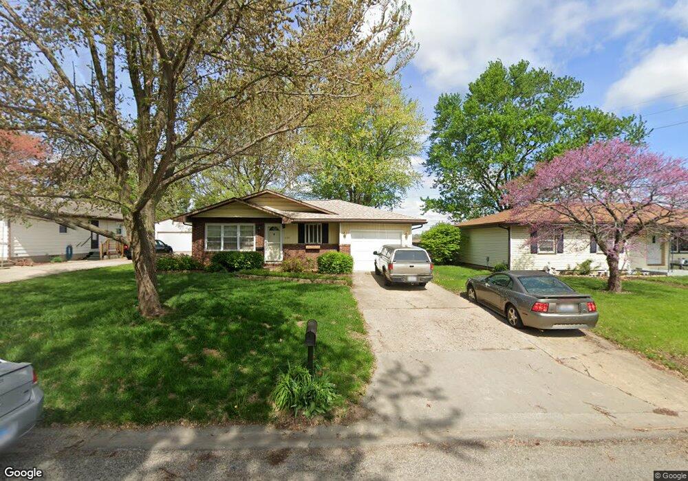
1709 Rutledge Dr Lincoln, IL 62656
Estimated Value: $130,000 - $160,000
3
Beds
--
Bath
1,040
Sq Ft
$139/Sq Ft
Est. Value
About This Home
This home is located at 1709 Rutledge Dr, Lincoln, IL 62656 and is currently estimated at $144,291, approximately $138 per square foot. 1709 Rutledge Dr is a home located in Logan County with nearby schools including Adams Elementary School, Central Elementary School, and Lincoln Junior High School.
Ownership History
Date
Name
Owned For
Owner Type
Purchase Details
Closed on
Aug 30, 2019
Sold by
Hellrung Karly
Bought by
Huskins Bruce J
Current Estimated Value
Home Financials for this Owner
Home Financials are based on the most recent Mortgage that was taken out on this home.
Original Mortgage
$100,000
Outstanding Balance
$87,771
Interest Rate
3.7%
Mortgage Type
New Conventional
Estimated Equity
$56,520
Purchase Details
Closed on
Sep 14, 2010
Sold by
Bruns Aaron J
Bought by
Hellrung Karly
Home Financials for this Owner
Home Financials are based on the most recent Mortgage that was taken out on this home.
Original Mortgage
$76,000
Interest Rate
4.42%
Mortgage Type
Stand Alone First
Create a Home Valuation Report for This Property
The Home Valuation Report is an in-depth analysis detailing your home's value as well as a comparison with similar homes in the area
Home Values in the Area
Average Home Value in this Area
Purchase History
| Date | Buyer | Sale Price | Title Company |
|---|---|---|---|
| Huskins Bruce J | $105,500 | None Available | |
| Hellrung Karly | $95,000 | -- |
Source: Public Records
Mortgage History
| Date | Status | Borrower | Loan Amount |
|---|---|---|---|
| Open | Huskins Bruce J | $100,000 | |
| Previous Owner | Hellrung Karly | $76,000 |
Source: Public Records
Tax History Compared to Growth
Tax History
| Year | Tax Paid | Tax Assessment Tax Assessment Total Assessment is a certain percentage of the fair market value that is determined by local assessors to be the total taxable value of land and additions on the property. | Land | Improvement |
|---|---|---|---|---|
| 2024 | $2,645 | $34,850 | $7,070 | $27,780 |
| 2023 | $2,484 | $32,270 | $6,550 | $25,720 |
| 2022 | $2,384 | $30,160 | $6,120 | $24,040 |
| 2021 | $2,273 | $28,960 | $5,880 | $23,080 |
| 2020 | $2,235 | $28,530 | $5,790 | $22,740 |
| 2019 | $2,176 | $27,970 | $5,680 | $22,290 |
| 2018 | $2,148 | $27,420 | $5,570 | $21,850 |
| 2017 | $2,135 | $27,420 | $5,570 | $21,850 |
| 2016 | $2,079 | $27,390 | $5,560 | $21,830 |
| 2015 | $1,409 | $20,620 | $5,380 | $15,240 |
| 2014 | $1,409 | $20,620 | $5,380 | $15,240 |
| 2013 | $1,409 | $19,580 | $5,110 | $14,470 |
| 2012 | $1,409 | $19,930 | $5,200 | $14,730 |
Source: Public Records
Map
Nearby Homes
- 1431 N Ottawa St
- 1503 N Kankakee St
- 1204 N Ottawa St
- 1208 N Kankakee St
- 1107 N Kankakee St
- 180 Regent St
- 6 Meadow Ln
- 145 Half Moon St
- 1019 N Mclean St
- 311 Davenport St
- 530 Grand Ave
- 102 Crestwood Dr
- 1354 Airport Rd
- 403 Grand Ave
- 103 Crestwood Dr
- 703 Grand Ave
- 330 Water St
- 515 Oglesby Ave
- 2294 Railsplitter Ave
- 104 Tremont St
- 1703 Rutledge Dr
- 1715 Rutledge Dr
- 1633 Rutledge Dr
- 1330 Feldman Dr
- 1627 Rutledge Dr
- 1714 Rutledge Dr
- 1720 Rutledge Dr
- 309 Rhoads Ave
- 1632 Rutledge Dr
- 1621 Rutledge Dr
- 1626 Rutledge Dr
- 1726 Rutledge Dr
- 1615 Rutledge Dr
- 1324 Feldman Dr
- 307 Rhoads Ave
- 1620 Rutledge Dr
- 1715 N Ottawa St
- 1721 N Ottawa St
- 1633 N Ottawa St
- 1727 N Ottawa St