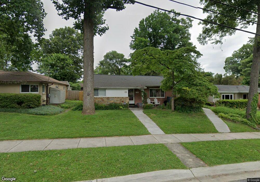
1709 Sanford Rd Silver Spring, MD 20902
Forest Estates NeighborhoodEstimated Value: $486,094 - $613,000
3
Beds
2
Baths
1,067
Sq Ft
$534/Sq Ft
Est. Value
About This Home
This home is located at 1709 Sanford Rd, Silver Spring, MD 20902 and is currently estimated at $569,274, approximately $533 per square foot. 1709 Sanford Rd is a home located in Montgomery County with nearby schools including Flora M. Singer Elementary School, Sligo Middle School, and Albert Einstein High School.
Ownership History
Date
Name
Owned For
Owner Type
Purchase Details
Closed on
May 20, 2019
Sold by
Dunathan Andrea L and Dunathan Maria Carla
Bought by
Dunathan Andrea L and Dunathan Maria Carla
Current Estimated Value
Purchase Details
Closed on
Jun 29, 2011
Sold by
Elfant Carol
Bought by
Dunathan Andrea L and Dunathan Maria Carla
Home Financials for this Owner
Home Financials are based on the most recent Mortgage that was taken out on this home.
Original Mortgage
$358,183
Outstanding Balance
$246,303
Interest Rate
4.5%
Mortgage Type
FHA
Estimated Equity
$322,971
Create a Home Valuation Report for This Property
The Home Valuation Report is an in-depth analysis detailing your home's value as well as a comparison with similar homes in the area
Home Values in the Area
Average Home Value in this Area
Purchase History
| Date | Buyer | Sale Price | Title Company |
|---|---|---|---|
| Dunathan Andrea L | -- | Accommodation | |
| Dunathan Andrea L | $367,500 | Fidelity Natl Title Ins Co |
Source: Public Records
Mortgage History
| Date | Status | Borrower | Loan Amount |
|---|---|---|---|
| Open | Dunathan Andrea L | $358,183 |
Source: Public Records
Tax History
| Year | Tax Paid | Tax Assessment Tax Assessment Total Assessment is a certain percentage of the fair market value that is determined by local assessors to be the total taxable value of land and additions on the property. | Land | Improvement |
|---|---|---|---|---|
| 2025 | $5,438 | $433,700 | $230,600 | $203,100 |
| 2024 | $5,438 | $408,833 | $0 | $0 |
| 2023 | $4,435 | $383,967 | $0 | $0 |
| 2022 | $2,894 | $359,100 | $209,700 | $149,400 |
| 2021 | $3,573 | $347,767 | $0 | $0 |
| 2020 | $3,573 | $336,433 | $0 | $0 |
| 2019 | $3,762 | $325,100 | $195,000 | $130,100 |
| 2018 | $3,311 | $318,067 | $0 | $0 |
| 2017 | $3,284 | $311,033 | $0 | $0 |
| 2016 | -- | $304,000 | $0 | $0 |
| 2015 | $3,806 | $304,000 | $0 | $0 |
| 2014 | $3,806 | $304,000 | $0 | $0 |
Source: Public Records
Map
Nearby Homes
- 1819 Sanford Rd
- 9707 Saxony Rd
- 9820 Georgia Ave Unit 2130
- 9802 Georgia Ave Unit 26-202
- 9800 Georgia Ave Unit 25301
- 2110 Bonnywood Ln Unit 102
- 9900 Georgia Ave Unit 113
- 9900 Georgia Ave
- 9900 Georgia Ave Unit 203
- 9900 Georgia Ave
- 2101 Walsh View Terrace Unit 17103
- 2107 Walsh View Terrace Unit 14-301 & 304
- 9907 Blundon Dr Unit 302
- 1513 Flora Ln
- 2002 Medical Park Dr
- 2209 Kimball Place
- 2209 Ellis St
- 9505 Columbia Blvd
- 1409 Crestridge Dr
- 2217 Westview Dr
- 1711 Sanford Rd
- 1716 Tilton Dr
- 1714 Tilton Dr
- 1713 Sanford Rd
- 1705 Sanford Rd
- 1718 Tilton Dr
- 1712 Tilton Dr
- 1708 Sanford Rd
- 1706 Sanford Rd
- 9903 Forest Grove Dr
- 1703 Sanford Rd
- 1715 Sanford Rd
- 1710 Sanford Rd
- 1710 Tilton Dr
- 1704 Sanford Rd
- 1712 Sanford Rd
- 1702 Sanford Rd
- 1708 Tilton Dr
- 1701 Sanford Rd
- 1717 Tilton Dr
Your Personal Tour Guide
Ask me questions while you tour the home.