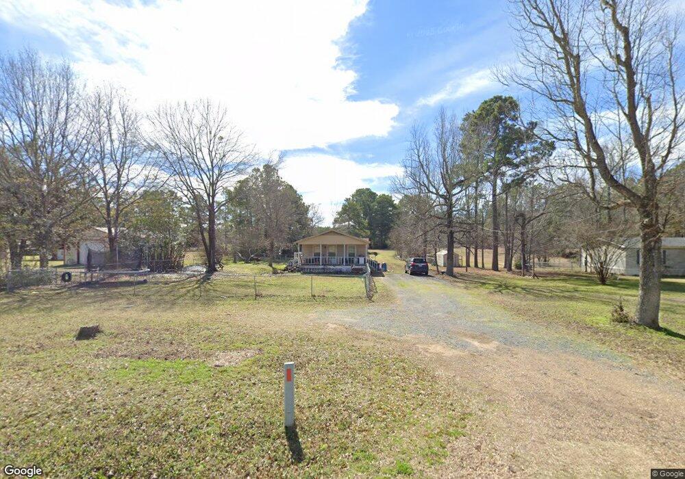
17093 Highway 174 Converse, LA 71419
Estimated Value: $74,000 - $132,000
--
Bed
--
Bath
1,152
Sq Ft
$80/Sq Ft
Est. Value
About This Home
This home is located at 17093 Highway 174, Converse, LA 71419 and is currently estimated at $91,790, approximately $79 per square foot. 17093 Highway 174 is a home located in Sabine Parish with nearby schools including Converse High School.
Ownership History
Date
Name
Owned For
Owner Type
Purchase Details
Closed on
Nov 17, 2011
Sold by
Griffith John Hulon and Griffith Janet I
Bought by
Brevelle Cody Jack and Brevelle Kelli Marie Lopez
Current Estimated Value
Home Financials for this Owner
Home Financials are based on the most recent Mortgage that was taken out on this home.
Original Mortgage
$63,362
Outstanding Balance
$43,436
Interest Rate
4.13%
Mortgage Type
FHA
Estimated Equity
$48,354
Purchase Details
Closed on
Mar 29, 2010
Sold by
Touchton Arthur C and Touchton Debra Kaye Thurman
Bought by
Griffith John and Griffith Janet
Purchase Details
Closed on
Feb 26, 2009
Sold by
Touchton Arthur Clifford and Touchton Debra Kaye Thurman
Bought by
Porter Adam L and Porter Tanya Hershiser
Create a Home Valuation Report for This Property
The Home Valuation Report is an in-depth analysis detailing your home's value as well as a comparison with similar homes in the area
Home Values in the Area
Average Home Value in this Area
Purchase History
| Date | Buyer | Sale Price | Title Company |
|---|---|---|---|
| Brevelle Cody Jack | $65,000 | None Available | |
| Griffith John | $34,000 | None Available | |
| Porter Adam L | $33,150 | None Available |
Source: Public Records
Mortgage History
| Date | Status | Borrower | Loan Amount |
|---|---|---|---|
| Open | Brevelle Cody Jack | $63,362 | |
| Closed | Porter Adam L | $0 |
Source: Public Records
Tax History Compared to Growth
Tax History
| Year | Tax Paid | Tax Assessment Tax Assessment Total Assessment is a certain percentage of the fair market value that is determined by local assessors to be the total taxable value of land and additions on the property. | Land | Improvement |
|---|---|---|---|---|
| 2024 | -- | $2,641 | $395 | $2,246 |
| 2023 | $0 | $2,641 | $395 | $2,246 |
| 2022 | $165 | $1,799 | $395 | $1,404 |
| 2021 | $176 | $1,799 | $395 | $1,404 |
| 2020 | $176 | $1,799 | $395 | $1,404 |
| 2019 | $175 | $1,799 | $395 | $1,404 |
| 2018 | $145 | $1,400 | $120 | $1,280 |
| 2017 | $146 | $1,400 | $120 | $1,280 |
| 2016 | $145 | $1,400 | $120 | $1,280 |
| 2015 | -- | $1,400 | $120 | $1,280 |
| 2014 | -- | $1,400 | $120 | $1,280 |
Source: Public Records
Map
Nearby Homes
- 00 Windmill Ln
- 101 Harrison Rd
- 355 Copeland Dr
- 2162 Ryals Rd
- 00 S Washburn St
- 234 Lincoln Rose Dr
- 25 Paul Cemetery Rd
- 487 Recreation Site 4 Rd
- 387 Wpa Rd
- 8644 Stoddard St
- 259 Lucy Dr
- 8353 Pearl St
- 2435 E Main St
- 4224 Louisiana 120
- 35 Tanner Rd Unit 21
- 60 Doris Ln
- 0 Sam Booker Rd
- TBD Sam Booker Rd
- 0 Lynch Clements Rd Unit 11231394
- 0 0 Hwy Unit 481
- 17131 Louisiana 174
- 17131 Highway 174
- 17057 Highway 174
- 17100 Highway 174
- 17140 Highway 174
- 17188 Highway 174
- 112 Michael Rd
- 5173 Highway 483
- 17261 Highway 174
- 16976 Highway 174
- 19 Fellowship Cir
- 124 Fellowship Cir
- 17394 Highway 174
- 17245 Highway 174
- 17313 Highway 174
- 16817 Highway 174
- 5785 Highway 483
- 17377 Highway 174
- 17372 Highway 174
- 6179 Highway 483