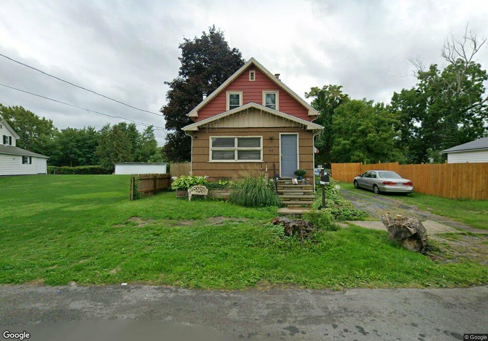
171 15th St Conneaut, OH 44030
Estimated Value: $49,000 - $112,000
2
Beds
1
Bath
750
Sq Ft
$106/Sq Ft
Est. Value
About This Home
This home is located at 171 15th St, Conneaut, OH 44030 and is currently estimated at $79,442, approximately $105 per square foot. 171 15th St is a home located in Ashtabula County with nearby schools including Lakeshore Primary Elementary School, Gateway Elementary School, and Conneaut Middle School.
Ownership History
Date
Name
Owned For
Owner Type
Purchase Details
Closed on
Aug 18, 2006
Sold by
Rockwell Joseph S and Rockwell Nancy J
Bought by
Kaczoroski Jason R and Kessler Kathryn E
Current Estimated Value
Home Financials for this Owner
Home Financials are based on the most recent Mortgage that was taken out on this home.
Original Mortgage
$14,000
Outstanding Balance
$8,415
Interest Rate
6.78%
Mortgage Type
Unknown
Estimated Equity
$71,027
Purchase Details
Closed on
Dec 28, 2000
Sold by
Shrf Scott A Lyons Per
Bought by
Rockwell Joseph S
Create a Home Valuation Report for This Property
The Home Valuation Report is an in-depth analysis detailing your home's value as well as a comparison with similar homes in the area
Home Values in the Area
Average Home Value in this Area
Purchase History
| Date | Buyer | Sale Price | Title Company |
|---|---|---|---|
| Kaczoroski Jason R | $65,000 | Midland Title | |
| Rockwell Joseph S | $25,000 | -- |
Source: Public Records
Mortgage History
| Date | Status | Borrower | Loan Amount |
|---|---|---|---|
| Open | Kaczoroski Jason R | $14,000 |
Source: Public Records
Tax History
| Year | Tax Paid | Tax Assessment Tax Assessment Total Assessment is a certain percentage of the fair market value that is determined by local assessors to be the total taxable value of land and additions on the property. | Land | Improvement |
|---|---|---|---|---|
| 2024 | $809 | $11,060 | $2,170 | $8,890 |
| 2023 | $530 | $11,060 | $2,170 | $8,890 |
| 2022 | $439 | $8,050 | $1,680 | $6,370 |
| 2021 | $447 | $8,050 | $1,680 | $6,370 |
| 2020 | $447 | $8,050 | $1,680 | $6,370 |
| 2019 | $582 | $10,360 | $1,260 | $9,100 |
| 2018 | $556 | $10,360 | $1,260 | $9,100 |
| 2017 | $555 | $10,360 | $1,260 | $9,100 |
| 2016 | $593 | $12,110 | $1,470 | $10,640 |
| 2015 | $599 | $12,110 | $1,470 | $10,640 |
| 2014 | $531 | $12,110 | $1,470 | $10,640 |
| 2013 | $552 | $12,960 | $1,650 | $11,310 |
Source: Public Records
Map
Nearby Homes
Your Personal Tour Guide
Ask me questions while you tour the home.