Estimated Value: $197,000 - $238,000
3
Beds
3
Baths
2,004
Sq Ft
$109/Sq Ft
Est. Value
About This Home
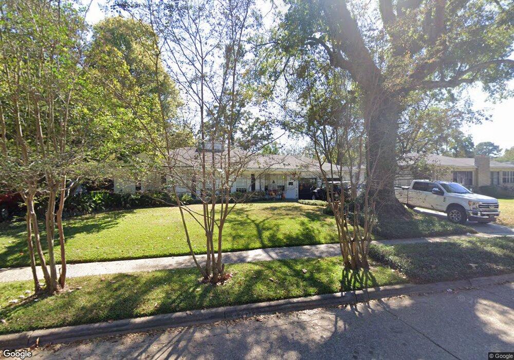
This home is located at 171 Arthur Ave, Shreveport, LA 71105 and is currently estimated at $219,111, approximately $109 per square foot. 171 Arthur Ave is a home located in Caddo Parish with nearby schools including Fairfield Magnet School, Judson Fundamental Elementary School, and Eden Gardens Fundamental Elementary School.
Ownership History
Date
Name
Owned For
Owner Type
Purchase Details
Closed on
Jun 14, 2007
Sold by
Grosz Andre Alexandre and Grosz Amy Anne
Bought by
Lanoue Virginia C and Lanoue Duane
Current Estimated Value
Purchase Details
Closed on
Mar 23, 2007
Sold by
Grosz Andre Alexandre and Grosz Amy Anne
Bought by
Pylant Duke Lavelle and Pylant Christie Coats
Home Financials for this Owner
Home Financials are based on the most recent Mortgage that was taken out on this home.
Original Mortgage
$28,800
Interest Rate
6.26%
Mortgage Type
Unknown
Create a Home Valuation Report for This Property
The Home Valuation Report is an in-depth analysis detailing your home's value as well as a comparison with similar homes in the area
Home Values in the Area
Average Home Value in this Area
Purchase History
| Date | Buyer | Sale Price | Title Company |
|---|---|---|---|
| Lanoue Virginia C | $571 | None Available | |
| Pylant Duke Lavelle | $144,000 | None Available |
Source: Public Records
Mortgage History
| Date | Status | Borrower | Loan Amount |
|---|---|---|---|
| Previous Owner | Pylant Duke Lavelle | $28,800 |
Source: Public Records
Tax History Compared to Growth
Tax History
| Year | Tax Paid | Tax Assessment Tax Assessment Total Assessment is a certain percentage of the fair market value that is determined by local assessors to be the total taxable value of land and additions on the property. | Land | Improvement |
|---|---|---|---|---|
| 2024 | $2,444 | $15,675 | $3,100 | $12,575 |
| 2023 | $2,296 | $14,404 | $2,952 | $11,452 |
| 2022 | $2,296 | $14,404 | $2,952 | $11,452 |
| 2021 | $2,261 | $14,404 | $2,952 | $11,452 |
| 2020 | $2,261 | $14,404 | $2,952 | $11,452 |
| 2019 | $2,360 | $14,591 | $2,952 | $11,639 |
| 2018 | $913 | $14,591 | $2,952 | $11,639 |
| 2017 | $2,397 | $14,591 | $2,952 | $11,639 |
| 2015 | $917 | $14,580 | $2,950 | $11,630 |
| 2014 | $925 | $14,580 | $2,950 | $11,630 |
| 2013 | -- | $14,580 | $2,950 | $11,630 |
Source: Public Records
Map
Nearby Homes
- 142 Lynn Ave
- 1836 Bryan Place
- 147 Pennsylvania Ave
- 1916 Anniston Ave
- 153 Carrollton Ave
- 174 Carrollton Ave
- 230 Pennsylvania Ave
- 129 Carrollton Ave
- 246 Russell Ave
- 156 Charles Ave
- 2005 E Kings Hwy
- 2013 E Kings Hwy
- 245 Stuart Ave
- 240 Carrollton Ave
- 163 Charles Ave
- 194 Charles Ave
- 1919 Audubon Place
- 106 Leo Ave
- 1810 Captain Shreve Dr
- 107 Preston Ave
- 173 Arthur Ave
- 165 Arthur Ave
- 154 Richard Ave
- 177 Arthur Ave
- 158 Richard Ave
- 157 Arthur Ave
- 150 Richard Ave
- 164 Richard Ave
- 170 Arthur Ave
- 168 Arthur Ave
- 174 Arthur Ave
- 166 Arthur Ave
- 166 Arthur Ave
- 166 Arthur Ave
- 179 Arthur Ave
- 146 Richard Ave
- 170 Richard Ave
- 176 Arthur Ave
- 153 Arthur Ave
- 160 Arthur Ave