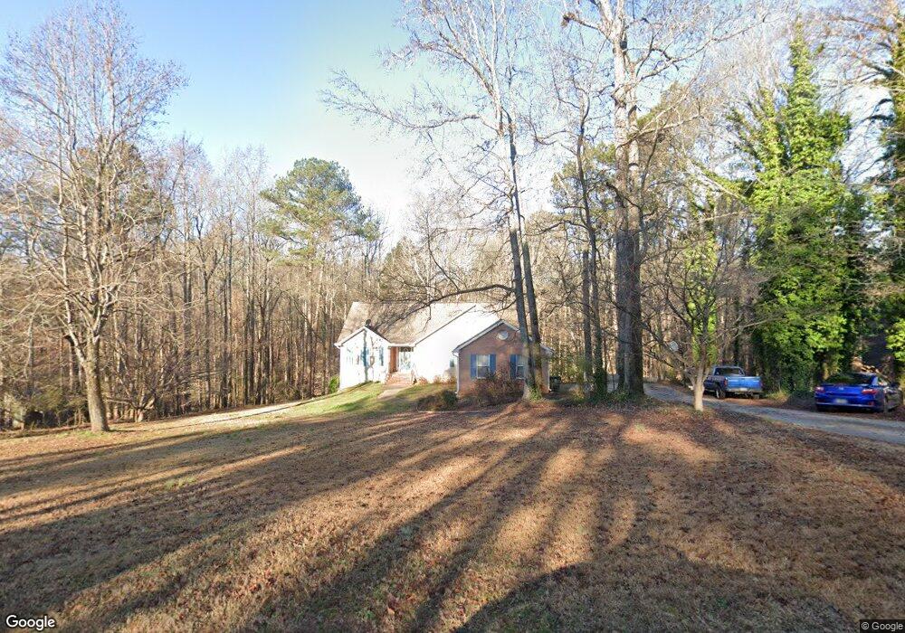
171 Ashley Trace Dr Unit 1 Locust Grove, GA 30248
Estimated Value: $266,582 - $296,000
4
Beds
2
Baths
1,474
Sq Ft
$188/Sq Ft
Est. Value
About This Home
This home is located at 171 Ashley Trace Dr Unit 1, Locust Grove, GA 30248 and is currently estimated at $277,396, approximately $188 per square foot. 171 Ashley Trace Dr Unit 1 is a home located in Henry County with nearby schools including Luella Elementary School, Luella Middle School, and Luella High School.
Ownership History
Date
Name
Owned For
Owner Type
Purchase Details
Closed on
Apr 28, 2004
Sold by
Harris Richard B and Harris Janet R
Bought by
Agan Michael and Agan Michelle
Current Estimated Value
Home Financials for this Owner
Home Financials are based on the most recent Mortgage that was taken out on this home.
Original Mortgage
$160,973
Outstanding Balance
$76,965
Interest Rate
5.89%
Mortgage Type
VA
Estimated Equity
$200,431
Create a Home Valuation Report for This Property
The Home Valuation Report is an in-depth analysis detailing your home's value as well as a comparison with similar homes in the area
Home Values in the Area
Average Home Value in this Area
Purchase History
| Date | Buyer | Sale Price | Title Company |
|---|---|---|---|
| Agan Michael | $163,500 | -- |
Source: Public Records
Mortgage History
| Date | Status | Borrower | Loan Amount |
|---|---|---|---|
| Open | Agan Michael | $160,973 |
Source: Public Records
Tax History Compared to Growth
Tax History
| Year | Tax Paid | Tax Assessment Tax Assessment Total Assessment is a certain percentage of the fair market value that is determined by local assessors to be the total taxable value of land and additions on the property. | Land | Improvement |
|---|---|---|---|---|
| 2025 | $3,306 | $119,400 | $12,000 | $107,400 |
| 2024 | $3,306 | $113,800 | $12,000 | $101,800 |
| 2023 | $2,932 | $112,520 | $10,000 | $102,520 |
| 2022 | $3,014 | $95,920 | $10,000 | $85,920 |
| 2021 | $2,479 | $74,960 | $10,000 | $64,960 |
| 2020 | $2,362 | $70,200 | $8,000 | $62,200 |
| 2019 | $2,146 | $61,960 | $8,000 | $53,960 |
| 2018 | $1,958 | $57,080 | $8,000 | $49,080 |
| 2016 | $1,757 | $51,840 | $8,000 | $43,840 |
| 2015 | $1,661 | $48,280 | $8,000 | $40,280 |
| 2014 | $1,301 | $38,880 | $8,000 | $30,880 |
Source: Public Records
Map
Nearby Homes
- 179 Ashley Trace Dr
- 170 Ashley Trace Dr
- 163 Ashley Trace Dr Unit 1
- 718 Derek Place
- 221 Ashley Trace Dr
- 231 Ashley Trace Dr
- 201 Vandalay Way
- 121 Bradesbury Ln
- 733 Derek Place Unit 2
- 1871 Weems Rd
- 876 Simpson Mill Rd
- 1999 Hampton Locust Grove Rd
- 161 Donovan Ave
- 871 Rocky Creek Rd
- 290 Whistle Way
- 246 Crabapple Rd Unit 193
- 246 Crabapple Rd
- 284 Valley Way
- 1007 S Hampton Rd
- 1665 Fuma Leaf Way Unit 244
- 175 Ashley Trace Dr
- 149 Ashley Trace Dr
- 159 Ashley Trace Dr
- 178 Ashley Trace Dr
- 154 Ashley Trace Dr
- 155 Ashley Trace Dr
- 186 Ashley Trace Dr
- 195 Ashley Trace Dr
- 643 Derek Place
- 639 Derek Place Unit 2
- 651 Derek Place
- 194 Ashley Trace Dr
- 655 Derek Place Unit 2
- 661 Derek Place
- 145 Ashley Trace Dr
- 627 Derek Place Unit 1
- 202 Ashley Trace Dr
- 642 Derek Place Unit 2
- 135 Ashley Trace Dr
- 211 Ashley Trace Dr