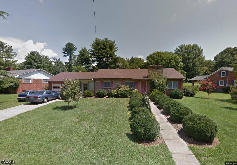
171 Broad St Unit Lo3 Black A Marion, NC 28752
Estimated Value: $326,000 - $356,114
3
Beds
3
Baths
2,128
Sq Ft
$158/Sq Ft
Est. Value
About This Home
This home is located at 171 Broad St Unit Lo3 Black A, Marion, NC 28752 and is currently estimated at $337,029, approximately $158 per square foot. 171 Broad St Unit Lo3 Black A is a home located in McDowell County with nearby schools including Marion Elementary School, East McDowell Junior High School, and McDowell High School.
Ownership History
Date
Name
Owned For
Owner Type
Purchase Details
Closed on
Aug 1, 2025
Sold by
Rathbone Caleb Michael and Auburn Wigginto
Bought by
Droste Caitlyn M and Kaelin Walter B
Current Estimated Value
Home Financials for this Owner
Home Financials are based on the most recent Mortgage that was taken out on this home.
Original Mortgage
$250,000
Outstanding Balance
$249,786
Interest Rate
6.77%
Mortgage Type
New Conventional
Estimated Equity
$87,243
Purchase Details
Closed on
Oct 24, 2022
Sold by
Music Christopher & Janele
Bought by
Rathbone Caleb and Rathbone Auburn
Home Financials for this Owner
Home Financials are based on the most recent Mortgage that was taken out on this home.
Original Mortgage
$252,000
Interest Rate
6.02%
Mortgage Type
New Conventional
Purchase Details
Closed on
Aug 16, 2021
Sold by
Wetmore Zachary P and Wetmore Michael J
Bought by
Music Christopher and Music Janele
Home Financials for this Owner
Home Financials are based on the most recent Mortgage that was taken out on this home.
Original Mortgage
$196,000
Interest Rate
2.9%
Mortgage Type
New Conventional
Purchase Details
Closed on
Jun 24, 2019
Sold by
Finn Patrick O and Finn Amanda E
Bought by
Wetmore Zachary P and Wetmore Michaela J
Home Financials for this Owner
Home Financials are based on the most recent Mortgage that was taken out on this home.
Original Mortgage
$186,400
Interest Rate
4.1%
Mortgage Type
New Conventional
Purchase Details
Closed on
Jan 24, 2018
Sold by
Stockton Rita Jo Crisp and Estate Of Ruth Naomi Taylor Cr
Bought by
Harris Carroll and Harris Barbara
Purchase Details
Closed on
Mar 14, 2016
Sold by
Mcneely Carl Jerry
Bought by
Finn Patrick O and Finn Amanda E
Home Financials for this Owner
Home Financials are based on the most recent Mortgage that was taken out on this home.
Original Mortgage
$150,500
Interest Rate
4.25%
Mortgage Type
Adjustable Rate Mortgage/ARM
Purchase Details
Closed on
Jan 1, 1954
Bought by
Frisbee Grover A
Create a Home Valuation Report for This Property
The Home Valuation Report is an in-depth analysis detailing your home's value as well as a comparison with similar homes in the area
Home Values in the Area
Average Home Value in this Area
Purchase History
| Date | Buyer | Sale Price | Title Company |
|---|---|---|---|
| Droste Caitlyn M | $335,000 | None Listed On Document | |
| Droste Caitlyn M | $335,000 | None Listed On Document | |
| Rathbone Caleb | $315,000 | -- | |
| Music Christopher | $296,000 | None Available | |
| Wetmore Zachary P | $233,000 | None Available | |
| Harris Carroll | $35,000 | None Available | |
| Finn Patrick O | $150,000 | None Available | |
| Frisbee Grover A | -- | -- |
Source: Public Records
Mortgage History
| Date | Status | Borrower | Loan Amount |
|---|---|---|---|
| Open | Droste Caitlyn M | $250,000 | |
| Closed | Droste Caitlyn M | $250,000 | |
| Previous Owner | Rathbone Caleb | $252,000 | |
| Previous Owner | Music Christopher | $196,000 | |
| Previous Owner | Wetmore Zachary P | $186,400 | |
| Previous Owner | Finn Patrick O | $150,500 |
Source: Public Records
Tax History Compared to Growth
Tax History
| Year | Tax Paid | Tax Assessment Tax Assessment Total Assessment is a certain percentage of the fair market value that is determined by local assessors to be the total taxable value of land and additions on the property. | Land | Improvement |
|---|---|---|---|---|
| 2025 | $2,092 | $349,810 | $40,000 | $309,810 |
| 2024 | $2,086 | $348,880 | $40,000 | $308,880 |
| 2023 | $2,086 | $348,880 | $40,000 | $308,880 |
| 2022 | $1,611 | $264,980 | $30,000 | $234,980 |
| 2021 | $919 | $151,220 | $30,000 | $121,220 |
| 2020 | $935 | $151,220 | $0 | $0 |
| 2019 | $935 | $128,020 | $0 | $0 |
| 2017 | $743 | $128,020 | $0 | $0 |
| 2016 | $743 | $128,020 | $25,000 | $103,020 |
| 2014 | $729 | $128,020 | $25,000 | $103,020 |
| 2013 | -- | $128,020 | $25,000 | $103,020 |
Source: Public Records
Map
Nearby Homes
- 220 Broad St
- 80 Morgan St
- 258 Broad St
- 19 W Glenview St
- 300 Morgan St
- 175 Blue Ridge St
- 36 & 50 Catawba Ave
- 390 Forest Heights Dr
- TBD Kathleen Park St
- 584 Rutherford Rd
- 218 E Hudgins St
- V/L Marterdan Ridge
- 99999 U S 221 Hwy N
- 634 Rutherford Rd
- 99999 Thole St
- 790 Tate St W
- 19 Thole St
- 16 Hoyle St Unit 16
- 12 Hoyle St Unit 12
- 61 W Woodlawn St