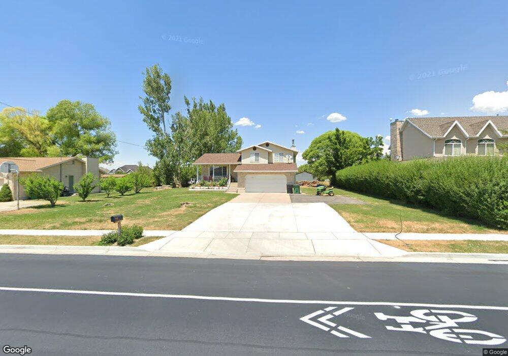
171 E Shepard Ln Kaysville, UT 84037
West Kaysville NeighborhoodEstimated Value: $768,000 - $857,000
5
Beds
3
Baths
2,328
Sq Ft
$350/Sq Ft
Est. Value
About This Home
This home is located at 171 E Shepard Ln, Kaysville, UT 84037 and is currently estimated at $813,901, approximately $349 per square foot. 171 E Shepard Ln is a home located in Davis County with nearby schools including Endeavour Elementary School, Farmington High, and Centennial Junior High School.
Ownership History
Date
Name
Owned For
Owner Type
Purchase Details
Closed on
Apr 25, 2013
Sold by
Caldwell N Craig and Caldwell Leanna S
Bought by
Caldwell Craig and Caldwell Leanna
Current Estimated Value
Home Financials for this Owner
Home Financials are based on the most recent Mortgage that was taken out on this home.
Original Mortgage
$170,000
Interest Rate
2.76%
Mortgage Type
New Conventional
Create a Home Valuation Report for This Property
The Home Valuation Report is an in-depth analysis detailing your home's value as well as a comparison with similar homes in the area
Home Values in the Area
Average Home Value in this Area
Purchase History
| Date | Buyer | Sale Price | Title Company |
|---|---|---|---|
| Caldwell Craig | -- | Pioneer Title Ins Agen |
Source: Public Records
Mortgage History
| Date | Status | Borrower | Loan Amount |
|---|---|---|---|
| Closed | Caldwell Craig | $170,000 |
Source: Public Records
Tax History Compared to Growth
Tax History
| Year | Tax Paid | Tax Assessment Tax Assessment Total Assessment is a certain percentage of the fair market value that is determined by local assessors to be the total taxable value of land and additions on the property. | Land | Improvement |
|---|---|---|---|---|
| 2024 | $3,467 | $354,750 | $269,820 | $84,930 |
| 2023 | $3,043 | $551,000 | $452,835 | $98,165 |
| 2022 | $3,158 | $323,400 | $245,662 | $77,738 |
| 2021 | $3,164 | $485,000 | $316,567 | $168,433 |
| 2020 | $2,867 | $427,000 | $275,198 | $151,802 |
| 2019 | $2,783 | $407,000 | $256,791 | $150,209 |
| 2018 | $2,597 | $378,000 | $224,403 | $153,597 |
| 2016 | $2,057 | $156,750 | $114,219 | $42,531 |
| 2015 | $2,015 | $145,860 | $114,219 | $31,641 |
| 2014 | $1,678 | $123,598 | $78,040 | $45,558 |
| 2013 | -- | $129,559 | $54,310 | $75,249 |
Source: Public Records
Map
Nearby Homes
- 278 E Shepard Ln
- 2261 S 50 E
- 1820 S Kerrybrook Dr
- 2274 S 50 E
- 276 E 2200 S
- 69 W 2200 S
- 2071 S 400 E
- 2226 S Betsys Way
- 2266 S Betsys Way
- 1566 W Pheasant Place
- 87 Baer Creek Dr
- 926 N 1875 W
- 419 E 1700 S
- 1578 S 300 E
- 1332 N 1580 W
- 1472 Via la Costa Way
- 395 W Burton Ln
- 1181 Set Ct Unit 2
- 245 E 1400 S
- 1424 S 400 E
- 193 E Shepard Ln
- 149 E Shepard Ln
- 127 E Shepard Ln
- 215 E Shepard Ln
- 202 E Shepard Ln
- 180 E Shepard Ln
- 114 E Shepard Ln
- 136 E Shepard Ln
- 224 E Shepard Ln
- 237 E Shepard Ln
- 105 E Shepard Ln
- 1992 Kerrybrook Dr
- 1999 Kerrybrook Dr Unit 153
- 94 E Shepard Ln
- 244 E Shepard Ln
- 259 E Shepard Ln
- 83 E Shepard Ln
- 122 E 1950 S
- 1985 Kerrybrook Dr
- 110 E 1950 S