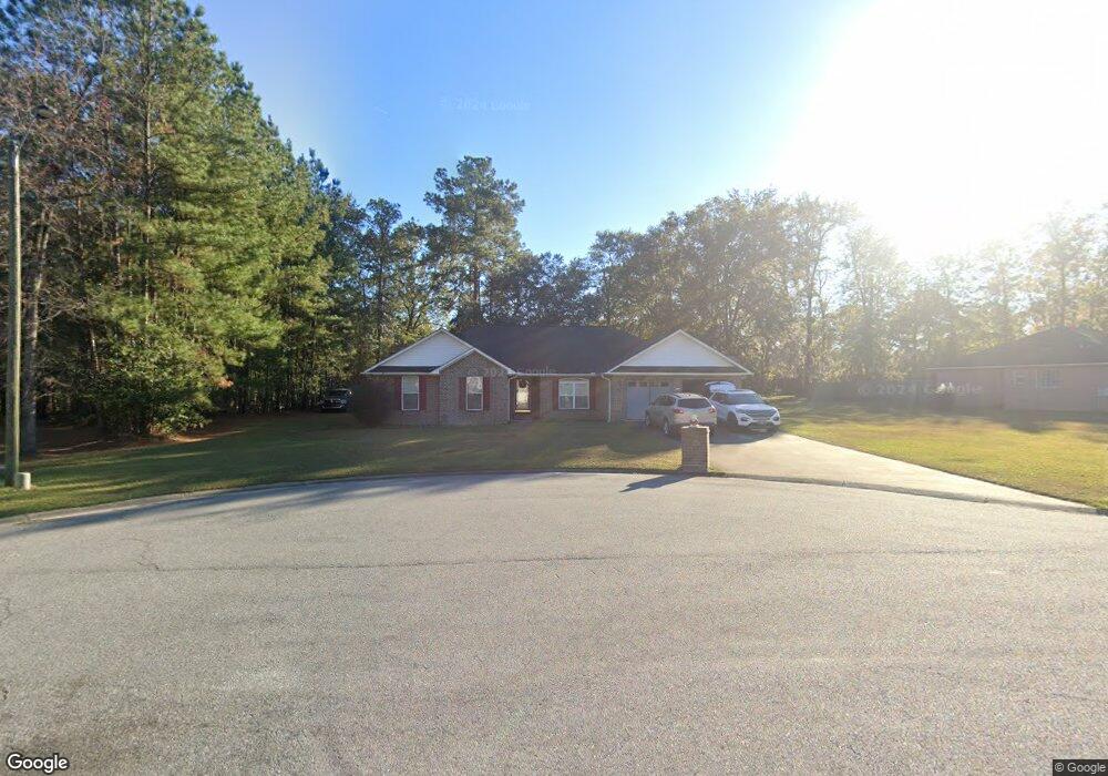
171 Harris Norman Blvd Unit n/a Allenhurst, GA 31301
Estimated Value: $290,300 - $323,000
4
Beds
2
Baths
2,200
Sq Ft
$139/Sq Ft
Est. Value
About This Home
This home is located at 171 Harris Norman Blvd Unit n/a, Allenhurst, GA 31301 and is currently estimated at $305,075, approximately $138 per square foot. 171 Harris Norman Blvd Unit n/a is a home located in Liberty County with nearby schools including Frank Long Elementary School, Lewis Frasier Middle School, and Liberty County High School.
Ownership History
Date
Name
Owned For
Owner Type
Purchase Details
Closed on
Nov 28, 2012
Sold by
Brown Ronnie F
Bought by
Chapman David M
Current Estimated Value
Home Financials for this Owner
Home Financials are based on the most recent Mortgage that was taken out on this home.
Original Mortgage
$179,900
Outstanding Balance
$125,051
Interest Rate
3.44%
Mortgage Type
VA
Estimated Equity
$180,024
Purchase Details
Closed on
Aug 5, 2005
Sold by
The Heritage Bank
Bought by
Rogers Walter D
Home Financials for this Owner
Home Financials are based on the most recent Mortgage that was taken out on this home.
Original Mortgage
$169,412
Interest Rate
5.57%
Mortgage Type
VA
Purchase Details
Closed on
Oct 9, 2004
Sold by
Woolard Michael and Deloach Richard
Bought by
Rogers Walter D
Purchase Details
Closed on
Oct 8, 2004
Sold by
Mcdonald William David
Bought by
Wollard Michael and Deloach Richard J
Purchase Details
Closed on
Jan 14, 1999
Bought by
Mcdonald William David
Create a Home Valuation Report for This Property
The Home Valuation Report is an in-depth analysis detailing your home's value as well as a comparison with similar homes in the area
Home Values in the Area
Average Home Value in this Area
Purchase History
| Date | Buyer | Sale Price | Title Company |
|---|---|---|---|
| Chapman David M | $179,900 | -- | |
| Rogers Walter D | -- | -- | |
| Brown Ronnie F | $164,000 | -- | |
| Rogers Walter D | $63,000 | -- | |
| Wollard Michael | -- | -- | |
| Mcdonald William David | -- | -- |
Source: Public Records
Mortgage History
| Date | Status | Borrower | Loan Amount |
|---|---|---|---|
| Open | Chapman David M | $179,900 | |
| Previous Owner | Brown Ronnie F | $169,412 |
Source: Public Records
Tax History Compared to Growth
Tax History
| Year | Tax Paid | Tax Assessment Tax Assessment Total Assessment is a certain percentage of the fair market value that is determined by local assessors to be the total taxable value of land and additions on the property. | Land | Improvement |
|---|---|---|---|---|
| 2024 | $3,405 | $103,637 | $18,000 | $85,637 |
| 2023 | $3,405 | $93,069 | $10,000 | $83,069 |
| 2022 | $2,798 | $77,300 | $10,000 | $67,300 |
| 2021 | $2,519 | $70,298 | $10,000 | $60,298 |
| 2020 | $2,448 | $68,211 | $10,000 | $58,211 |
| 2019 | $2,410 | $68,865 | $10,000 | $58,865 |
| 2018 | $2,405 | $69,519 | $10,000 | $59,519 |
| 2017 | $2,856 | $67,308 | $10,000 | $57,308 |
| 2016 | $2,184 | $67,930 | $10,000 | $57,930 |
| 2015 | $2,107 | $65,034 | $10,000 | $55,034 |
| 2014 | $2,107 | $65,048 | $10,000 | $55,048 |
| 2013 | -- | $65,467 | $12,400 | $53,067 |
Source: Public Records
Map
Nearby Homes
- 1600 Dunlevie Rd Unit 16
- 996 Dunlevie Rd
- 128 Nashview Trail
- 50 Harold's Nook
- 40 Red Blossom Ct
- 100 Mccumber Dr
- 1801 Dunlevie Rd
- 151 Hunters Branch Dr
- 353 Wilder Rd
- 480 Mccumber Dr
- 169 Wellspring Terrace
- 7.22 AC Dunlevie Rd
- 166 Stephanie Dr
- 619 Mccumber Dr
- 1343 Talmadge Rd
- 534 Deer Meadow Way
- 685 Deer Meadow Way
- 256 Deer Meadow Way
- 1118 Buckhead Loop
- 684 Deer Meadow Way
- 171 Harris Norman Blvd
- 40 Carrie St
- 133 Harris Norman Blvd
- 180 Harris Norman Blvd
- 56 Carrie St
- 172 Harris Norman Blvd
- 16 Carrie St
- 152 Harris Norman Blvd
- 140 Harris Norman Blvd
- 57 Carrie St
- 51 Carrie St
- 112 Harris Norman Blvd
- 3 Harris Norman Blvd
- 49 Harris Norman Blvd
- 128 Harris Norman Blvd
- 88 Harris Norman Blvd
- 64 Harris Norman Blvd
- 284 Bobbie St Unit n/a
- 284 Bobbie St
- 264 Bobbie St