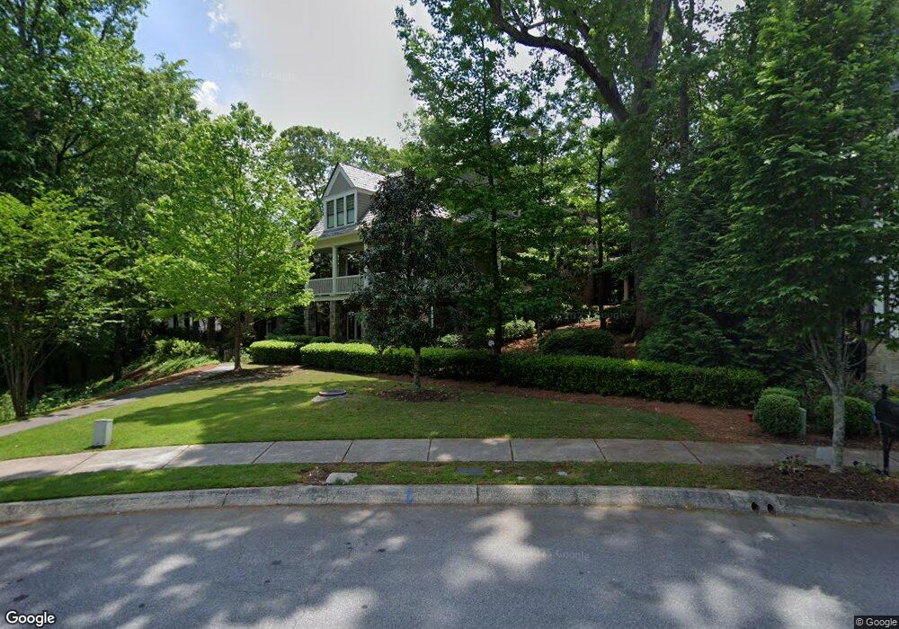
171 Hubbard Rd Woodstock, GA 30188
Estimated Value: $1,168,142 - $1,208,000
4
Beds
5
Baths
4,358
Sq Ft
$273/Sq Ft
Est. Value
About This Home
This home is located at 171 Hubbard Rd, Woodstock, GA 30188 and is currently estimated at $1,188,071, approximately $272 per square foot. 171 Hubbard Rd is a home located in Cherokee County with nearby schools including Woodstock Elementary School, Woodstock Middle School, and Woodstock High School.
Ownership History
Date
Name
Owned For
Owner Type
Purchase Details
Closed on
Jul 17, 2008
Sold by
Hedgewood Properties Inc
Bought by
Fauver Phillip H
Current Estimated Value
Purchase Details
Closed on
Feb 7, 2008
Sold by
Woodstock Dev Llc
Bought by
Hedgewood Properties Inc
Home Financials for this Owner
Home Financials are based on the most recent Mortgage that was taken out on this home.
Original Mortgage
$607,500
Interest Rate
6.06%
Create a Home Valuation Report for This Property
The Home Valuation Report is an in-depth analysis detailing your home's value as well as a comparison with similar homes in the area
Home Values in the Area
Average Home Value in this Area
Purchase History
| Date | Buyer | Sale Price | Title Company |
|---|---|---|---|
| Fauver Phillip H | $892,100 | -- | |
| Hedgewood Properties Inc | $200,000 | -- |
Source: Public Records
Mortgage History
| Date | Status | Borrower | Loan Amount |
|---|---|---|---|
| Previous Owner | Hedgewood Properties Inc | $607,500 |
Source: Public Records
Tax History Compared to Growth
Tax History
| Year | Tax Paid | Tax Assessment Tax Assessment Total Assessment is a certain percentage of the fair market value that is determined by local assessors to be the total taxable value of land and additions on the property. | Land | Improvement |
|---|---|---|---|---|
| 2024 | $5,399 | $443,588 | $108,800 | $334,788 |
| 2023 | $52 | $449,916 | $108,800 | $341,116 |
| 2022 | $4,179 | $351,648 | $74,800 | $276,848 |
| 2021 | $4,115 | $324,740 | $74,800 | $249,940 |
| 2020 | $3,692 | $298,432 | $68,000 | $230,432 |
| 2019 | $3,875 | $307,280 | $68,000 | $239,280 |
| 2018 | $3,865 | $300,760 | $68,000 | $232,760 |
| 2017 | $3,888 | $741,600 | $68,000 | $228,640 |
| 2016 | $3,611 | $700,700 | $68,000 | $212,280 |
| 2015 | $3,372 | $663,900 | $57,120 | $208,440 |
| 2014 | -- | $610,100 | $57,120 | $186,920 |
Source: Public Records
Map
Nearby Homes
- 147 Hubbard Rd
- 719 Hammond Dr
- 191 Fowler St
- 170 Fowler St Unit 100
- 170 Fowler St Unit 200
- 360 Chambers St Unit 155
- 360 Chambers St Unit 456
- 360 Chambers St Unit 408
- 360 Chambers St Unit 407
- 360 Chambers St Unit 210
- 360 Chambers St Unit 402
- 360 Chambers St Unit 405
- 360 Chambers St Unit 301
- 114 Parks Cir
- 204 Melanie Ln
- 108 Barnesdale Terrace
- 110 Barnesdale Terrace
- 201 Dobbs Rd
- 173 Hubbard Rd
- 175 Hubbard Rd
- 0 Noonday St
- 177 Hubbard Rd Unit 57
- 177 Hubbard Rd
- 169 Hubbard Rd
- 179 Hubbard Rd Unit 58
- 179 Hubbard Rd
- 181 Hubbard Rd
- 509 Oakwood Ct
- 510 Oakwood Ct
- 183 Hubbard Rd
- 1122 Cousins Rd
- 165 Hubbard Rd
- 163 Hubbard Rd
- 185 Hubbard Rd
- 161 Hubbard Rd
- 443 Latimer St
- 443 Latimer St Unit 443
- 441 Latimer St