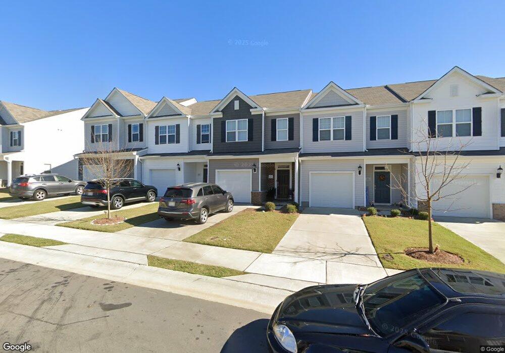
171 Liam St Unit 118 Clayton, NC 27520
Municipal Park NeighborhoodEstimated Value: $292,000 - $297,000
3
Beds
3
Baths
1,647
Sq Ft
$179/Sq Ft
Est. Value
About This Home
This home is located at 171 Liam St Unit 118, Clayton, NC 27520 and is currently estimated at $294,429, approximately $178 per square foot. 171 Liam St Unit 118 is a home located in Johnston County with nearby schools including Cooper Academy, Riverwood Middle School, and Clayton High.
Ownership History
Date
Name
Owned For
Owner Type
Purchase Details
Closed on
Jul 25, 2023
Sold by
Nagle John Paul and Nagle Debra Lynn
Bought by
Kristen Dohslaw and Kristen Michael Dobslaw
Current Estimated Value
Home Financials for this Owner
Home Financials are based on the most recent Mortgage that was taken out on this home.
Original Mortgage
$197,200
Outstanding Balance
$192,426
Interest Rate
6.71%
Mortgage Type
New Conventional
Estimated Equity
$102,003
Purchase Details
Closed on
Oct 30, 2020
Sold by
D R Horton Terramor Llc
Bought by
Nagle John Paul and Nagle Debra Lynn
Home Financials for this Owner
Home Financials are based on the most recent Mortgage that was taken out on this home.
Original Mortgage
$167,999
Interest Rate
2.3%
Mortgage Type
New Conventional
Create a Home Valuation Report for This Property
The Home Valuation Report is an in-depth analysis detailing your home's value as well as a comparison with similar homes in the area
Home Values in the Area
Average Home Value in this Area
Purchase History
| Date | Buyer | Sale Price | Title Company |
|---|---|---|---|
| Kristen Dohslaw | $300,000 | None Listed On Document | |
| Nagle John Paul | $210,000 | None Available |
Source: Public Records
Mortgage History
| Date | Status | Borrower | Loan Amount |
|---|---|---|---|
| Open | Kristen Dohslaw | $197,200 | |
| Previous Owner | Nagle John Paul | $167,999 |
Source: Public Records
Tax History Compared to Growth
Tax History
| Year | Tax Paid | Tax Assessment Tax Assessment Total Assessment is a certain percentage of the fair market value that is determined by local assessors to be the total taxable value of land and additions on the property. | Land | Improvement |
|---|---|---|---|---|
| 2025 | $2,973 | $294,320 | $65,000 | $229,320 |
| 2024 | $2,747 | $208,070 | $55,000 | $153,070 |
| 2023 | $2,684 | $208,070 | $55,000 | $153,070 |
| 2022 | $2,767 | $208,070 | $55,000 | $153,070 |
| 2021 | $2,726 | $208,070 | $55,000 | $153,070 |
Source: Public Records
Map
Nearby Homes
- 201 Liam St
- 191 Liam St
- 48 Enterprise Dr
- 709 W Horne St
- 316 S Moore St
- 1509 Kenmore Dr
- 129 Sturbridge Dr Unit 15
- 113 Sturbridge Dr Unit 113
- 129 Crawford Pkwy
- 510 Willow Dr
- 591 Atwood Dr
- 48 Honeydew Way
- 44 Honeydew Way
- 320 Virginia St
- 55 Honeydew Way
- 52 E Piston Point
- TBD Channel Drop Dr Unit 123
- TBD Channel Drop Dr Unit 94
- 407 W Second St
- 161 Wildflower Cir
- 171 Liam St
- 161 Liam St
- 161 Liam St Unit 117
- 181 Liam St
- 181 Liam St Unit 119
- 191 Liam St Unit 120
- 153 Liam St
- 153 Liam St Unit 116
- 201 Liam St Unit 121
- 176 Liam St
- 176 Liam St Unit 76
- 186 Liam St
- 186 Liam St Unit 75
- 166 Liam St Unit 77
- 156 Liam St Unit 78
- 196 Liam St Unit 74
- 130 Liam St Unit 79
- 213 Liam St Unit 122
- 206 Liam St
- 206 Liam St