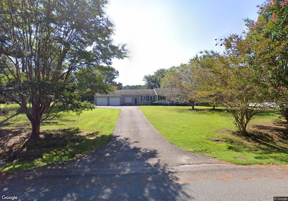
171 Londonderry Ln Williamsburg, VA 23188
Estimated Value: $336,000 - $454,000
3
Beds
2
Baths
1,420
Sq Ft
$287/Sq Ft
Est. Value
About This Home
This home is located at 171 Londonderry Ln, Williamsburg, VA 23188 and is currently estimated at $406,876, approximately $286 per square foot. 171 Londonderry Ln is a home located in York County with nearby schools including Waller Mill Elementary School, Queens Lake Middle School, and Bruton High School.
Ownership History
Date
Name
Owned For
Owner Type
Purchase Details
Closed on
Aug 10, 2015
Sold by
Powell William F
Bought by
Wood Zachary T
Current Estimated Value
Home Financials for this Owner
Home Financials are based on the most recent Mortgage that was taken out on this home.
Original Mortgage
$204,000
Outstanding Balance
$160,717
Interest Rate
4.08%
Mortgage Type
New Conventional
Estimated Equity
$246,159
Create a Home Valuation Report for This Property
The Home Valuation Report is an in-depth analysis detailing your home's value as well as a comparison with similar homes in the area
Home Values in the Area
Average Home Value in this Area
Purchase History
| Date | Buyer | Sale Price | Title Company |
|---|---|---|---|
| Wood Zachary T | $255,000 | -- |
Source: Public Records
Mortgage History
| Date | Status | Borrower | Loan Amount |
|---|---|---|---|
| Open | Wood Zachary T | $204,000 |
Source: Public Records
Tax History Compared to Growth
Tax History
| Year | Tax Paid | Tax Assessment Tax Assessment Total Assessment is a certain percentage of the fair market value that is determined by local assessors to be the total taxable value of land and additions on the property. | Land | Improvement |
|---|---|---|---|---|
| 2025 | $2,717 | $367,200 | $112,700 | $254,500 |
| 2024 | $2,717 | $367,200 | $112,700 | $254,500 |
| 2023 | $2,414 | $313,500 | $112,700 | $200,800 |
| 2022 | $2,445 | $313,500 | $112,700 | $200,800 |
| 2021 | $2,183 | $274,600 | $110,000 | $164,600 |
| 2020 | $2,183 | $274,600 | $110,000 | $164,600 |
| 2019 | $3,051 | $267,600 | $103,000 | $164,600 |
| 2018 | $3,051 | $267,600 | $103,000 | $164,600 |
| 2017 | $1,988 | $264,600 | $100,000 | $164,600 |
| 2016 | $1,988 | $264,600 | $100,000 | $164,600 |
| 2015 | -- | $264,600 | $100,000 | $164,600 |
| 2014 | -- | $264,600 | $100,000 | $164,600 |
Source: Public Records
Map
Nearby Homes
- 409 Marks Pond Way
- 124 Londonderry Ln
- 105 Londonderry Ln
- 1204 Treviso Bay
- 1284 Treviso Bay
- 1300 Treviso Bay
- 1312 Treviso Bay
- 1268 Treviso Bay
- 1272 Treviso Bay
- 1296 Treviso Bay
- 1236 Treviso Bay
- 114 Wilson Dr
- 306 Arbordale Loop
- 405 Skimino Landing Dr
- 3842 South Orchard
- 208 Skimino Rd
- 406 Wilkinson Dr
- 100 Clark Ln
- 328 Wilkinson Dr
- 6266 Richmond Rd
- 100 Kingsgate Rd
- 2020 Newman Rd
- 101 Indiana Ln
- 105 Wichita Ln
- 165 Londonderry Ln
- 107 Wichita Ln
- 174 Londonderry Ln
- 103 Indiana Ln
- 109 Wichita Ln
- 101 Kingsgate Rd
- 100 Nevada Cir
- 111 Wichita Ln
- 100 Indiana Ln
- 164 Londonderry Ln
- 103 Kingsgate Rd
- 105 Indiana Ln
- 102 Indiana Ln
- 101 Nevada Cir
- 102 Nevada Cir
- 113 Wichita Ln