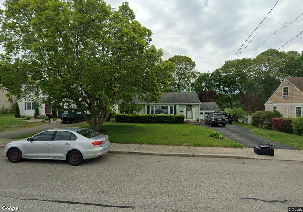
171 Morse Ave Groton, CT 06340
Estimated Value: $308,576 - $355,000
3
Beds
1
Bath
976
Sq Ft
$347/Sq Ft
Est. Value
About This Home
This home is located at 171 Morse Ave, Groton, CT 06340 and is currently estimated at $339,144, approximately $347 per square foot. 171 Morse Ave is a home located in New London County with nearby schools including Catherine Kolnaski STEAM Magnet School, Groton Middle School, and Robert E. Fitch High School.
Ownership History
Date
Name
Owned For
Owner Type
Purchase Details
Closed on
Dec 28, 2012
Sold by
Holzschlag Charles and Fitzgerald Elizabeth
Bought by
Chef Realty Llc
Current Estimated Value
Purchase Details
Closed on
Sep 14, 2009
Sold by
Blinn Mark J and Blinn Tinak
Bought by
Holzschlag Charles and Holzschlag Benny
Purchase Details
Closed on
Oct 4, 2001
Sold by
Lemieux Brian F
Bought by
Blinn Mark J and Blinn Tina
Home Financials for this Owner
Home Financials are based on the most recent Mortgage that was taken out on this home.
Original Mortgage
$125,500
Interest Rate
6.89%
Purchase Details
Closed on
Apr 28, 1998
Sold by
Hull-Eberle Barbara
Bought by
Lemieux Brian F
Home Financials for this Owner
Home Financials are based on the most recent Mortgage that was taken out on this home.
Original Mortgage
$106,700
Interest Rate
7.11%
Mortgage Type
Unknown
Create a Home Valuation Report for This Property
The Home Valuation Report is an in-depth analysis detailing your home's value as well as a comparison with similar homes in the area
Home Values in the Area
Average Home Value in this Area
Purchase History
| Date | Buyer | Sale Price | Title Company |
|---|---|---|---|
| Chef Realty Llc | -- | -- | |
| Holzschlag Charles | $200,000 | -- | |
| Blinn Mark J | $127,000 | -- | |
| Lemieux Brian F | $109,900 | -- |
Source: Public Records
Mortgage History
| Date | Status | Borrower | Loan Amount |
|---|---|---|---|
| Previous Owner | Lemieux Brian F | $35,000 | |
| Previous Owner | Lemieux Brian F | $125,500 | |
| Previous Owner | Lemieux Brian F | $106,700 | |
| Closed | Lemieux Brian F | $5,000 |
Source: Public Records
Tax History
| Year | Tax Paid | Tax Assessment Tax Assessment Total Assessment is a certain percentage of the fair market value that is determined by local assessors to be the total taxable value of land and additions on the property. | Land | Improvement |
|---|---|---|---|---|
| 2025 | $4,122 | $142,590 | $84,035 | $58,555 |
| 2024 | $3,834 | $142,590 | $84,035 | $58,555 |
| 2023 | $3,679 | $142,590 | $58,940 | $83,650 |
| 2022 | $3,558 | $142,590 | $58,940 | $83,650 |
| 2021 | $3,222 | $106,400 | $38,710 | $67,690 |
| 2020 | $3,129 | $106,400 | $38,710 | $67,690 |
| 2019 | $3,029 | $106,400 | $38,710 | $67,690 |
| 2018 | $3,059 | $106,400 | $38,710 | $67,690 |
| 2017 | $3,070 | $106,400 | $38,710 | $67,690 |
| 2016 | $3,090 | $113,750 | $47,810 | $65,940 |
| 2015 | $3,051 | $113,750 | $47,810 | $65,940 |
| 2014 | $2,838 | $113,750 | $47,810 | $65,940 |
Source: Public Records
Map
Nearby Homes
- 55 Virginia Ave Unit C
- 231 Poquonnock Rd
- 3 George Ave
- 576 Shennecossett Rd Unit G69
- 136 Blueberry Hill Rd
- 119 High Rock Rd
- 10 B St
- 26 Bakers Cove Ln
- 172 D St
- 174 D St
- 85 Baker Ave
- 374 Meridian Street Extension Unit 68
- 1043 Poquonnock Rd
- 24 Westomere Terrace
- 292 Pequot Ave Unit E1
- 292 Pequot Ave Unit 2G
- 110 Valley Rd
- 50 School St
- 25 Morgan Ct
- 279 Bridge St Unit 10
Your Personal Tour Guide
Ask me questions while you tour the home.