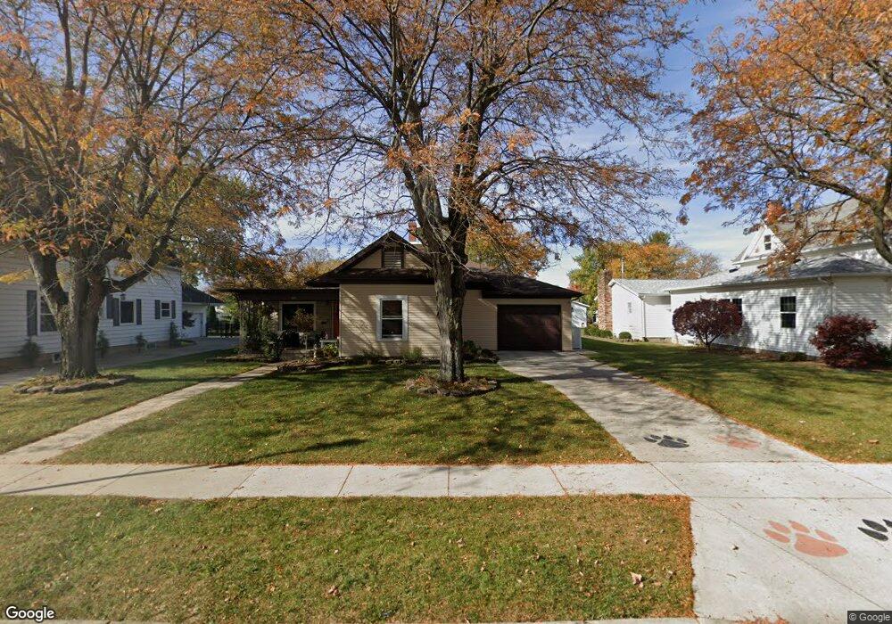
171 N Hanover St Minster, OH 45865
Estimated Value: $330,783 - $391,000
3
Beds
3
Baths
2,564
Sq Ft
$141/Sq Ft
Est. Value
About This Home
This home is located at 171 N Hanover St, Minster, OH 45865 and is currently estimated at $362,446, approximately $141 per square foot. 171 N Hanover St is a home located in Auglaize County with nearby schools including Minster Elementary School and Minster Junior/Senior High School.
Ownership History
Date
Name
Owned For
Owner Type
Purchase Details
Closed on
Dec 1, 2005
Sold by
Albers Craig A and Albers Tracy
Bought by
Bergman Douglas J
Current Estimated Value
Home Financials for this Owner
Home Financials are based on the most recent Mortgage that was taken out on this home.
Original Mortgage
$104,500
Outstanding Balance
$58,051
Interest Rate
6.17%
Mortgage Type
Future Advance Clause Open End Mortgage
Estimated Equity
$304,395
Purchase Details
Closed on
Sep 2, 1999
Sold by
Aselage Robert L
Bought by
Albers Craig A
Create a Home Valuation Report for This Property
The Home Valuation Report is an in-depth analysis detailing your home's value as well as a comparison with similar homes in the area
Home Values in the Area
Average Home Value in this Area
Purchase History
| Date | Buyer | Sale Price | Title Company |
|---|---|---|---|
| Bergman Douglas J | $27,500 | None Available | |
| Albers Craig A | $78,000 | -- |
Source: Public Records
Mortgage History
| Date | Status | Borrower | Loan Amount |
|---|---|---|---|
| Open | Bergman Douglas J | $104,500 |
Source: Public Records
Tax History Compared to Growth
Tax History
| Year | Tax Paid | Tax Assessment Tax Assessment Total Assessment is a certain percentage of the fair market value that is determined by local assessors to be the total taxable value of land and additions on the property. | Land | Improvement |
|---|---|---|---|---|
| 2024 | $5,660 | $81,480 | $15,290 | $66,190 |
| 2023 | $2,760 | $81,480 | $15,290 | $66,190 |
| 2022 | $2,669 | $73,250 | $14,030 | $59,220 |
| 2021 | $2,727 | $73,250 | $14,030 | $59,220 |
| 2020 | $1,402 | $73,245 | $14,028 | $59,217 |
| 2019 | $2,790 | $60,145 | $11,526 | $48,619 |
| 2018 | $2,803 | $60,145 | $11,526 | $48,619 |
| 2017 | $2,626 | $60,145 | $11,526 | $48,619 |
| 2016 | $2,391 | $52,333 | $10,455 | $41,878 |
| 2015 | $2,489 | $52,333 | $10,455 | $41,878 |
| 2014 | $2,386 | $52,333 | $10,455 | $41,878 |
| 2013 | $794 | $26,996 | $10,455 | $16,541 |
Source: Public Records
Map
Nearby Homes
- 47 N Frankfort St
- 17 Stonegate Dr
- 0 Stonegate Dr Unit 21 10544857
- 0 Stonegate Dr Unit 14 10544847
- 36 Shania Place Unit 23
- 27 Shania Place Unit 26
- 19 Shania Place Unit 33
- 28 Shania Place Unit 33
- 11 Shania Place Unit 28
- 193 N Paris St
- 561 S Walnut St Unit Lot3
- 129 Janice Dr
- 12600 E Shelby Rd
- 323 Margaret St
- 319 Margaret St
- 316 Margaret St
- 312 Margaret St
- 130 Janice Dr
- 133 Janice Dr
- 416 E Plum St
- 179 N Hanover St
- 163 N Hanover St
- 187 N Hanover St
- 155 N Hanover St
- 45 W 6th St
- 39 W 6th St
- 195 N Hanover St
- 147 N Hanover St
- 164 N Frankfort St
- 55 W 6th St
- 156 N Frankfort St
- 139 N Hanover St
- 172 N Frankfort St
- 180 N Frankfort St
- 188 N Frankfort St
- 48 W 6th St
- 7 Melcher St
- 40 W 6th St
- 190 N Frankfort St
- 196 N Frankfort St