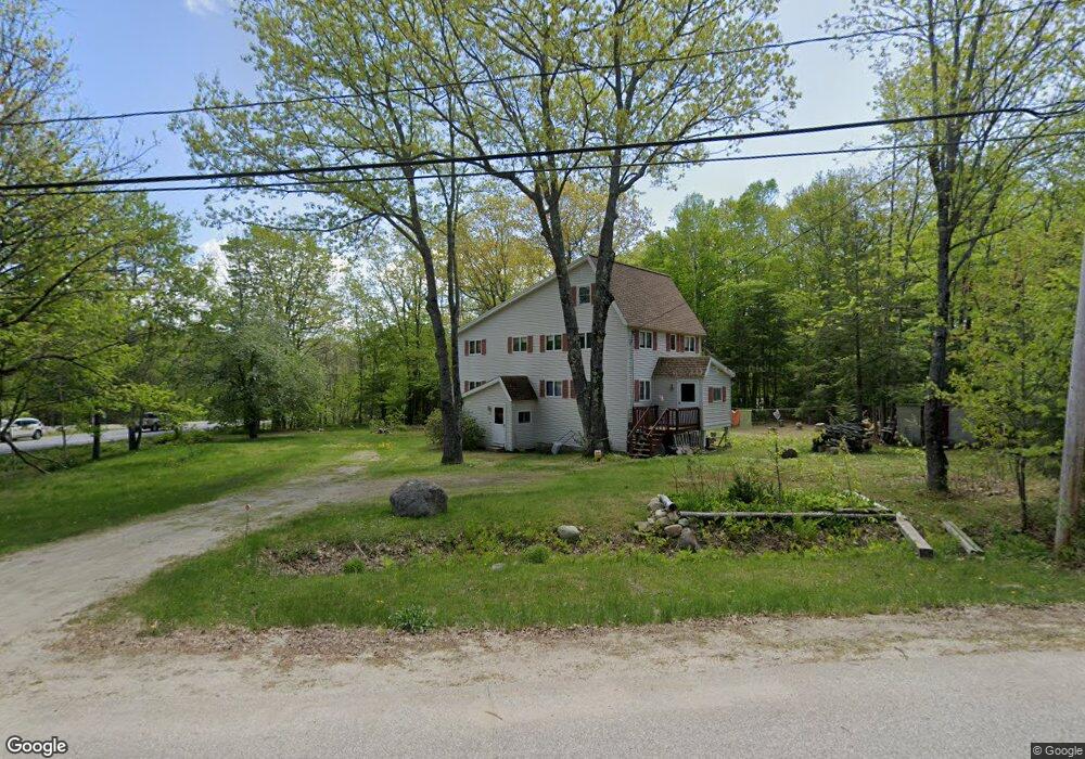
171 Pamela Dr Winthrop, ME 04364
Estimated Value: $376,000 - $403,000
4
Beds
3
Baths
2,616
Sq Ft
$149/Sq Ft
Est. Value
About This Home
This home is located at 171 Pamela Dr, Winthrop, ME 04364 and is currently estimated at $388,521, approximately $148 per square foot. 171 Pamela Dr is a home located in Kennebec County with nearby schools including Winthrop Grade School, Winthrop Middle School, and Winthrop High School.
Ownership History
Date
Name
Owned For
Owner Type
Purchase Details
Closed on
Jul 10, 2014
Sold by
Langlais Joseph F Est
Bought by
Langlais Michael
Current Estimated Value
Purchase Details
Closed on
Jul 2, 2009
Sold by
White Mark R
Bought by
Langlais Joseph F
Home Financials for this Owner
Home Financials are based on the most recent Mortgage that was taken out on this home.
Original Mortgage
$50,000
Interest Rate
4.86%
Mortgage Type
Purchase Money Mortgage
Create a Home Valuation Report for This Property
The Home Valuation Report is an in-depth analysis detailing your home's value as well as a comparison with similar homes in the area
Home Values in the Area
Average Home Value in this Area
Purchase History
| Date | Buyer | Sale Price | Title Company |
|---|---|---|---|
| Langlais Michael | -- | -- | |
| Langlais Joseph F | -- | -- |
Source: Public Records
Mortgage History
| Date | Status | Borrower | Loan Amount |
|---|---|---|---|
| Closed | Langlais Joseph F | $50,000 |
Source: Public Records
Tax History Compared to Growth
Tax History
| Year | Tax Paid | Tax Assessment Tax Assessment Total Assessment is a certain percentage of the fair market value that is determined by local assessors to be the total taxable value of land and additions on the property. | Land | Improvement |
|---|---|---|---|---|
| 2024 | $4,283 | $185,400 | $32,400 | $153,000 |
| 2022 | $4,036 | $185,400 | $32,400 | $153,000 |
| 2021 | $3,810 | $185,400 | $32,400 | $153,000 |
| 2020 | $3,829 | $185,400 | $32,400 | $153,000 |
| 2019 | $1,364 | $185,400 | $32,400 | $153,000 |
| 2018 | $1,288 | $185,400 | $32,400 | $153,000 |
| 2017 | $1,272 | $185,400 | $32,400 | $153,000 |
| 2016 | $1,261 | $185,400 | $32,400 | $153,000 |
| 2015 | $2,833 | $185,400 | $32,400 | $153,000 |
| 2014 | $2,833 | $185,400 | $32,400 | $153,000 |
Source: Public Records
Map
Nearby Homes
- 150 Pamela Dr
- 38 Pamela Dr
- 206 Route 133
- 22 Guerette Rd
- 35A-12 Woodland Rd
- 23 Green St
- 90 Route 133
- 168 Main St
- 170 Hathaway Rd
- 0 U S Highway 202
- 795 Memorial Dr
- 90 Bearce Rd
- 87 Annabessacook Rd
- 429 Sturtevant Hill Rd
- 347 Metcalf Rd
- 8 Horseshoe Rd
- 172-B Annabessacook Rd
- 172 Annabessacook Rd
- 173 Loon Cove Ln
- 427 Mount Pisgah Rd