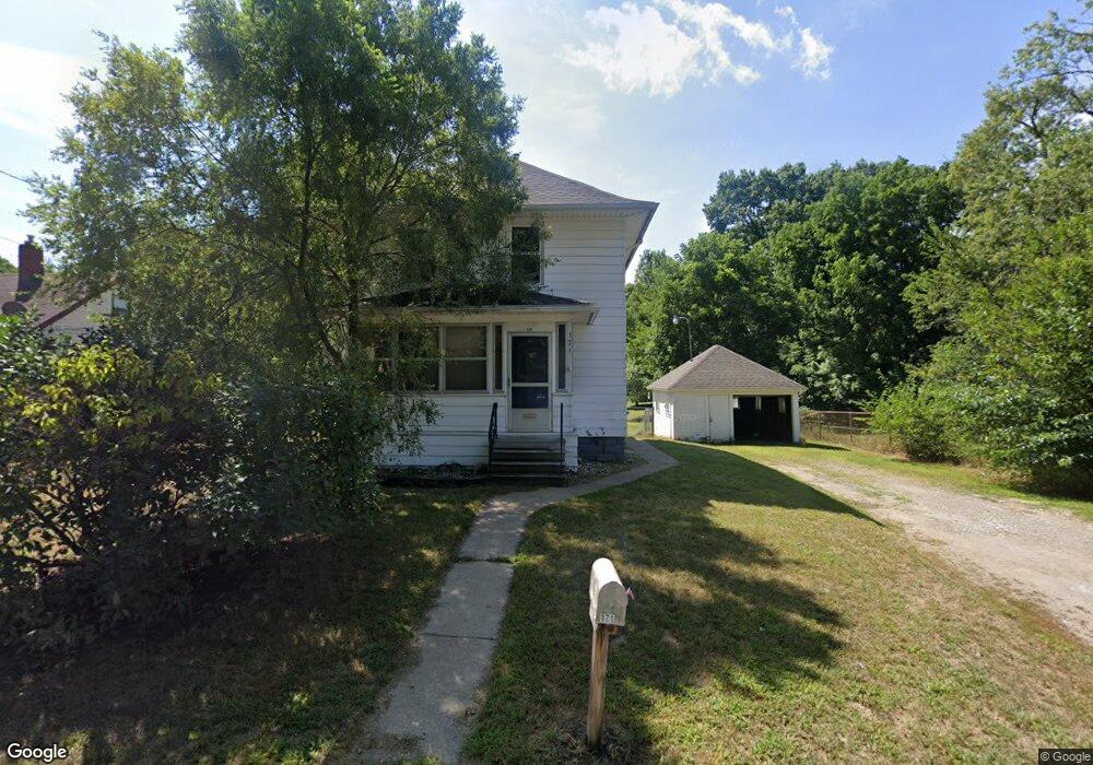
171 Pierce Ave Jackson, MI 49203
Estimated Value: $126,000 - $159,000
3
Beds
1
Bath
1,300
Sq Ft
$112/Sq Ft
Est. Value
About This Home
This home is located at 171 Pierce Ave, Jackson, MI 49203 and is currently estimated at $145,646, approximately $112 per square foot. 171 Pierce Ave is a home located in Jackson County with nearby schools including Cascades School, Sharp Park Academy, and Middle School at Parkside.
Ownership History
Date
Name
Owned For
Owner Type
Purchase Details
Closed on
Oct 11, 2010
Sold by
Hogwood Steven and Hogwood Carol
Bought by
Hogwood Properties Llc
Current Estimated Value
Purchase Details
Closed on
Jul 6, 2005
Sold by
Holland Timothy P and Holland Lisa G
Bought by
Kemp Michael S and Kemp Alicia R
Home Financials for this Owner
Home Financials are based on the most recent Mortgage that was taken out on this home.
Original Mortgage
$74,640
Interest Rate
7.18%
Mortgage Type
Fannie Mae Freddie Mac
Create a Home Valuation Report for This Property
The Home Valuation Report is an in-depth analysis detailing your home's value as well as a comparison with similar homes in the area
Home Values in the Area
Average Home Value in this Area
Purchase History
| Date | Buyer | Sale Price | Title Company |
|---|---|---|---|
| Hogwood Properties Llc | -- | None Available | |
| Kemp Michael S | $93,300 | At |
Source: Public Records
Mortgage History
| Date | Status | Borrower | Loan Amount |
|---|---|---|---|
| Previous Owner | Kemp Michael S | $74,640 |
Source: Public Records
Tax History
| Year | Tax Paid | Tax Assessment Tax Assessment Total Assessment is a certain percentage of the fair market value that is determined by local assessors to be the total taxable value of land and additions on the property. | Land | Improvement |
|---|---|---|---|---|
| 2025 | $1,916 | $59,700 | $0 | $0 |
| 2024 | $15 | $54,600 | $0 | $0 |
| 2023 | $1,402 | $47,200 | $0 | $0 |
| 2022 | $1,751 | $40,500 | $0 | $0 |
| 2021 | $1,717 | $41,500 | $0 | $0 |
| 2020 | $1,693 | $37,700 | $0 | $0 |
| 2019 | $1,671 | $35,400 | $0 | $0 |
| 2018 | $1,623 | $34,500 | $0 | $0 |
| 2017 | $1,392 | $32,900 | $0 | $0 |
| 2016 | $1,104 | $32,400 | $32,400 | $0 |
| 2015 | $1,332 | $30,400 | $30,400 | $0 |
| 2014 | $1,332 | $28,700 | $28,700 | $0 |
| 2013 | -- | $28,700 | $28,700 | $0 |
Source: Public Records
Map
Nearby Homes
- 144 Walcott Ave
- 216 W Clark St
- 2620 Francis St Unit Summit Twp
- 314 Oakwood Ave
- 112 Lincoln Ct
- 4900 Nantucket Dr Unit 1
- VL Spring Arbor Rd
- 4600 Nantucket Dr Unit 12
- 4600 Nantucket Dr Unit 9
- 4700 Nantucket Dr Unit 15
- 4700 Nantucket Dr Unit 13
- 4600 Nantucket Dr Unit 10
- 4700 Nantucket Dr Unit 6
- 4800 Nantucket Dr Unit 4
- 4900 Nantucket Dr Unit 2
- 4600 Nantucket Dr Unit 11
- 4800 Nantucket Dr Unit 17
- 4700 Nantucket Dr Unit 14
- 139 W Prospect St
- 433 E South St
- 165 Pierce Ave
- 163 Pierce Ave
- 203 Pierce Ave
- 172 Pierce Ave
- 200 Pierce Ave
- 159 Pierce Ave
- 166 Pierce Ave
- 160 Pierce Ave
- 206 Pierce Ave
- 157 Pierce Ave
- 156 Pierce Ave
- 210 Pierce Ave
- 215 Pierce Ave
- 152 Pierce Ave
- 214 Pierce Ave
- 151 Pierce Ave
- 151 Pierce Ave
- 148 Pierce Ave
- 143 Walcott Ave
- 157 Walcott Ave
Your Personal Tour Guide
Ask me questions while you tour the home.