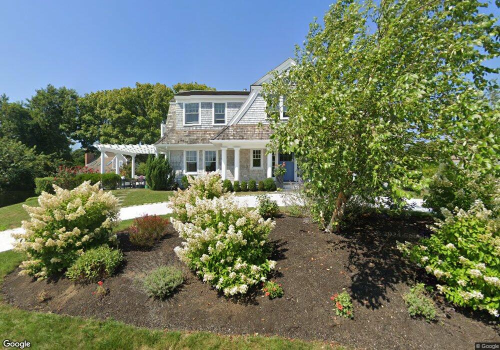
171 Queen Anne Rd Chatham, MA 02633
Chatham Village NeighborhoodEstimated Value: $3,045,000 - $4,111,000
3
Beds
3
Baths
2,000
Sq Ft
$1,814/Sq Ft
Est. Value
About This Home
This home is located at 171 Queen Anne Rd, Chatham, MA 02633 and is currently estimated at $3,628,031, approximately $1,814 per square foot. 171 Queen Anne Rd is a home located in Barnstable County with nearby schools including Chatham Elementary School, Harwich Elementary School, and Monomoy Regional Middle School.
Ownership History
Date
Name
Owned For
Owner Type
Purchase Details
Closed on
Dec 31, 2020
Sold by
Pinto Frank and Pinto Susan
Bought by
Frank P & Susan M Pinto Ft
Current Estimated Value
Purchase Details
Closed on
Sep 15, 2009
Sold by
Ruth L Cooling Ret
Bought by
Pinto Frank and Pinto Susan
Create a Home Valuation Report for This Property
The Home Valuation Report is an in-depth analysis detailing your home's value as well as a comparison with similar homes in the area
Home Values in the Area
Average Home Value in this Area
Purchase History
| Date | Buyer | Sale Price | Title Company |
|---|---|---|---|
| Frank P & Susan M Pinto Ft | -- | None Available | |
| Pinto Frank | $867,500 | -- |
Source: Public Records
Tax History Compared to Growth
Tax History
| Year | Tax Paid | Tax Assessment Tax Assessment Total Assessment is a certain percentage of the fair market value that is determined by local assessors to be the total taxable value of land and additions on the property. | Land | Improvement |
|---|---|---|---|---|
| 2025 | $12,386 | $3,569,500 | $1,268,900 | $2,300,600 |
| 2024 | $12,168 | $3,408,300 | $1,014,000 | $2,394,300 |
| 2023 | $11,280 | $2,907,200 | $844,900 | $2,062,300 |
| 2022 | $10,056 | $2,176,700 | $844,900 | $1,331,800 |
| 2021 | $9,927 | $1,993,400 | $768,000 | $1,225,400 |
| 2020 | $4,733 | $982,000 | $768,000 | $214,000 |
| 2019 | $4,769 | $983,400 | $717,900 | $265,500 |
| 2018 | $4,671 | $959,200 | $717,900 | $241,300 |
| 2017 | $4,651 | $924,700 | $696,900 | $227,800 |
| 2016 | $4,319 | $860,400 | $683,400 | $177,000 |
| 2015 | $5,088 | $1,019,700 | $844,800 | $174,900 |
| 2014 | $4,339 | $854,200 | $675,800 | $178,400 |
Source: Public Records
Map
Nearby Homes
- 12 Pond St
- 24 Shattuck Place
- 58 Oyster Bluff
- 912 Main St Unit 304
- 450 Main St
- 425 Main St Unit D
- 425 Main St Unit D
- 27 Martha Kendrick Dr
- 85 Cedar St
- 230 Barcliff Ave
- 409 Main St
- 292 Stage Harbor Rd
- 53 Gristmill Ln
- 231 Crowell Rd
- 99 Uncle Alberts Drive Extension
- 92 Barcliff Ave
- 287 Cedar St
- 32 Sunset Ln
- 20 Cedar Swamp Ln
- 163 Queen Anne Rd
- 155 Queen Anne Rd
- 713 Main St
- 693 Main St
- 166 Queen Anne Rd
- 185 Queen Anne Rd
- 757 Main St Unit 2
- 141 Queen Anne Rd
- 140 Queen Anne Rd
- 58 Pond St
- 52 Pond St
- 679 Main St
- 194 Queen Anne Rd
- 741 Main St
- 739 Main St Unit E
- 735 Main St Unit C
- 739 Main St
- 735 Main St
- 727 Main St
- 133 Queen Anne Rd