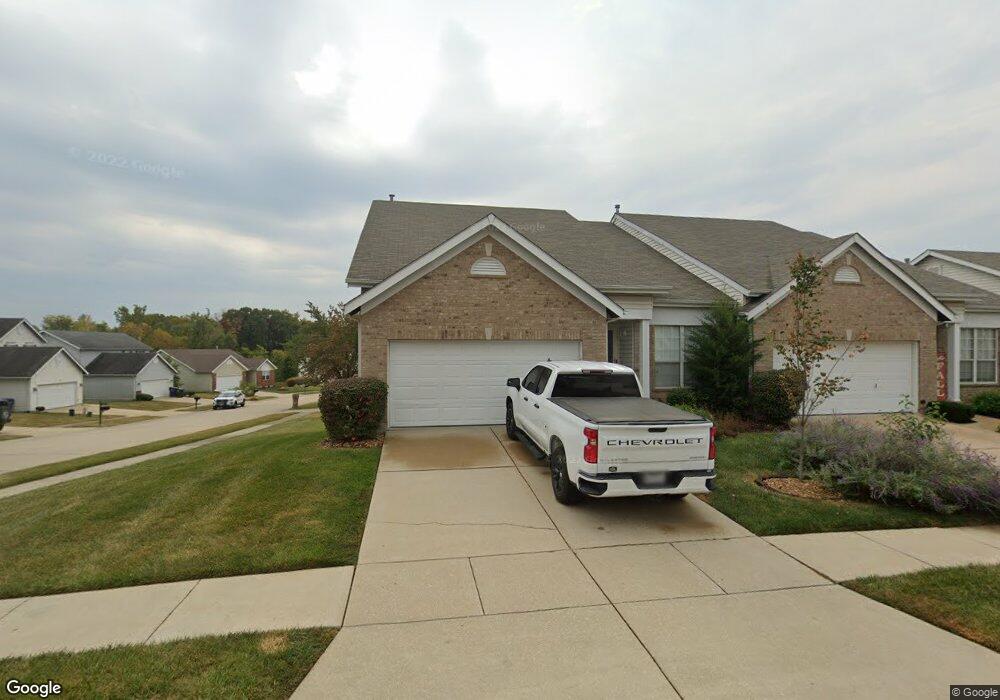
171 Robbins Way Dr Florissant, MO 63034
Estimated Value: $192,000 - $273,000
3
Beds
3
Baths
1,734
Sq Ft
$137/Sq Ft
Est. Value
About This Home
This home is located at 171 Robbins Way Dr, Florissant, MO 63034 and is currently estimated at $237,253, approximately $136 per square foot. 171 Robbins Way Dr is a home located in St. Louis County with nearby schools including Barrington Elementary School, Central Middle School, and Hazelwood Central High School.
Ownership History
Date
Name
Owned For
Owner Type
Purchase Details
Closed on
Dec 23, 2002
Sold by
Mcbride & Son Homes Inc
Bought by
Harrell Donald L and Robinson Joyce L
Current Estimated Value
Home Financials for this Owner
Home Financials are based on the most recent Mortgage that was taken out on this home.
Original Mortgage
$161,225
Interest Rate
5.9%
Create a Home Valuation Report for This Property
The Home Valuation Report is an in-depth analysis detailing your home's value as well as a comparison with similar homes in the area
Home Values in the Area
Average Home Value in this Area
Purchase History
| Date | Buyer | Sale Price | Title Company |
|---|---|---|---|
| Harrell Donald L | $165,275 | -- |
Source: Public Records
Mortgage History
| Date | Status | Borrower | Loan Amount |
|---|---|---|---|
| Previous Owner | Harrell Donald L | $161,225 |
Source: Public Records
Tax History Compared to Growth
Tax History
| Year | Tax Paid | Tax Assessment Tax Assessment Total Assessment is a certain percentage of the fair market value that is determined by local assessors to be the total taxable value of land and additions on the property. | Land | Improvement |
|---|---|---|---|---|
| 2025 | $2,429 | $39,100 | $4,410 | $34,690 |
| 2024 | $2,429 | $26,620 | $2,680 | $23,940 |
| 2023 | $2,420 | $26,620 | $2,680 | $23,940 |
| 2022 | $2,928 | $28,710 | $5,760 | $22,950 |
| 2021 | $2,771 | $28,710 | $5,760 | $22,950 |
| 2020 | $2,538 | $24,470 | $2,300 | $22,170 |
| 2019 | $2,497 | $24,470 | $2,300 | $22,170 |
| 2018 | $2,568 | $23,280 | $1,560 | $21,720 |
| 2017 | $2,565 | $23,280 | $1,560 | $21,720 |
| 2016 | $2,706 | $24,170 | $1,940 | $22,230 |
| 2015 | $2,644 | $24,170 | $1,940 | $22,230 |
| 2014 | $2,730 | $24,860 | $5,210 | $19,650 |
Source: Public Records
Map
Nearby Homes
- 4629 Richmond Forest Dr
- 173 Behlmann Meadows Way
- 210 Behlmann Meadows Way
- 107 Behlmann Orchard Ct
- 13630 Old Halls Ferry Rd
- 14333 River Oaks Ct
- 5220 Delcastle Dr
- 4304 Inlet Isle Dr Unit 7
- 4328 Inlet Isle Dr
- 13124 Crestwood Bend Ln
- 13125 Crestwood Bend Ln
- 13136 Crestwood Bend Ln
- 13141 Crestwood Bend Ln
- 13140 Crestwood Bend Ln
- 13107 Ambrose Ct
- 4846 Trees Edge Ln
- 13144 Crestwood Bend Ln
- 4866 Trees Edge Ln
- 13145 Crestwood Bend Ln
- 4870 Trees Edge Ln
- 165 Robbins Way Dr
- 4615 Robbins Grove Dr
- 163 Robbins Way Dr
- 4606 Robbins Grove Dr
- 4610 Robbins Grove Dr
- 172 Robbins Way Dr
- 170 Robbins Way Dr
- 4602 Robbins Grove Dr
- 4623 Robbins Grove Dr
- 4614 Robbins Grove Dr
- 166 Robbins Way Dr
- 4572 Robbins Grove Dr
- 159 Robbins Way Dr
- 164 Robbins Way Dr
- 4639 Robbins Grove Dr
- 4568 Robbins Grove Dr
- 4643 Robbins Grove Dr
- 4618 Robbins Grove Dr
- 157 Robbins Way Dr
- 4561 Robbins Grove Dr