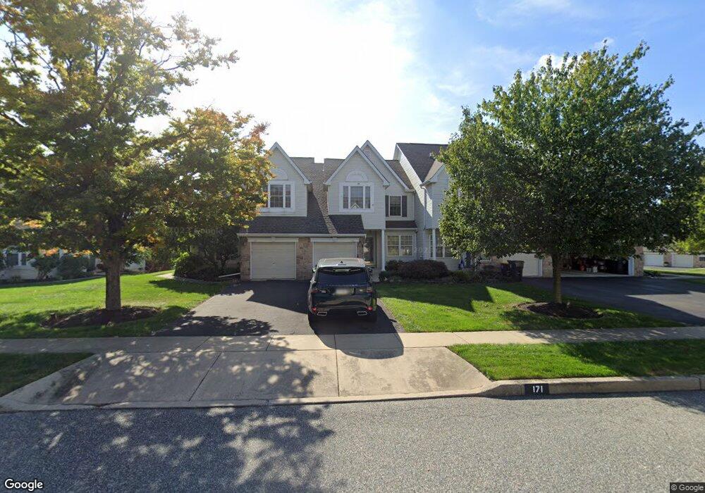
171 Stetson Dr Chalfont, PA 18914
Estimated Value: $488,030 - $529,000
3
Beds
3
Baths
1,708
Sq Ft
$300/Sq Ft
Est. Value
About This Home
This home is located at 171 Stetson Dr, Chalfont, PA 18914 and is currently estimated at $512,258, approximately $299 per square foot. 171 Stetson Dr is a home located in Bucks County with nearby schools including Mill Creek Elementary School, Unami Middle School, and Central Bucks High School - South.
Ownership History
Date
Name
Owned For
Owner Type
Purchase Details
Closed on
May 1, 2001
Sold by
Augustyn Robin L and Idason Anthony R
Bought by
Idason Anthony R
Current Estimated Value
Home Financials for this Owner
Home Financials are based on the most recent Mortgage that was taken out on this home.
Original Mortgage
$150,400
Outstanding Balance
$55,535
Interest Rate
6.88%
Estimated Equity
$456,723
Purchase Details
Closed on
Aug 18, 1998
Sold by
The Cutler Group Inc
Bought by
Kneller Mark D and Kneller Angela L
Home Financials for this Owner
Home Financials are based on the most recent Mortgage that was taken out on this home.
Original Mortgage
$135,600
Interest Rate
6.86%
Mortgage Type
Balloon
Create a Home Valuation Report for This Property
The Home Valuation Report is an in-depth analysis detailing your home's value as well as a comparison with similar homes in the area
Home Values in the Area
Average Home Value in this Area
Purchase History
| Date | Buyer | Sale Price | Title Company |
|---|---|---|---|
| Idason Anthony R | $17,980 | -- | |
| Kneller Mark D | $169,550 | -- |
Source: Public Records
Mortgage History
| Date | Status | Borrower | Loan Amount |
|---|---|---|---|
| Open | Idason Anthony R | $150,400 | |
| Previous Owner | Kneller Mark D | $135,600 |
Source: Public Records
Tax History Compared to Growth
Tax History
| Year | Tax Paid | Tax Assessment Tax Assessment Total Assessment is a certain percentage of the fair market value that is determined by local assessors to be the total taxable value of land and additions on the property. | Land | Improvement |
|---|---|---|---|---|
| 2025 | $5,841 | $31,640 | $3,240 | $28,400 |
| 2024 | $5,841 | $31,640 | $3,240 | $28,400 |
| 2023 | $5,408 | $31,640 | $3,240 | $28,400 |
| 2022 | $5,301 | $31,640 | $3,240 | $28,400 |
| 2021 | $5,242 | $31,640 | $3,240 | $28,400 |
| 2020 | $5,242 | $31,640 | $3,240 | $28,400 |
| 2019 | $5,210 | $31,640 | $3,240 | $28,400 |
| 2018 | $5,152 | $31,640 | $3,240 | $28,400 |
| 2017 | $5,083 | $31,640 | $3,240 | $28,400 |
| 2016 | $5,067 | $31,640 | $3,240 | $28,400 |
| 2015 | -- | $31,640 | $3,240 | $28,400 |
| 2014 | -- | $31,640 | $3,240 | $28,400 |
Source: Public Records
Map
Nearby Homes
- 3000 Tyler Way
- 511 McNaney Farm Dr Lot #6
- 528 Fullerton Farm Ct
- 506 McNaney Farm Dr Lot # 27
- 506 Fullerton Farm Court Lot #22
- 503
- 508 Fullerton Farm Court Lot#21
- 3220 Wier Dr W Unit W
- 1231 Lower State Rd
- 222 Grove Valley Ct
- 214 Grove Valley Ct
- 204 Neighbors Rd
- 1608 County Line Rd
- 625 N Settlers Cir
- 407 Maryjoe Way
- 87 Schreiner Dr
- 2627 County Line Rd
- 2617 County Line Rd
- 430 Homestead Cir
- 623 Addison Way
- 169 Stetson Dr
- 173 Stetson Dr
- 167 Stetson Dr
- 175 Stetson Dr
- 177 Stetson Dr
- 826 Sherrick Ct
- 830 Sherrick Ct
- 828 Sherrick Ct Unit 234
- 179 Stetson Dr
- 832 Sherrick Ct
- 834 Sherrick Ct
- 181 Stetson Dr
- 172 Stetson Dr
- 170 Stetson Dr
- 174 Stetson Dr
- 836 Sherrick Ct
- 176 Stetson Dr
- 178 Stetson Dr
- 168 Stetson Dr
- 166 Stetson Dr