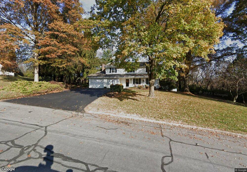
171 Sunset Dr Carlisle, PA 17013
Estimated Value: $398,000 - $464,000
4
Beds
3
Baths
2,589
Sq Ft
$170/Sq Ft
Est. Value
About This Home
This home is located at 171 Sunset Dr, Carlisle, PA 17013 and is currently estimated at $440,321, approximately $170 per square foot. 171 Sunset Dr is a home located in Cumberland County with nearby schools including Bellaire Elementary School, Wilson Middle School, and Carlisle Area High School.
Ownership History
Date
Name
Owned For
Owner Type
Purchase Details
Closed on
Jun 30, 2010
Sold by
Dunaway Thomas W
Bought by
Trolinger Brian K
Current Estimated Value
Home Financials for this Owner
Home Financials are based on the most recent Mortgage that was taken out on this home.
Original Mortgage
$254,571
Outstanding Balance
$169,419
Interest Rate
4.75%
Mortgage Type
FHA
Estimated Equity
$270,902
Purchase Details
Closed on
Dec 19, 2006
Sold by
Shalikashvili Othar J
Bought by
Dunaway Thomas W
Home Financials for this Owner
Home Financials are based on the most recent Mortgage that was taken out on this home.
Original Mortgage
$224,000
Interest Rate
6.24%
Mortgage Type
New Conventional
Create a Home Valuation Report for This Property
The Home Valuation Report is an in-depth analysis detailing your home's value as well as a comparison with similar homes in the area
Home Values in the Area
Average Home Value in this Area
Purchase History
| Date | Buyer | Sale Price | Title Company |
|---|---|---|---|
| Trolinger Brian K | $258,000 | -- | |
| Dunaway Thomas W | $280,000 | -- |
Source: Public Records
Mortgage History
| Date | Status | Borrower | Loan Amount |
|---|---|---|---|
| Open | Trolinger Brian K | $254,571 | |
| Previous Owner | Dunaway Thomas W | $224,000 |
Source: Public Records
Tax History Compared to Growth
Tax History
| Year | Tax Paid | Tax Assessment Tax Assessment Total Assessment is a certain percentage of the fair market value that is determined by local assessors to be the total taxable value of land and additions on the property. | Land | Improvement |
|---|---|---|---|---|
| 2025 | $5,552 | $265,000 | $65,800 | $199,200 |
| 2024 | $5,341 | $265,000 | $65,800 | $199,200 |
| 2023 | $5,148 | $265,000 | $65,800 | $199,200 |
| 2022 | $5,065 | $265,000 | $65,800 | $199,200 |
| 2021 | $4,984 | $265,000 | $65,800 | $199,200 |
| 2020 | $4,865 | $265,000 | $65,800 | $199,200 |
| 2019 | $4,750 | $265,000 | $65,800 | $199,200 |
| 2018 | $4,626 | $265,000 | $65,800 | $199,200 |
| 2017 | $4,521 | $265,000 | $65,800 | $199,200 |
| 2016 | -- | $265,000 | $65,800 | $199,200 |
| 2015 | -- | $265,000 | $65,800 | $199,200 |
| 2014 | -- | $265,000 | $65,800 | $199,200 |
Source: Public Records
Map
Nearby Homes
- 40 Moongale Dr
- 140 Shatto Dr
- 181 Shatto Dr
- 10 Family Dr
- 2 Stream Dr
- 10 Stream Dr
- 23 American Ave
- 21 American Ave
- 4 Stream Dr
- 6 Stream Dr
- 3 Lantern Ct
- 12 Family Dr
- Bryson Plan at Hays Landing
- Monroe Plan at Hays Landing
- Willow Plan at Hays Landing
- Mackenzie Plan at Hays Landing
- Cooper Plan at Hays Landing
- Charlotte Plan at Hays Landing
- Dalton Plan at Hays Landing
- Heron Plan at Hays Landing
- 161 Sunset Dr
- 170 Sunset Dr
- 181 Sunset Dr
- 1550 Waggoners Gap Rd
- 190 Sunset Dr
- 151 Sunset Dr
- 40 Union Hall Rd
- 21 Moongale Dr
- 221 Sunset Dr
- 31 Moongale Dr
- 130 Sunset Dr
- 41 Moongale Dr
- 220 Sunset Dr
- 121 Sunset Dr
- 20 Moongale Dr
- 10 Moongale Dr
- 51 Moongale Dr
- 120 Sunset Dr
- 30 Moongale Dr
- 1561 Waggoners Gap Rd