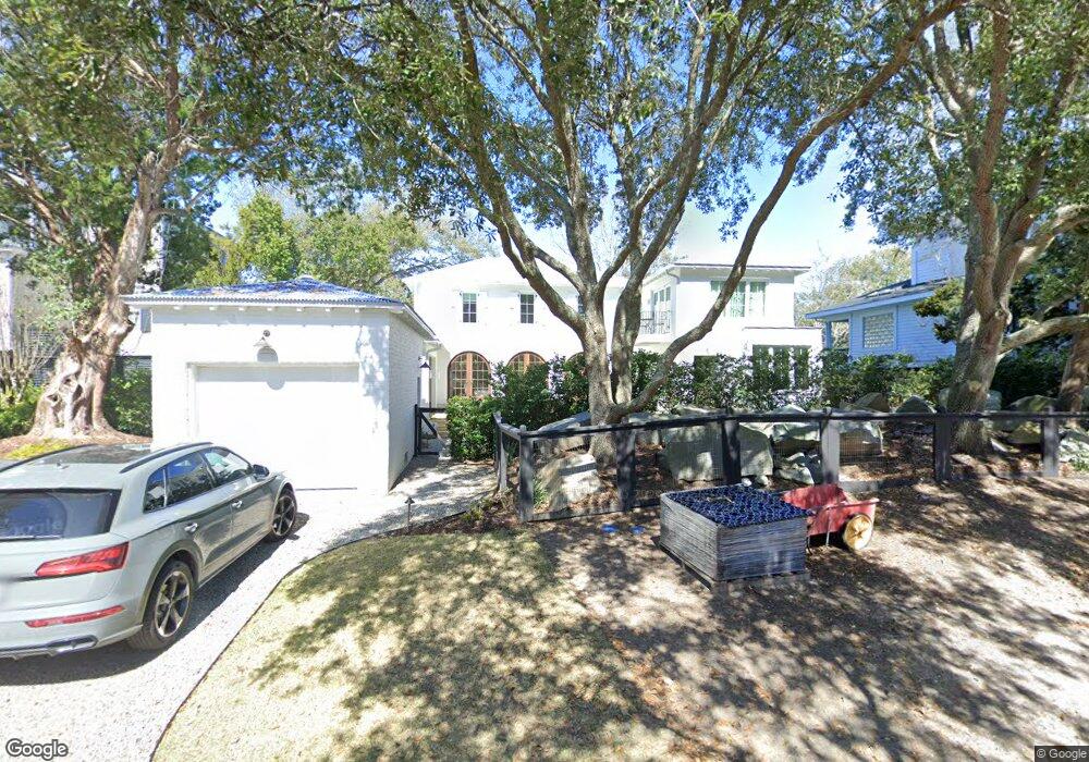
1710 Atlantic Ave Unit B Sullivans Island, SC 29482
Sullivan's Island NeighborhoodEstimated Value: $3,059,000 - $4,584,671
3
Beds
2
Baths
1,250
Sq Ft
$3,189/Sq Ft
Est. Value
About This Home
This home is located at 1710 Atlantic Ave Unit B, Sullivans Island, SC 29482 and is currently estimated at $3,986,418, approximately $3,189 per square foot. 1710 Atlantic Ave Unit B is a home located in Charleston County with nearby schools including Sullivans Island Elementary School, Moultrie Middle School, and Wando High School.
Ownership History
Date
Name
Owned For
Owner Type
Purchase Details
Closed on
Feb 17, 2020
Sold by
Veranda Levande Llc
Bought by
Graves Jeremy G
Current Estimated Value
Home Financials for this Owner
Home Financials are based on the most recent Mortgage that was taken out on this home.
Original Mortgage
$1,300,000
Outstanding Balance
$1,148,856
Interest Rate
3.5%
Mortgage Type
Construction
Estimated Equity
$2,837,562
Purchase Details
Closed on
Mar 4, 2014
Sold by
Volkmann Mark
Bought by
Veranda Levande Llc
Purchase Details
Closed on
Jun 12, 2000
Sold by
Douglas Gepford J and Mayer William B
Bought by
Two Pelicans Llc
Create a Home Valuation Report for This Property
The Home Valuation Report is an in-depth analysis detailing your home's value as well as a comparison with similar homes in the area
Home Values in the Area
Average Home Value in this Area
Purchase History
| Date | Buyer | Sale Price | Title Company |
|---|---|---|---|
| Graves Jeremy G | $1,208,500 | None Available | |
| Veranda Levande Llc | -- | -- | |
| Two Pelicans Llc | $600,000 | -- |
Source: Public Records
Mortgage History
| Date | Status | Borrower | Loan Amount |
|---|---|---|---|
| Open | Graves Jeremy G | $1,300,000 |
Source: Public Records
Tax History Compared to Growth
Tax History
| Year | Tax Paid | Tax Assessment Tax Assessment Total Assessment is a certain percentage of the fair market value that is determined by local assessors to be the total taxable value of land and additions on the property. | Land | Improvement |
|---|---|---|---|---|
| 2024 | $12,168 | $108,000 | $0 | $0 |
| 2023 | $12,168 | $108,000 | $0 | $0 |
| 2022 | $5,431 | $48,320 | $0 | $0 |
| 2021 | $18,001 | $48,320 | $0 | $0 |
| 2020 | $14,672 | $59,510 | $0 | $0 |
| 2019 | $13,008 | $51,750 | $0 | $0 |
| 2017 | $11,923 | $51,750 | $0 | $0 |
| 2016 | $11,490 | $51,750 | $0 | $0 |
| 2015 | $10,887 | $51,750 | $0 | $0 |
| 2014 | $8,975 | $0 | $0 | $0 |
| 2011 | -- | $0 | $0 | $0 |
Source: Public Records
Map
Nearby Homes
- 1651 Atlantic Ave
- 1727 Atlantic Ave
- 1714 Middle St
- 1750 Ion Ave
- 1773 Atlantic Ave
- 932 Middle St
- 409 Station 22 1 2 St
- 2307 Ion Ave
- 2407 Atlantic Ave
- 2414 Goldbug Ave
- 2424 Middle St
- 1602 Marsh Harbor Ln Unit A
- 1647 Marsh Harbor Ln
- 2524 Middle St
- 2524 Goldbug Ave
- 1608 Marsh Harbor Ln Unit C
- 2630 Bayonne Ave
- 2629 Goldbug Ave
- 0 Middle St
- 967 Royall Ave
- 1710 Atlantic Ave
- 1710 Atlantic Ave Unit A
- 1714 Atlantic Ave
- 1702 Atlantic Ave
- 1718 Atlantic Ave
- 1707 Atlantic Ave
- 1711 Atlantic Ave
- 1702 Ion Ave
- 1710 Ion Ave
- 1701 Atlantic Ave
- 1660 Atlantic Ave
- 1722 Atlantic Ave
- 1718 Ion Ave
- 1709 Atlantic Ave
- 209 Station 17 St
- 1659 Atlantic Ave
- 1715 Atlantic Ave
- 1726 Atlantic Ave
- 1721 Atlantic Ave
- 1724 Ion Ave