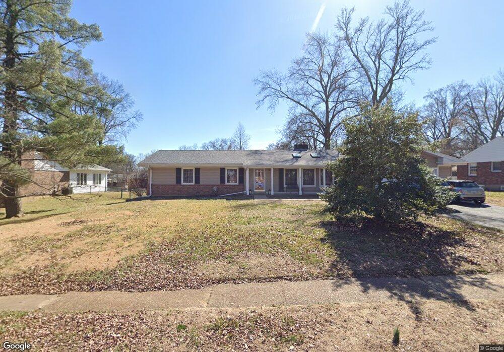
1710 Black Twig Ln Saint Louis, MO 63122
Estimated Value: $620,000 - $691,000
4
Beds
3
Baths
2,156
Sq Ft
$306/Sq Ft
Est. Value
About This Home
This home is located at 1710 Black Twig Ln, Saint Louis, MO 63122 and is currently estimated at $660,395, approximately $306 per square foot. 1710 Black Twig Ln is a home located in St. Louis County with nearby schools including Westchester Elementary School, North Kirkwood Middle School, and Kirkwood Senior High School.
Ownership History
Date
Name
Owned For
Owner Type
Purchase Details
Closed on
Aug 26, 2011
Sold by
Randolph Theodore F
Bought by
Whittaker Donald and Whittaker Colleen
Current Estimated Value
Home Financials for this Owner
Home Financials are based on the most recent Mortgage that was taken out on this home.
Original Mortgage
$299,550
Outstanding Balance
$24,695
Interest Rate
4.53%
Mortgage Type
VA
Estimated Equity
$635,700
Create a Home Valuation Report for This Property
The Home Valuation Report is an in-depth analysis detailing your home's value as well as a comparison with similar homes in the area
Home Values in the Area
Average Home Value in this Area
Purchase History
| Date | Buyer | Sale Price | Title Company |
|---|---|---|---|
| Whittaker Donald | $290,000 | Title Partners Agency Llc |
Source: Public Records
Mortgage History
| Date | Status | Borrower | Loan Amount |
|---|---|---|---|
| Open | Whittaker Donald | $299,550 |
Source: Public Records
Tax History Compared to Growth
Tax History
| Year | Tax Paid | Tax Assessment Tax Assessment Total Assessment is a certain percentage of the fair market value that is determined by local assessors to be the total taxable value of land and additions on the property. | Land | Improvement |
|---|---|---|---|---|
| 2025 | $6,616 | $110,120 | $60,990 | $49,130 |
| 2024 | $6,616 | $105,490 | $41,930 | $63,560 |
| 2023 | $6,511 | $105,490 | $41,930 | $63,560 |
| 2022 | $6,051 | $91,440 | $41,930 | $49,510 |
| 2021 | $5,972 | $91,440 | $41,930 | $49,510 |
| 2020 | $5,678 | $83,580 | $33,310 | $50,270 |
| 2019 | $5,679 | $83,580 | $33,310 | $50,270 |
| 2018 | $5,288 | $68,720 | $26,960 | $41,760 |
| 2017 | $5,281 | $68,720 | $26,960 | $41,760 |
| 2016 | $4,889 | $64,090 | $23,160 | $40,930 |
| 2015 | $4,884 | $64,090 | $23,160 | $40,930 |
| 2014 | $5,284 | $67,850 | $16,380 | $51,470 |
Source: Public Records
Map
Nearby Homes
- 12006 Montour Dr
- 11913 Lillian Ave
- 11909 Lillian Ave
- 1422 Northlin Dr
- 896 Twin Pine Dr
- 1710 Lynkirk Ln
- 919 Nana Ln
- 12224 TBB Roger Ln
- 1090 Kinstern Dr
- 785 N Ballas Rd
- 918 N Ballas Rd
- 1312 W Essex Ave
- 2005 Woodland Knoll
- 2037 Trailcrest Ln Unit 7
- 1126 Bopp Rd
- 1001 Dovergate Dr
- 2017 Woodland Knoll
- 2002 Woodland Knoll
- 698 Trailcrest Ct Unit 5
- 2025 Woodland Knoll
- 1714 Black Twig Ln
- 1704 Black Twig Ln
- 1709 Ben Davis Ln
- 1703 Ben Davis Ln
- 1711 Black Twig Ln
- 914 Black Twig Ln
- 1715 Black Twig Ln
- 1705 Black Twig Ln
- 908 Black Twig Ln
- 1719 Black Twig Ln
- 1609 Lindgate Dr
- 860 Lindeman Rd
- 12010 Montour Dr
- 12014 Montour Dr
- 1612 Lindgate Dr
- 12018 Montour Dr
- 1708 Ben Davis Ln
- 12000 Montour Dr
- 1723 Black Twig Ln
- 1712 Ben Davis Ln