Estimated Value: $183,000 - $201,000
4
Beds
1
Bath
1,450
Sq Ft
$135/Sq Ft
Est. Value
About This Home
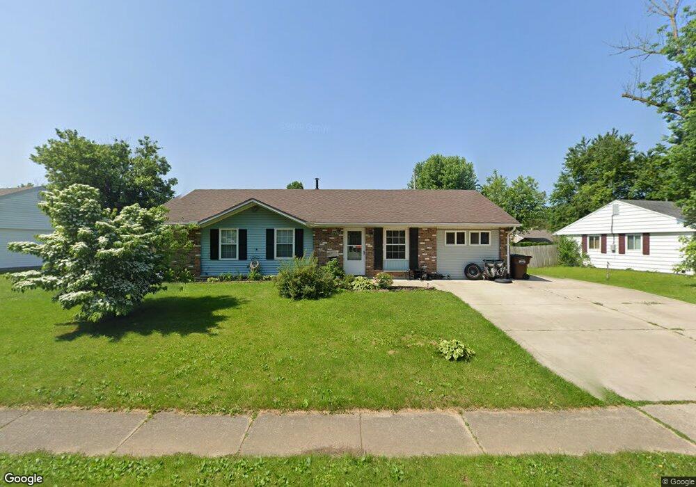
This home is located at 1710 Commonwealth Dr, Xenia, OH 45385 and is currently estimated at $195,233, approximately $134 per square foot. 1710 Commonwealth Dr is a home located in Greene County with nearby schools including Xenia High School, Summit Academy Community School for Alternative Learners - Xenia, and Legacy Christian Academy.
Ownership History
Date
Name
Owned For
Owner Type
Purchase Details
Closed on
Oct 20, 2021
Sold by
Mckenzie Angela and Mckenzie Carey
Bought by
Mckenzie Carey and Mckenzie Angela
Current Estimated Value
Home Financials for this Owner
Home Financials are based on the most recent Mortgage that was taken out on this home.
Original Mortgage
$76,500
Outstanding Balance
$64,884
Interest Rate
2.99%
Mortgage Type
New Conventional
Estimated Equity
$130,349
Purchase Details
Closed on
May 31, 2000
Sold by
Fry James R and Fry Janet L
Bought by
Furlong Angela B
Home Financials for this Owner
Home Financials are based on the most recent Mortgage that was taken out on this home.
Original Mortgage
$76,176
Interest Rate
8.14%
Mortgage Type
FHA
Create a Home Valuation Report for This Property
The Home Valuation Report is an in-depth analysis detailing your home's value as well as a comparison with similar homes in the area
Home Values in the Area
Average Home Value in this Area
Purchase History
| Date | Buyer | Sale Price | Title Company |
|---|---|---|---|
| Mckenzie Carey | -- | None Available | |
| Furlong Angela B | $76,500 | -- |
Source: Public Records
Mortgage History
| Date | Status | Borrower | Loan Amount |
|---|---|---|---|
| Open | Mckenzie Carey | $76,500 | |
| Closed | Furlong Angela B | $76,176 |
Source: Public Records
Tax History Compared to Growth
Tax History
| Year | Tax Paid | Tax Assessment Tax Assessment Total Assessment is a certain percentage of the fair market value that is determined by local assessors to be the total taxable value of land and additions on the property. | Land | Improvement |
|---|---|---|---|---|
| 2024 | $2,083 | $48,670 | $12,300 | $36,370 |
| 2023 | $2,083 | $48,670 | $12,300 | $36,370 |
| 2022 | $1,724 | $34,370 | $7,240 | $27,130 |
| 2021 | $1,747 | $34,370 | $7,240 | $27,130 |
| 2020 | $1,674 | $34,370 | $7,240 | $27,130 |
| 2019 | $1,445 | $27,920 | $7,080 | $20,840 |
| 2018 | $1,450 | $27,920 | $7,080 | $20,840 |
| 2017 | $1,326 | $27,920 | $7,080 | $20,840 |
| 2016 | $1,327 | $25,060 | $7,080 | $17,980 |
| 2015 | $1,330 | $25,060 | $7,080 | $17,980 |
| 2014 | $1,274 | $25,060 | $7,080 | $17,980 |
Source: Public Records
Map
Nearby Homes
- 1866 Roxbury Dr
- 1403 Texas Dr
- 1778 Arapaho Dr
- 1829 Gayhart Dr
- 1769 Gayhart Dr
- 1908 Whitt St
- 1255 Colorado Dr
- 1107 Arkansas Dr
- 1618 Navajo Dr
- 1653 Seneca Dr
- 1272 Bellbrook Ave
- 1208 Bellbrook Ave
- 2499 Jenny Marie Dr
- 2257 Maryland Dr
- 2540 Jenny Marie Dr
- 2345 Tennessee Dr
- 2421 Louisiana Dr
- 2142 Michigan Dr
- 2540 Cornwall Dr
- 1568 Cheyenne Dr
- 1728 Commonwealth Dr
- 1700 Commonwealth Dr
- 1755 Roxbury Dr
- 1743 Roxbury Dr
- 1684 Commonwealth Dr
- 1746 Commonwealth Dr
- 1683 Commonwealth Dr
- 1767 Roxbury Dr
- 1673 Commonwealth Dr
- 1697 Commonwealth Dr
- 1659 Commonwealth Dr
- 1764 Commonwealth Dr
- 1670 Commonwealth Dr
- 1711 Commonwealth Dr
- 1725 Commonwealth Dr
- 1779 Roxbury Dr
- 1739 Commonwealth Dr
- 1645 Commonwealth Dr
- 1782 Commonwealth Dr
- 1299 Texas Dr