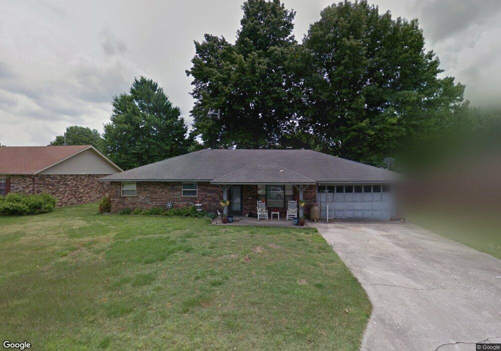
1710 Crouch St Bentonville, AR 72712
Estimated Value: $380,957 - $501,000
--
Bed
2
Baths
1,770
Sq Ft
$256/Sq Ft
Est. Value
About This Home
This home is located at 1710 Crouch St, Bentonville, AR 72712 and is currently estimated at $452,489, approximately $255 per square foot. 1710 Crouch St is a home located in Benton County with nearby schools including Ruth Barker Middle School, R.E. Baker Elementary School, and Fulbright Junior High School.
Ownership History
Date
Name
Owned For
Owner Type
Purchase Details
Closed on
Jul 21, 2011
Sold by
Chick Linda Kay and Chick Donald L
Bought by
Chick Linda Kay and Chick Donald Lee
Current Estimated Value
Purchase Details
Closed on
Mar 5, 2008
Sold by
Banks Randall Carl
Bought by
Chick Linda Kay
Purchase Details
Closed on
Dec 12, 1995
Bought by
Dod 12-12-1995
Purchase Details
Closed on
Jun 1, 1993
Bought by
Banks Family Trust
Purchase Details
Closed on
Jun 13, 1989
Bought by
Banks
Purchase Details
Closed on
Jul 5, 1985
Bought by
Banks
Purchase Details
Closed on
Apr 15, 1980
Bought by
Banks
Create a Home Valuation Report for This Property
The Home Valuation Report is an in-depth analysis detailing your home's value as well as a comparison with similar homes in the area
Home Values in the Area
Average Home Value in this Area
Purchase History
| Date | Buyer | Sale Price | Title Company |
|---|---|---|---|
| Chick Linda Kay | -- | None Available | |
| Chick Linda Kay | -- | None Available | |
| Dod 12-12-1995 | -- | -- | |
| Banks Family Trust | -- | -- | |
| Banks | -- | -- | |
| Banks | -- | -- | |
| Banks | $45,000 | -- |
Source: Public Records
Tax History Compared to Growth
Tax History
| Year | Tax Paid | Tax Assessment Tax Assessment Total Assessment is a certain percentage of the fair market value that is determined by local assessors to be the total taxable value of land and additions on the property. | Land | Improvement |
|---|---|---|---|---|
| 2025 | $1,182 | $69,678 | $15,000 | $54,678 |
| 2024 | $1,187 | $69,678 | $15,000 | $54,678 |
| 2023 | $1,187 | $44,040 | $8,600 | $35,440 |
| 2022 | $841 | $44,040 | $8,600 | $35,440 |
| 2021 | $837 | $44,040 | $8,600 | $35,440 |
| 2020 | $849 | $30,300 | $3,800 | $26,500 |
| 2019 | $849 | $30,300 | $3,800 | $26,500 |
| 2018 | $874 | $30,300 | $3,800 | $26,500 |
| 2017 | $782 | $30,300 | $3,800 | $26,500 |
| 2016 | $782 | $30,300 | $3,800 | $26,500 |
| 2015 | $1,080 | $17,470 | $3,840 | $13,630 |
| 2014 | $730 | $17,470 | $3,840 | $13,630 |
Source: Public Records
Map
Nearby Homes
- 1902 Lawrence St
- 1710 SE Flynt St
- 1602 SE P St
- 2302 & 2301 SE 14th 15th St
- 1126 Lockheed St
- 2401 SE 16th St
- 1126 Lockheed St
- 1908 and 1910 SE J St
- 0 SE J St
- 1100 Lockheed St
- 1102 Lockheed St
- 1203 SE 21st St
- 906 Convair St
- 2301 Beth Ln
- 900 Convair St
- 929 SE 10th St
- 814 SE Jon Dr
- 2401 SE 9th St
- 2202 Del White Dr
- 803 SE Jon Dr
- 1712 Crouch St
- 1708 Crouch St
- 1803 Lawrence St
- 1805 Lawrence St
- 1801 Lawrence St
- 1802 Crouch St
- 1706 Crouch St
- 1709 Crouch St
- 1807 Lawrence St
- 1711 Crouch St
- 1801 SE Crouch St
- 1705 Crouch St
- 1801 Crouch St
- 1713 Lawrence St
- 1713 SE Lawrence St
- 1901 Lawrence St
- 1804 Crouch St
- 1803 Crouch St
- 1704 Crouch St
- 1711 Lawrence St