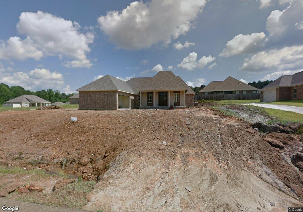
1710 Decatur Dr Ruston, LA 71270
Estimated Value: $350,000 - $394,000
3
Beds
2
Baths
2,092
Sq Ft
$177/Sq Ft
Est. Value
About This Home
This home is located at 1710 Decatur Dr, Ruston, LA 71270 and is currently estimated at $370,960, approximately $177 per square foot. 1710 Decatur Dr is a home with nearby schools including Hillcrest Elementary School, Ruston Elementary School, and Ruston Junior High School.
Ownership History
Date
Name
Owned For
Owner Type
Purchase Details
Closed on
Sep 10, 2013
Sold by
Lee Terral Kenneth
Bought by
Yon Kim Jeong Mi and Jeong Seung C
Current Estimated Value
Home Financials for this Owner
Home Financials are based on the most recent Mortgage that was taken out on this home.
Original Mortgage
$223,360
Outstanding Balance
$164,369
Interest Rate
4.36%
Mortgage Type
Unknown
Estimated Equity
$206,591
Purchase Details
Closed on
Dec 14, 2012
Sold by
The French Quarters Of Lincoln Llc
Bought by
Terral Kenneth L
Home Financials for this Owner
Home Financials are based on the most recent Mortgage that was taken out on this home.
Original Mortgage
$202,495
Interest Rate
3.41%
Mortgage Type
Unknown
Create a Home Valuation Report for This Property
The Home Valuation Report is an in-depth analysis detailing your home's value as well as a comparison with similar homes in the area
Purchase History
| Date | Buyer | Sale Price | Title Company |
|---|---|---|---|
| Yon Kim Jeong Mi | $284,900 | Commonwealth Land Title Ins | |
| Terral Kenneth L | $35,000 | None Available |
Source: Public Records
Mortgage History
| Date | Status | Borrower | Loan Amount |
|---|---|---|---|
| Open | Yon Kim Jeong Mi | $223,360 | |
| Previous Owner | Terral Kenneth L | $202,495 |
Source: Public Records
Tax History
| Year | Tax Paid | Tax Assessment Tax Assessment Total Assessment is a certain percentage of the fair market value that is determined by local assessors to be the total taxable value of land and additions on the property. | Land | Improvement |
|---|---|---|---|---|
| 2025 | $2,876 | $33,691 | $4,340 | $29,351 |
| 2024 | $2,876 | $33,692 | $4,340 | $29,352 |
| 2023 | $2,584 | $29,071 | $3,360 | $25,711 |
| 2022 | $2,596 | $29,071 | $3,360 | $25,711 |
| 2021 | $2,404 | $29,071 | $3,360 | $25,711 |
| 2020 | $2,293 | $27,589 | $3,360 | $24,229 |
| 2019 | $2,324 | $28,619 | $3,360 | $25,259 |
| 2018 | $2,261 | $28,619 | $3,360 | $25,259 |
| 2017 | $2,267 | $28,619 | $3,360 | $25,259 |
| 2016 | $2,258 | $0 | $0 | $0 |
| 2015 | $2,122 | $24,711 | $3,360 | $21,351 |
| 2013 | $293 | $3,360 | $3,360 | $0 |
Source: Public Records
Map
Nearby Homes
- 1709 Rampart Dr
- 2900 Post Oak Dr
- 2805 Post Oak Dr
- 0 English Turn
- 2420 Highway 33
- 711 Joseph Ln Unit 2
- 707 Joseph Ln Unit 2
- 703 Joseph Ln Unit 2
- 0 Louisiana 33
- 615 E Kentucky Ave
- 3001 Belcara Dr
- 503 Dayton Dr
- 2104 Greenbriar Dr
- 392 Tremont Dr
- 503 E Kentucky Ave
- 2322 Bocage Place
- 2408 Rhody Dr
- 910 Laura Ln
- 1727 Trade Dr
- 402 E Kentucky Ave
- 1800 Decatur Dr
- 1711 Esplanade Ave
- 1706 Decatur Dr
- 1707 Esplanade Ave
- 1801 Esplanade Ave
- 1801 Esplanade Ave
- 1804 Decatur Dr
- 1702 Decatur Dr
- 1703 Esplanade Ave
- 3109 Canal St
- 1711 Decatur Dr
- 1706 Esplanade Blvd
- 1707 Decatur Dr
- 1803 Decatur Dr
- Lot #38 Canal St
- 3103 Canal St
- 1710 Esplanade Ave
- 1612 Decatur Dr
- 1706 Esplanade Ave
- 1703 Decatur Dr
Your Personal Tour Guide
Ask me questions while you tour the home.