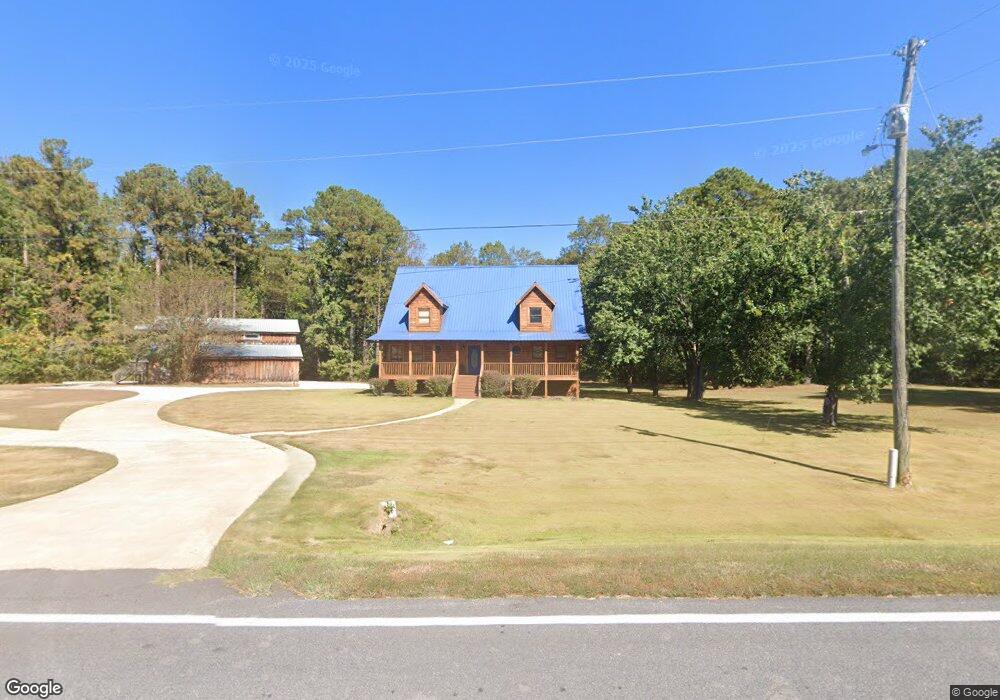
1710 Gordon Rd Moreland, GA 30259
Estimated Value: $567,000 - $654,000
5
Beds
4
Baths
3,211
Sq Ft
$187/Sq Ft
Est. Value
About This Home
This home is located at 1710 Gordon Rd, Moreland, GA 30259 and is currently estimated at $600,871, approximately $187 per square foot. 1710 Gordon Rd is a home located in Coweta County with nearby schools including Moreland Elementary School, Smokey Road Middle School, and Newnan High School.
Ownership History
Date
Name
Owned For
Owner Type
Purchase Details
Closed on
Apr 29, 2009
Sold by
Federal Home Loan Mortgage Corporation
Bought by
Burgess Robert A
Current Estimated Value
Home Financials for this Owner
Home Financials are based on the most recent Mortgage that was taken out on this home.
Original Mortgage
$194,500
Outstanding Balance
$122,093
Interest Rate
4.89%
Mortgage Type
New Conventional
Estimated Equity
$478,778
Purchase Details
Closed on
Feb 3, 2009
Sold by
Wells Fargo Bank Na
Bought by
Federal Home Loan Mortgage Corporation
Purchase Details
Closed on
Apr 28, 2004
Sold by
Southern Community Bank
Bought by
Sundance Homes Inc
Purchase Details
Closed on
Dec 30, 2003
Sold by
Southern Community Bank
Bought by
Phillips Deborah D
Home Financials for this Owner
Home Financials are based on the most recent Mortgage that was taken out on this home.
Original Mortgage
$29,250
Interest Rate
6.03%
Mortgage Type
New Conventional
Purchase Details
Closed on
Sep 29, 2003
Sold by
Southern Community Bank
Bought by
Sundance Homes Inc
Home Financials for this Owner
Home Financials are based on the most recent Mortgage that was taken out on this home.
Original Mortgage
$81,000
Interest Rate
6.16%
Mortgage Type
Purchase Money Mortgage
Purchase Details
Closed on
Jul 1, 2003
Sold by
Mason Roger and Mason Donna
Bought by
Southern Community Bk
Purchase Details
Closed on
Apr 1, 2003
Sold by
Mason Donna
Bought by
Southern Community Bank
Purchase Details
Closed on
Sep 17, 2002
Sold by
Mason Donna
Bought by
Mason Donna and Mason Roger
Home Financials for this Owner
Home Financials are based on the most recent Mortgage that was taken out on this home.
Original Mortgage
$318,368
Interest Rate
6.18%
Mortgage Type
New Conventional
Purchase Details
Closed on
Jan 23, 1997
Bought by
Adair Fulton Ginger
Purchase Details
Closed on
Jul 12, 1989
Bought by
Hester Gayle Chappel
Purchase Details
Closed on
Jun 30, 1988
Bought by
Chappell Patricia
Create a Home Valuation Report for This Property
The Home Valuation Report is an in-depth analysis detailing your home's value as well as a comparison with similar homes in the area
Home Values in the Area
Average Home Value in this Area
Purchase History
| Date | Buyer | Sale Price | Title Company |
|---|---|---|---|
| Burgess Robert A | -- | -- | |
| Federal Home Loan Mortgage Corporation | -- | -- | |
| Wells Fargo Bank Na | $236,209 | -- | |
| Federal Home Loan Mortgage Corp | $236,200 | -- | |
| Sundance Homes Inc | -- | -- | |
| Phillips Deborah D | $195,000 | -- | |
| Sundance Homes Inc | $28,500 | -- | |
| Southern Community Bk | $260,000 | -- | |
| Southern Community Bank | $20,000 | -- | |
| Mason Donna | -- | -- | |
| Adair Fulton Ginger | $1,200 | -- | |
| Hester Gayle Chappel | -- | -- | |
| Chappell Patricia | -- | -- |
Source: Public Records
Mortgage History
| Date | Status | Borrower | Loan Amount |
|---|---|---|---|
| Open | Burgess Robert A | $194,500 | |
| Previous Owner | Phillips Deborah D | $29,250 | |
| Previous Owner | Sundance Homes Inc | $81,000 | |
| Previous Owner | Mason Donna | $318,368 |
Source: Public Records
Tax History Compared to Growth
Tax History
| Year | Tax Paid | Tax Assessment Tax Assessment Total Assessment is a certain percentage of the fair market value that is determined by local assessors to be the total taxable value of land and additions on the property. | Land | Improvement |
|---|---|---|---|---|
| 2025 | $4,098 | $215,103 | $22,874 | $192,229 |
| 2024 | $4,037 | $217,020 | $21,377 | $195,643 |
| 2023 | $4,037 | $249,464 | $34,640 | $214,824 |
| 2022 | $2,918 | $160,844 | $19,794 | $141,050 |
| 2021 | $3,934 | $149,437 | $18,851 | $130,586 |
| 2020 | $3,960 | $149,437 | $18,851 | $130,586 |
| 2019 | $3,653 | $124,804 | $12,990 | $111,814 |
| 2018 | $3,659 | $124,804 | $12,990 | $111,814 |
| 2017 | $3,658 | $124,804 | $12,990 | $111,814 |
| 2016 | $3,614 | $124,804 | $12,990 | $111,814 |
| 2015 | $3,553 | $124,804 | $12,990 | $111,814 |
| 2014 | $3,524 | $124,804 | $12,990 | $111,814 |
Source: Public Records
Map
Nearby Homes
- 92 Gordon Oaks Way
- 1495 Martin Mill Rd
- 30 Linton Estates Ave
- 885 Alex Stephens Rd Unit LOT 1
- 837 Alex Stephens Rd Unit 2
- 757 Alex Stephens Rd Unit 5
- 743 Alex Stephens Rd Unit LOT 6
- 779 Alex Stephens Rd Unit LOT 4
- 803 Alex Stephens Rd Unit LOT 3
- 2784 Martin Mill Rd
- 2725 Gordon Rd
- 215 Grey Fairs Ave
- 59 Akers Lake Dr
- 143 Ryeland Dr
- 0 Teasley Trail Unit 10600969
- 465 Little Rd
- 1234 Haynie Rd
- 98 Ryeland Dr
- 136 Ryeland Dr
- 74 Kindelwood Dr Unit LOT 3
- 1680 Gordon Rd
- 1705 Gordon Rd
- 1644 Gordon Rd
- 737 Tabby Linch Rd
- 715 Tabby Linch Rd
- 675 Tabby Linch Rd
- 704 Tabby Linch Rd
- 724 Tabby Linch Rd
- 724 Tabby Linch Rd Unit LOT 1
- 678 Tabby Linch Rd
- 720 Tabby Linch Rd
- 720 Tabby Linch Rd Unit 126
- 650 Tabby Linch Rd
- 744 Tabby Linch Rd
- 722 Tabby Linch Rd
- 664 Tabby Linch Rd
- 599 Tabby Linch Rd
- 672 Tabby Linch Rd
- 668 Tabby Linch Rd
- 1565 Gordon Rd