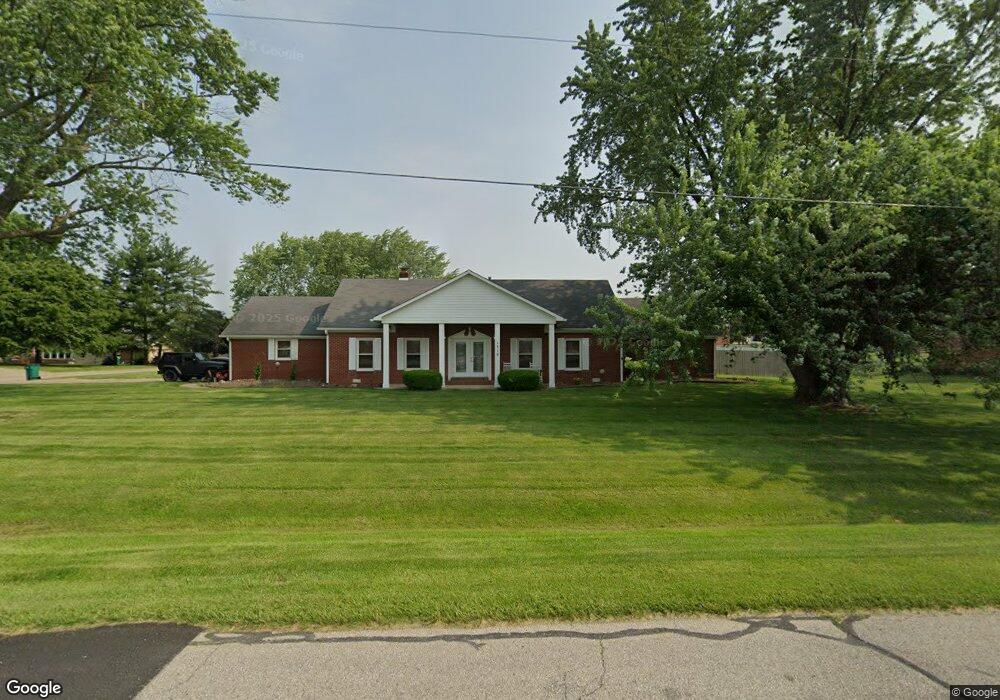
1710 Longest Dr Franklin, IN 46131
Estimated Value: $390,459 - $404,000
3
Beds
3
Baths
2,353
Sq Ft
$168/Sq Ft
Est. Value
About This Home
This home is located at 1710 Longest Dr, Franklin, IN 46131 and is currently estimated at $394,615, approximately $167 per square foot. 1710 Longest Dr is a home located in Johnson County with nearby schools including Webb Elementary School, Franklin Community Middle School, and Custer Baker Intermediate School.
Ownership History
Date
Name
Owned For
Owner Type
Purchase Details
Closed on
May 25, 2007
Sold by
Schaffer Vicki L
Bought by
Graves James M and Graves Carrie A
Current Estimated Value
Home Financials for this Owner
Home Financials are based on the most recent Mortgage that was taken out on this home.
Original Mortgage
$53,250
Interest Rate
6.21%
Mortgage Type
Stand Alone Second
Create a Home Valuation Report for This Property
The Home Valuation Report is an in-depth analysis detailing your home's value as well as a comparison with similar homes in the area
Home Values in the Area
Average Home Value in this Area
Purchase History
| Date | Buyer | Sale Price | Title Company |
|---|---|---|---|
| Graves James M | -- | Chicago Title Insurance Co |
Source: Public Records
Mortgage History
| Date | Status | Borrower | Loan Amount |
|---|---|---|---|
| Closed | Graves James M | $53,250 | |
| Open | Graves James M | $159,750 |
Source: Public Records
Tax History Compared to Growth
Tax History
| Year | Tax Paid | Tax Assessment Tax Assessment Total Assessment is a certain percentage of the fair market value that is determined by local assessors to be the total taxable value of land and additions on the property. | Land | Improvement |
|---|---|---|---|---|
| 2025 | $2,862 | $320,000 | $36,000 | $284,000 |
| 2024 | $2,862 | $258,300 | $36,000 | $222,300 |
| 2023 | $3,137 | $264,100 | $36,000 | $228,100 |
| 2022 | $3,099 | $264,100 | $36,000 | $228,100 |
| 2021 | $2,844 | $238,400 | $36,000 | $202,400 |
| 2020 | $2,785 | $233,300 | $36,000 | $197,300 |
| 2019 | $2,722 | $226,300 | $36,000 | $190,300 |
| 2018 | $2,364 | $213,500 | $36,000 | $177,500 |
| 2017 | $2,349 | $211,500 | $36,000 | $175,500 |
| 2016 | $2,366 | $213,400 | $36,000 | $177,400 |
| 2014 | $2,367 | $207,100 | $39,700 | $167,400 |
| 2013 | $2,367 | $211,100 | $39,700 | $171,400 |
Source: Public Records
Map
Nearby Homes
- 1850 Longest Dr
- 1532 Williamsburg Ln
- 1083 Beechtree Ln
- 1185 Beechtree Ln
- 2117 Jennifer Ct
- 1130 E Adams Dr
- 1682 Millpond Ln
- 1669 Millpond Ln
- 1646 Millpond Ln
- 1636 Millpond Ln
- 1679 Millpond Ln
- 1690 Millpond Ln
- 1642 Millpond Ln
- 1663 Millpond Ln
- 1640 Millpond Ln
- 1650 Millpond Ln
- 1654 Millpond Ln
- 1660 Millpond Ln
- 1653 Millpond Ln
- 1686 Millpond Ln
- 1730 Longest Dr
- 1715 Green Ct
- 180 N Milford Dr
- 1725 Green Ct
- 1750 Longest Dr
- 1745 Green Ct
- 235 N Milford Dr
- 220 N Milford Dr
- 1660 Longest Dr
- 175 Hole in One Ct
- 1720 Green Ct
- 150 Fairway Ct
- 1740 Green Ct
- 90 N Milford Dr
- 1278 Atlas Ln
- 1295 Atlas Ln
- 1294 Atlas Ln
- 1237 Atlas Ln
- 1225 Atlas Ln
- 1213 Atlas Ln