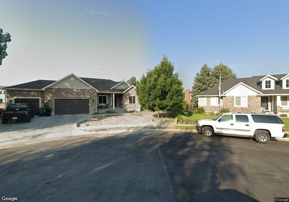
1710 N 1900 E Unit 17 North Logan, UT 84341
Estimated Value: $677,000 - $753,103
--
Bed
--
Bath
2,050
Sq Ft
$355/Sq Ft
Est. Value
About This Home
This home is located at 1710 N 1900 E Unit 17, North Logan, UT 84341 and is currently estimated at $726,776, approximately $354 per square foot. 1710 N 1900 E Unit 17 is a home located in Cache County with nearby schools including Greenville School, Cedar Ridge School, and Cedar Ridge Middle School.
Ownership History
Date
Name
Owned For
Owner Type
Purchase Details
Closed on
May 8, 2020
Sold by
Giesey Christopher J
Bought by
Lee Cade and Lee Candace L
Current Estimated Value
Home Financials for this Owner
Home Financials are based on the most recent Mortgage that was taken out on this home.
Original Mortgage
$327,200
Outstanding Balance
$289,309
Interest Rate
3.3%
Mortgage Type
New Conventional
Estimated Equity
$437,467
Purchase Details
Closed on
Jun 27, 2014
Sold by
Green Canyon Inc
Bought by
Giesey Christopher J and Giesey Candace L
Home Financials for this Owner
Home Financials are based on the most recent Mortgage that was taken out on this home.
Original Mortgage
$271,000
Interest Rate
4.07%
Mortgage Type
Construction
Create a Home Valuation Report for This Property
The Home Valuation Report is an in-depth analysis detailing your home's value as well as a comparison with similar homes in the area
Home Values in the Area
Average Home Value in this Area
Purchase History
| Date | Buyer | Sale Price | Title Company |
|---|---|---|---|
| Lee Cade | -- | American Secure Title Logan | |
| Giesey Christopher J | -- | Hickman Land Title Company |
Source: Public Records
Mortgage History
| Date | Status | Borrower | Loan Amount |
|---|---|---|---|
| Open | Lee Cade | $327,200 | |
| Previous Owner | Giesey Christopher J | $271,000 |
Source: Public Records
Tax History Compared to Growth
Tax History
| Year | Tax Paid | Tax Assessment Tax Assessment Total Assessment is a certain percentage of the fair market value that is determined by local assessors to be the total taxable value of land and additions on the property. | Land | Improvement |
|---|---|---|---|---|
| 2025 | $302 | $423,250 | $0 | $0 |
| 2024 | $3,235 | $421,335 | $0 | $0 |
| 2023 | $3,432 | $418,385 | $0 | $0 |
| 2022 | $3,592 | $418,385 | $0 | $0 |
| 2021 | $2,640 | $476,790 | $70,800 | $405,990 |
| 2020 | $2,503 | $423,835 | $70,800 | $353,035 |
| 2019 | $2,621 | $423,835 | $70,800 | $353,035 |
| 2018 | $2,462 | $386,010 | $70,800 | $315,210 |
| 2017 | $2,472 | $204,050 | $0 | $0 |
| 2016 | $2,511 | $184,965 | $0 | $0 |
| 2015 | $2,285 | $184,965 | $0 | $0 |
| 2014 | $854 | $70,800 | $0 | $0 |
Source: Public Records
Map
Nearby Homes
- 1901 Southpointe Ct
- 1949 Deer Crest Cir Unit 49
- 1586 N Sharptail Cir
- 1891 E 1500 N
- 1902 E 1500 N
- 1872 N 1850 E
- 1465 N Stonecrest Ln Unit 14
- 1451 N Aspen Dr
- 1810 N 2070 E Unit 10
- 1405 N Aspen Dr
- 2025 N 1550 E
- 1454 N 1400 E
- 1901 N 1380 E
- 1285 E 1600 N
- 1395 E Talmage Ln Unit 31
- 1374 N 1250 E
- Sydney Plan at Mountainside Estates
- Providence Plan at Mountainside Estates
- Maryland Plan at Mountainside Estates
- Rochester Plan at Mountainside Estates
- 1720 N 1900 E Unit 18
- 1715 N 1900 E Unit 16
- 1726 N 1850 E
- 1725 N 1900 E Unit 15
- 1725 N 1900 E
- 1730 N 1900 E Unit 19
- 1736 N 1850 E
- 1898 Northpointe Ct Unit 59
- 1888 Northpointe Ct Unit 58
- 1735 N 1900 E Unit 14
- 1878 Northpointe Ct Unit 57
- 1878 Northpointe Ct
- 1910 N Pointe Ct Unit 60
- 1910 Northpointe Ct Unit 60
- 1910 Northpointe Ct
- 1868 Northpointe Ct
- 1868 Northpointe Ct Unit 25
- 1720 N 1850 E
- 1746 N 1850 E
- 1740 N 1900 E Unit 20