Estimated Value: $493,000 - $689,000
4
Beds
3
Baths
2,450
Sq Ft
$238/Sq Ft
Est. Value
About This Home
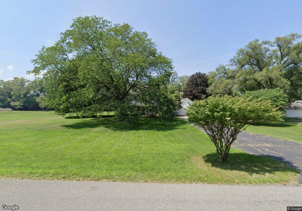
This home is located at 1710 N Philip Rd, Niles, MI 49120 and is currently estimated at $583,165, approximately $238 per square foot. 1710 N Philip Rd is a home located in Berrien County with nearby schools including Ballard Elementary School, Oak Manor Sixth Grade Center, and Ring Lardner Middle School.
Ownership History
Date
Name
Owned For
Owner Type
Purchase Details
Closed on
Jul 23, 2013
Sold by
Brown Ronald L and Brown Alice Diane
Bought by
Payne Jason and Payne Jennifer
Current Estimated Value
Home Financials for this Owner
Home Financials are based on the most recent Mortgage that was taken out on this home.
Original Mortgage
$252,000
Outstanding Balance
$183,319
Interest Rate
3.93%
Mortgage Type
New Conventional
Estimated Equity
$399,846
Purchase Details
Closed on
Jul 12, 2007
Sold by
Hansen James B and Hansen Becki L
Bought by
Brown Ronald L and Brown Alice Diane
Home Financials for this Owner
Home Financials are based on the most recent Mortgage that was taken out on this home.
Original Mortgage
$220,000
Interest Rate
6.76%
Mortgage Type
Purchase Money Mortgage
Purchase Details
Closed on
Sep 28, 2000
Purchase Details
Closed on
Dec 20, 1978
Create a Home Valuation Report for This Property
The Home Valuation Report is an in-depth analysis detailing your home's value as well as a comparison with similar homes in the area
Home Values in the Area
Average Home Value in this Area
Purchase History
| Date | Buyer | Sale Price | Title Company |
|---|---|---|---|
| Payne Jason | $315,000 | Chicago Title Of Michigan | |
| Brown Ronald L | $240,000 | Chicago Title | |
| -- | $185,000 | -- | |
| -- | $7,300 | -- |
Source: Public Records
Mortgage History
| Date | Status | Borrower | Loan Amount |
|---|---|---|---|
| Open | Payne Jason | $252,000 | |
| Previous Owner | Brown Ronald L | $220,000 |
Source: Public Records
Tax History
| Year | Tax Paid | Tax Assessment Tax Assessment Total Assessment is a certain percentage of the fair market value that is determined by local assessors to be the total taxable value of land and additions on the property. | Land | Improvement |
|---|---|---|---|---|
| 2025 | $4,395 | $275,900 | $0 | $0 |
| 2024 | $1,647 | $233,300 | $0 | $0 |
| 2023 | $1,568 | $184,200 | $0 | $0 |
| 2022 | $1,494 | $176,300 | $0 | $0 |
| 2021 | $3,704 | $178,300 | $15,000 | $163,300 |
| 2020 | $3,654 | $164,100 | $0 | $0 |
| 2019 | $3,561 | $137,700 | $15,000 | $122,700 |
| 2018 | $3,392 | $137,700 | $0 | $0 |
| 2017 | $3,364 | $134,900 | $0 | $0 |
| 2016 | $3,275 | $125,200 | $0 | $0 |
| 2015 | $3,265 | $121,900 | $0 | $0 |
| 2014 | $1,298 | $120,500 | $0 | $0 |
Source: Public Records
Map
Nearby Homes
- 1551 Walling Ln
- 1491 Valley View Dr
- 0 Drew Dr Unit Lot 31
- 0 Drew Dr Unit Lot 29
- 0 Drew Dr Unit Lot 22
- 824 N Philip Rd
- 0 Rd
- 1005 Winchester Ct
- 8 Marmont St
- 1209 Morris Dr
- 2434 Jeffery Ln
- 1836 Platt St
- 220 Christiana Dr
- 1290 Missions East Dr
- 117 N Fairview Ave
- 1919 Jay St
- 1 Grand Ave
- 2802 Primrose Ct
- 1610 N 5th St
- 2103 Niles Buchanan Rd
- 1716 N Philip Rd
- 1700 N Philip Rd
- 1713 N Philip Rd
- 1705 N Philip Rd
- 1410 Morris Dr
- 0 Morris Dr
- 1717 N Philip Rd
- 1531 N Philip Rd
- 1720 N Philip Rd
- 1714 Southworth Dr
- 1721 N Philip Rd
- 1610 Eastview Dr
- 1606 Eastview Dr
- 1519 N Philip Rd
- 1709 Southworth Dr
- 1705 Southworth Dr
- 1723 N Philip Rd
- 1713 Southworth Dr
- 1721 Southworth Dr
- 1725 Southworth Dr
Your Personal Tour Guide
Ask me questions while you tour the home.