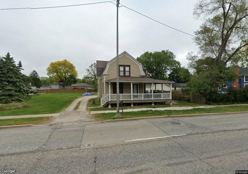
1710 Rand Rd Des Plaines, IL 60016
Estimated Value: $364,000 - $512,000
3
Beds
1
Bath
1,786
Sq Ft
$240/Sq Ft
Est. Value
About This Home
This home is located at 1710 Rand Rd, Des Plaines, IL 60016 and is currently estimated at $427,942, approximately $239 per square foot. 1710 Rand Rd is a home located in Cook County with nearby schools including North Elementary School, Chippewa Middle School, and Maine West High School.
Ownership History
Date
Name
Owned For
Owner Type
Purchase Details
Closed on
Nov 10, 2006
Sold by
Ahlbeck Thomas H and Ahlbeck Beverly A
Bought by
The Chicago Trust Co and Trust #8002347763
Current Estimated Value
Home Financials for this Owner
Home Financials are based on the most recent Mortgage that was taken out on this home.
Original Mortgage
$300,000
Interest Rate
6.5%
Mortgage Type
Unknown
Purchase Details
Closed on
Oct 13, 2006
Sold by
Shea John
Bought by
Ahlbeck Thomas H and Ahlbeck Beverly A
Home Financials for this Owner
Home Financials are based on the most recent Mortgage that was taken out on this home.
Original Mortgage
$300,000
Interest Rate
6.5%
Mortgage Type
Unknown
Purchase Details
Closed on
Nov 2, 2000
Sold by
Esser William P
Bought by
Shea John
Home Financials for this Owner
Home Financials are based on the most recent Mortgage that was taken out on this home.
Original Mortgage
$122,384
Interest Rate
7.86%
Mortgage Type
FHA
Create a Home Valuation Report for This Property
The Home Valuation Report is an in-depth analysis detailing your home's value as well as a comparison with similar homes in the area
Home Values in the Area
Average Home Value in this Area
Purchase History
| Date | Buyer | Sale Price | Title Company |
|---|---|---|---|
| The Chicago Trust Co | -- | None Available | |
| Ahlbeck Thomas H | $430,000 | Attorneys Title Guaranty Fun | |
| Shea John | -- | -- |
Source: Public Records
Mortgage History
| Date | Status | Borrower | Loan Amount |
|---|---|---|---|
| Previous Owner | Ahlbeck Thomas H | $300,000 | |
| Previous Owner | Shea John | $122,384 |
Source: Public Records
Tax History
| Year | Tax Paid | Tax Assessment Tax Assessment Total Assessment is a certain percentage of the fair market value that is determined by local assessors to be the total taxable value of land and additions on the property. | Land | Improvement |
|---|---|---|---|---|
| 2025 | $7,909 | $39,000 | $16,490 | $22,510 |
| 2024 | $7,909 | $30,000 | $14,658 | $15,342 |
| 2023 | $7,719 | $30,000 | $14,658 | $15,342 |
| 2022 | $7,719 | $30,000 | $14,658 | $15,342 |
| 2021 | $5,840 | $19,000 | $11,909 | $7,091 |
| 2020 | $6,606 | $21,859 | $11,909 | $9,950 |
| 2019 | $6,536 | $24,288 | $11,909 | $12,379 |
| 2018 | $5,172 | $17,293 | $10,535 | $6,758 |
| 2017 | $5,080 | $17,293 | $10,535 | $6,758 |
| 2016 | $4,805 | $17,293 | $10,535 | $6,758 |
| 2015 | $3,774 | $15,106 | $9,161 | $5,945 |
| 2014 | $3,710 | $15,106 | $9,161 | $5,945 |
| 2013 | $3,600 | $15,106 | $9,161 | $5,945 |
Source: Public Records
Map
Nearby Homes
- 1569 Sherman Place
- 603 S River Rd Unit 2M
- 1509 Brown St Unit 11
- 183 Grove Ave Unit C
- 1480 Jefferson St Unit 203A
- 659 S Des Plaines River Rd Unit 2A
- 1670 Mill St Unit 207
- 656 Pearson St Unit 203C
- 365 Graceland Ave Unit 205A
- 170 Grove Ave Unit B
- 650 S River Rd Unit 701
- 1389 Perry St Unit 203
- 1349 E Washington St Unit 310A
- 1327 E Washington St Unit 309
- 1333 Willow Ave
- 770 Pearson St Unit 808
- 770 Pearson St Unit 2505
- 1308 Perry St Unit B
- 1288 Perry St Unit 2
- 1660 E Thacker St Unit 1D
- 395 Elk Blvd
- 395 Elk Blvd Unit 3B
- 395 Elk Blvd Unit 3A
- 395 Elk Blvd Unit 3F
- 395 Elk Blvd Unit 2A
- 395 Elk Blvd Unit 1A
- 1738 Rand Rd
- 1701 Rand Rd
- 385 Elk Blvd
- 388 Hawthorne Ln
- 381 Elk Blvd
- 389 Elk Blvd
- 396 Hawthorne Ln
- 1717 Rand Rd
- 377 Elk Blvd
- 384 Hawthorne Ln
- 1770 Rand Rd
- 365 Elk Blvd
- 376 Hawthorne Ln
Your Personal Tour Guide
Ask me questions while you tour the home.