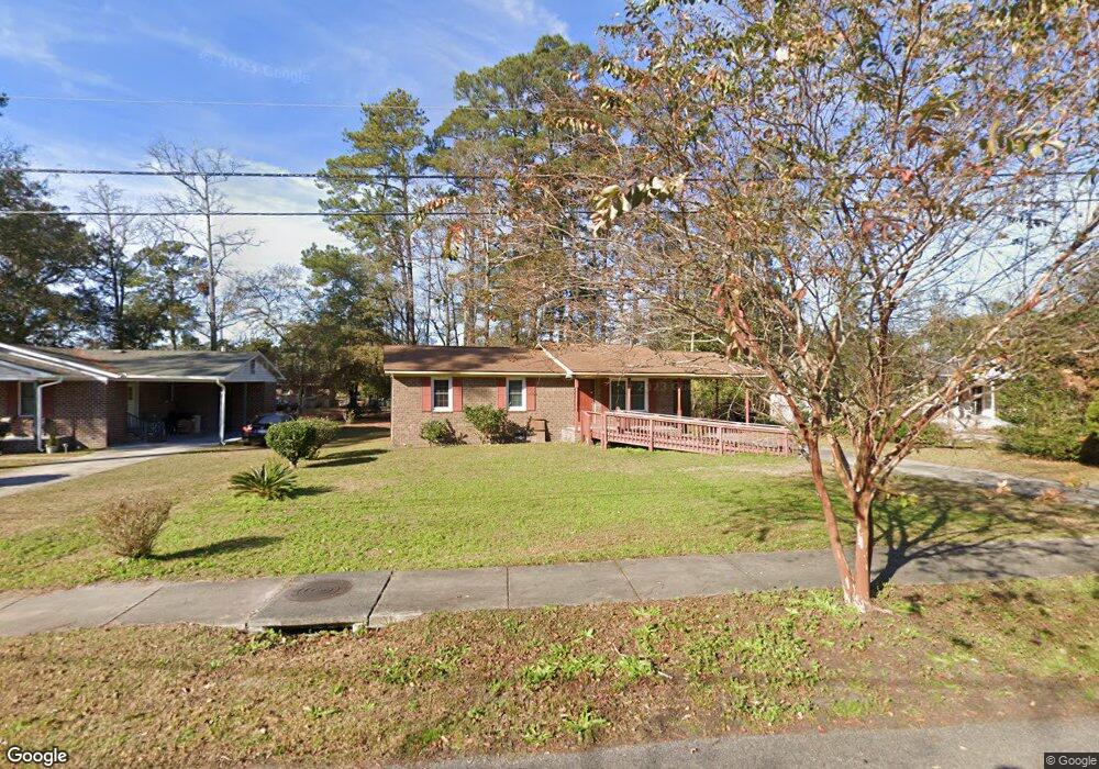
1710 Robin Rd Conway, SC 29527
Estimated Value: $133,000 - $155,000
3
Beds
2
Baths
1,050
Sq Ft
$139/Sq Ft
Est. Value
About This Home
This home is located at 1710 Robin Rd, Conway, SC 29527 and is currently estimated at $145,733, approximately $138 per square foot. 1710 Robin Rd is a home located in Horry County with nearby schools including Waccamaw Elementary School, Black Water Middle School, and Carolina Forest High School.
Ownership History
Date
Name
Owned For
Owner Type
Purchase Details
Closed on
Apr 30, 2021
Sold by
Purnell Lisa Mckissick
Bought by
Mckissick Craig
Current Estimated Value
Home Financials for this Owner
Home Financials are based on the most recent Mortgage that was taken out on this home.
Original Mortgage
$85,500
Outstanding Balance
$76,655
Interest Rate
3.1%
Mortgage Type
New Conventional
Estimated Equity
$69,078
Purchase Details
Closed on
Jul 2, 2011
Sold by
Mckissick Craig
Bought by
Mckissick Craig
Purchase Details
Closed on
Jun 29, 2011
Sold by
Mckissick Betty J
Bought by
Mckissick Craig
Purchase Details
Closed on
Dec 10, 2009
Sold by
Mckissick Craig
Bought by
Mckissick Betty J
Purchase Details
Closed on
Aug 18, 2008
Sold by
Mckissick Betty J
Bought by
Mckissick Craig
Create a Home Valuation Report for This Property
The Home Valuation Report is an in-depth analysis detailing your home's value as well as a comparison with similar homes in the area
Home Values in the Area
Average Home Value in this Area
Purchase History
| Date | Buyer | Sale Price | Title Company |
|---|---|---|---|
| Mckissick Craig | $25,000 | -- | |
| Mckissick Craig | $25,000 | -- | |
| Mckissick Craig | -- | -- | |
| Mckissick Craig | $21,000 | -- | |
| Mckissick Betty J | -- | -- | |
| Mckissick Craig | -- | -- |
Source: Public Records
Mortgage History
| Date | Status | Borrower | Loan Amount |
|---|---|---|---|
| Open | Mckissick Craig | $85,500 |
Source: Public Records
Tax History
| Year | Tax Paid | Tax Assessment Tax Assessment Total Assessment is a certain percentage of the fair market value that is determined by local assessors to be the total taxable value of land and additions on the property. | Land | Improvement |
|---|---|---|---|---|
| 2025 | $1,950 | $0 | $0 | $0 |
| 2024 | $1,950 | $7,506 | $3,006 | $4,500 |
| 2023 | $1,929 | $4,881 | $603 | $4,278 |
| 2021 | $1,663 | $4,881 | $603 | $4,278 |
| 2020 | $1,243 | $4,881 | $603 | $4,278 |
| 2019 | $1,243 | $4,881 | $603 | $4,278 |
| 2018 | $1,270 | $4,741 | $601 | $4,140 |
| 2017 | $1,270 | $4,741 | $601 | $4,140 |
| 2016 | -- | $4,741 | $601 | $4,140 |
| 2015 | $1,270 | $4,741 | $601 | $4,140 |
| 2014 | $1,236 | $4,741 | $601 | $4,140 |
Source: Public Records
Map
Nearby Homes
- 903 Durant St
- 1011 Tin Top Aly
- 1009 Tin Top Aly
- TBD 4.48 acres E Highway 501
- TBD HWY 501 E Highway 501
- 1011 Hickory Cir
- 2204 6th Ave
- TBD Highway 378
- 1105 Hickory Dr
- 1708 9th Ave
- 1795 Hemingway St
- 1503 Ward Cir
- 411 Apple Ln
- 1712 Singleton St
- 1613 4th Ave
- 7921 U S 701 Hwy
- 1520 4th Ave
- 1305 Forest View Rd
- 351 Myrtle St Unit 413D
- 354 Myrtle St Unit 469C
Your Personal Tour Guide
Ask me questions while you tour the home.