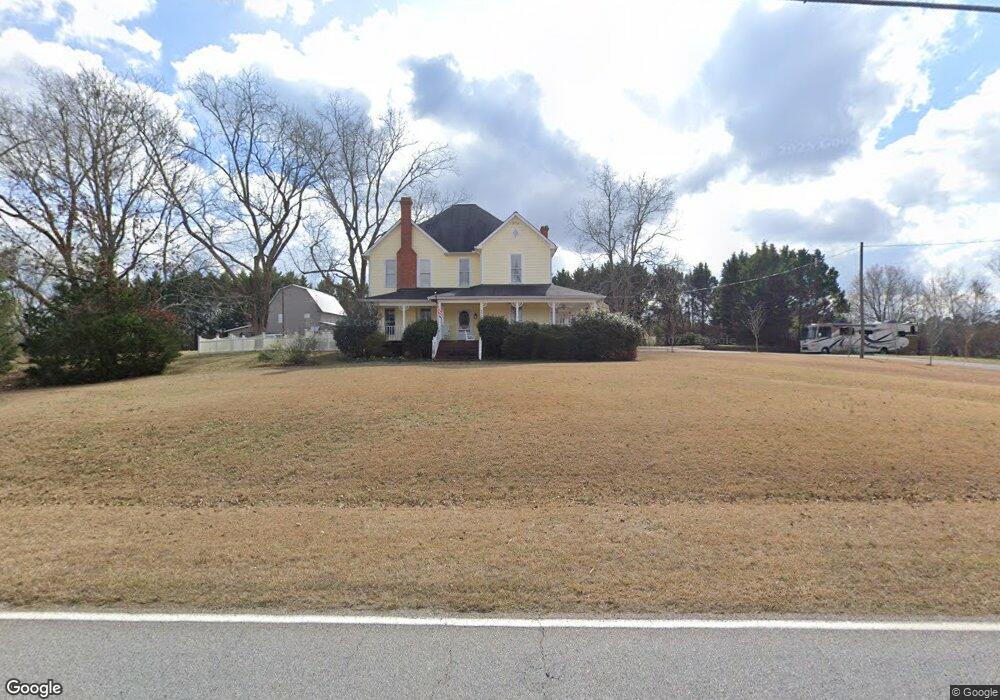
1710 Swint Rd Griffin, GA 30224
Spalding County NeighborhoodEstimated Value: $409,000 - $602,893
5
Beds
3
Baths
4,576
Sq Ft
$109/Sq Ft
Est. Value
About This Home
This home is located at 1710 Swint Rd, Griffin, GA 30224 and is currently estimated at $499,223, approximately $109 per square foot. 1710 Swint Rd is a home located in Spalding County with nearby schools including Futral Road Elementary School, Rehoboth Road Middle School, and Spalding High School.
Ownership History
Date
Name
Owned For
Owner Type
Purchase Details
Closed on
Mar 15, 2002
Sold by
Hamilton Jane E
Bought by
Hamilton Terry
Current Estimated Value
Home Financials for this Owner
Home Financials are based on the most recent Mortgage that was taken out on this home.
Original Mortgage
$100,000
Interest Rate
6.98%
Mortgage Type
New Conventional
Create a Home Valuation Report for This Property
The Home Valuation Report is an in-depth analysis detailing your home's value as well as a comparison with similar homes in the area
Home Values in the Area
Average Home Value in this Area
Purchase History
| Date | Buyer | Sale Price | Title Company |
|---|---|---|---|
| Hamilton Terry | -- | -- |
Source: Public Records
Mortgage History
| Date | Status | Borrower | Loan Amount |
|---|---|---|---|
| Closed | Hamilton Terry | $100,000 |
Source: Public Records
Tax History Compared to Growth
Tax History
| Year | Tax Paid | Tax Assessment Tax Assessment Total Assessment is a certain percentage of the fair market value that is determined by local assessors to be the total taxable value of land and additions on the property. | Land | Improvement |
|---|---|---|---|---|
| 2024 | $4,898 | $209,606 | $19,800 | $189,806 |
| 2023 | $4,898 | $203,598 | $19,800 | $183,798 |
| 2022 | $4,080 | $131,368 | $15,840 | $115,528 |
| 2021 | $4,227 | $116,236 | $15,840 | $100,396 |
| 2020 | $4,241 | $116,236 | $15,840 | $100,396 |
| 2019 | $4,327 | $116,236 | $15,840 | $100,396 |
| 2018 | $4,092 | $107,097 | $15,840 | $91,257 |
| 2017 | $3,981 | $107,097 | $15,840 | $91,257 |
| 2016 | $3,692 | $97,570 | $15,840 | $81,730 |
| 2015 | $2,159 | $55,400 | $15,840 | $39,560 |
| 2014 | $2,202 | $55,400 | $15,840 | $39,560 |
Source: Public Records
Map
Nearby Homes
- 111 Cynthia Cir
- 460 McKneely Rd
- 275 Liberty Bell Ln
- 2495 Barnesville Rd
- 245 Kennelsman Dr
- 270 Kennelsman Dr
- 87 Hounds Way
- 108 Timber Ridge Dr
- Flora Plan at Fox Crossing
- Cali Plan at Fox Crossing
- Galen Plan at Fox Crossing
- Aisle Plan at Fox Crossing
- Aria Plan at Fox Crossing
- 250 Kennelsman Dr
- 258 Kennelsman Dr
- 264 Kennelsman Dr
- 145 Hounds Way Unit LOT 94
- 171 Kennelsman Dr
- 269 Kennelsman Dr
- 261 Kennelsman Dr
- 100 Cynthia Cir
- 102 Cynthia Cir
- 104 Cynthia Cir
- 0 Cynthia Cir Unit 7610114
- 0 Cynthia Cir Unit 7610112
- 0 Cynthia Cir Unit 8621846
- 0 Cynthia Cir Unit 8583362
- 0 Cynthia Cir Unit 8234462
- 0 Cynthia Cir Unit 7529015
- 0 Cynthia Cir Unit 7424153
- 0 Cynthia Cir Unit 7339669
- 0 Cynthia Cir Unit 7154725
- 0 Cynthia Cir Unit 7154719
- 0 Cynthia Cir Unit 3278118
- 0 Cynthia Cir Unit 7061972
- 0 Cynthia Cir Unit 9047253
- 0 Cynthia Cir Unit 9047419
- 0 Cynthia Cir Unit 8064621
- 0 Cynthia Cir Unit 8178830
- 0 Cynthia Cir Unit 8308472