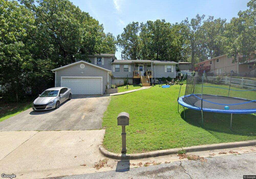
1710 Todd Dr Branson, MO 65616
North Branson NeighborhoodEstimated Value: $246,000 - $276,000
4
Beds
3
Baths
2,260
Sq Ft
$114/Sq Ft
Est. Value
About This Home
This home is located at 1710 Todd Dr, Branson, MO 65616 and is currently estimated at $258,680, approximately $114 per square foot. 1710 Todd Dr is a home located in Taney County with nearby schools including Cedar Ridge Primary, Cedar Ridge Intermediate School, and Cedar Ridge Elementary School.
Ownership History
Date
Name
Owned For
Owner Type
Purchase Details
Closed on
Nov 3, 2017
Sold by
Haygood Dominic J and Haygood Heather
Bought by
Hampton Jacob J and Hampton Lacey M
Current Estimated Value
Purchase Details
Closed on
Jan 14, 2006
Sold by
Phillips Ralph B and Phillips Beatrice L
Bought by
Haygood Dominic J
Home Financials for this Owner
Home Financials are based on the most recent Mortgage that was taken out on this home.
Original Mortgage
$100,000
Interest Rate
6%
Mortgage Type
Seller Take Back
Create a Home Valuation Report for This Property
The Home Valuation Report is an in-depth analysis detailing your home's value as well as a comparison with similar homes in the area
Home Values in the Area
Average Home Value in this Area
Purchase History
| Date | Buyer | Sale Price | Title Company |
|---|---|---|---|
| Hampton Jacob J | -- | None Available | |
| Haygood Dominic J | -- | -- |
Source: Public Records
Mortgage History
| Date | Status | Borrower | Loan Amount |
|---|---|---|---|
| Previous Owner | Haygood Dominic J | $100,000 |
Source: Public Records
Tax History
| Year | Tax Paid | Tax Assessment Tax Assessment Total Assessment is a certain percentage of the fair market value that is determined by local assessors to be the total taxable value of land and additions on the property. | Land | Improvement |
|---|---|---|---|---|
| 2025 | $995 | $16,560 | -- | -- |
| 2023 | $995 | $18,610 | $0 | $0 |
| 2022 | $968 | $18,610 | $0 | $0 |
| 2021 | $961 | $18,610 | $0 | $0 |
| 2019 | $896 | $16,620 | $0 | $0 |
| 2018 | $896 | $16,620 | $0 | $0 |
| 2017 | $774 | $14,480 | $0 | $0 |
| 2016 | $772 | $14,480 | $0 | $0 |
| 2015 | $764 | $14,480 | $0 | $0 |
| 2014 | $698 | $13,870 | $0 | $0 |
Source: Public Records
Map
Nearby Homes
- Tbd Roark Valley Rd
- Tbd 0 Roark Valley Rd
- 1709 Neihardt St
- Lot 22 Rose Oneill Dr
- 000 W St
- 109 Cottonwood Cir
- 126 Cottonwood Cir
- 103 Della St
- 1293 Hillcrest Place Unit A&B
- 102 Hero Dr
- 1211 W 76 Country Blvd
- Tbd Gretna Rd
- 000 Gretna Rd
- 5100 Gretna Rd
- 1203 Westwood Dr Unit A & B
- 000 Shepherd of the Hillls Expy
- 3500 Gretna Rd
- 000 Roark Valley Drive Highland
- TBD W 76 Country Blvd
- 1125/1127 W 76 Country Blvd
Your Personal Tour Guide
Ask me questions while you tour the home.