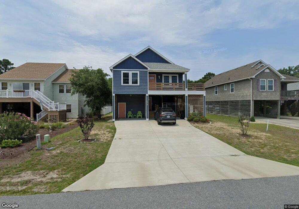
1710 Upper Dune Rd Unit Lot: 19 Kill Devil Hills, NC 27948
Estimated Value: $680,000 - $710,000
4
Beds
3
Baths
2,200
Sq Ft
$316/Sq Ft
Est. Value
About This Home
This home is located at 1710 Upper Dune Rd Unit Lot: 19, Kill Devil Hills, NC 27948 and is currently estimated at $695,607, approximately $316 per square foot. 1710 Upper Dune Rd Unit Lot: 19 is a home located in Dare County with nearby schools including Nags Head Elementary School, First Flight Middle School, and First Flight High School.
Ownership History
Date
Name
Owned For
Owner Type
Purchase Details
Closed on
Oct 31, 2022
Sold by
Carroll Charles B and Carroll Katharine W
Bought by
Dicarlo Brandon T and Dicarlo Lisa H
Current Estimated Value
Home Financials for this Owner
Home Financials are based on the most recent Mortgage that was taken out on this home.
Original Mortgage
$492,000
Outstanding Balance
$473,383
Interest Rate
6.02%
Mortgage Type
New Conventional
Estimated Equity
$222,224
Purchase Details
Closed on
Oct 1, 2020
Sold by
Soles Franklin Don
Bought by
Carroll Charles B and Carroll Katharine W
Home Financials for this Owner
Home Financials are based on the most recent Mortgage that was taken out on this home.
Original Mortgage
$320,000
Interest Rate
2.9%
Mortgage Type
New Conventional
Purchase Details
Closed on
Feb 17, 2011
Sold by
Rollason & Wood Realty Inc
Bought by
Rollason Sherelene G
Create a Home Valuation Report for This Property
The Home Valuation Report is an in-depth analysis detailing your home's value as well as a comparison with similar homes in the area
Home Values in the Area
Average Home Value in this Area
Purchase History
| Date | Buyer | Sale Price | Title Company |
|---|---|---|---|
| Dicarlo Brandon T | $3,075,000 | -- | |
| Carroll Charles B | $100,000 | None Available | |
| Rollason Sherelene G | -- | None Available |
Source: Public Records
Mortgage History
| Date | Status | Borrower | Loan Amount |
|---|---|---|---|
| Open | Dicarlo Brandon T | $492,000 | |
| Previous Owner | Carroll Charles B | $320,000 |
Source: Public Records
Tax History Compared to Growth
Tax History
| Year | Tax Paid | Tax Assessment Tax Assessment Total Assessment is a certain percentage of the fair market value that is determined by local assessors to be the total taxable value of land and additions on the property. | Land | Improvement |
|---|---|---|---|---|
| 2025 | $3,583 | $659,700 | $155,800 | $503,900 |
| 2024 | $3,132 | $414,600 | $84,000 | $330,600 |
| 2023 | $1,660 | $414,600 | $84,000 | $330,600 |
| 2022 | $2,987 | $414,600 | $84,000 | $330,600 |
| 2021 | $1,468 | $203,800 | $84,000 | $119,800 |
| 2020 | $726 | $100,800 | $100,800 | $0 |
| 2019 | $570 | $65,500 | $65,500 | $0 |
| 2018 | $557 | $65,500 | $65,500 | $0 |
| 2017 | $557 | $65,500 | $65,500 | $0 |
| 2016 | $531 | $65,500 | $65,500 | $0 |
| 2014 | $511 | $65,500 | $65,500 | $0 |
Source: Public Records
Map
Nearby Homes
- 1705 Sea Swept Rd Unit Lot 26
- 1716 Upper Dune Rd Unit Lot 13
- 1204 Indian Dr Unit Lot 29
- 1733 Bay Dr Unit Lot 3
- 1814 Sea Swept Rd Unit Lot 6
- 1809 Wyandotte St Unit 3
- 1802 Bay Dr Unit Lot 13-14
- 700 W First St Unit E-11
- 403 Indian Dr Unit Lot 7
- 1806 Creek St Unit Lot 13
- 912 Console Ln Unit Lot 82
- 700 Skipjack Ln Unit G7
- 330 Canal Dr Unit 170
- 201 W 4th St
- 603 W Landing Dr Unit Lot 93
- 1402 Harpoon Dr Unit Lot 88
- 500 W 5th St Unit 16
- 1613 N Croatan Hwy Unit 23
- 1718 Soble Dr Unit Lot23&part24
- 524 Anika Way Unit Lot 30
- 1710 Upper Dune Rd
- 1712 Upper Dune Rd
- 1708 Upper Dune Rd Unit 21
- 1708 Upper Dune Rd
- 1711 Sea Swept Rd
- 1706 Upper Dune Rd
- 1714 Upper Dune Rd
- 1713 Sea Swept Rd
- 1709 Sea Swept Rd
- 1716 Upper Dune Rd
- 1715 Sea Swept Rd Unit 16
- 1715 Sea Swept Rd
- 1707 Sea Swept Rd
- 1704 Upper Dune Rd
- 1714 Apache St
- 1717 Sea Swept Rd
- 1712 Apache St
- 1716 Apache St
- 1705 Sea Swept Rd
- 1718 Upper Dune Rd