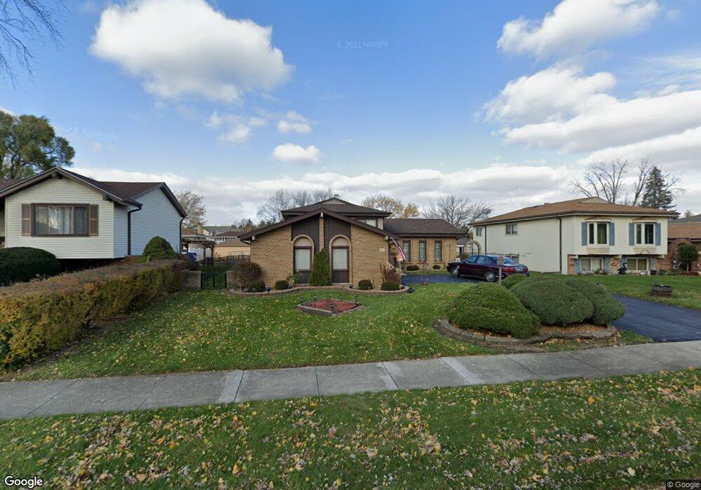
1710 W Rampart Rd Addison, IL 60101
Estimated Value: $343,145 - $448,000
Studio
--
Bath
1,933
Sq Ft
$214/Sq Ft
Est. Value
About This Home
This home is located at 1710 W Rampart Rd, Addison, IL 60101 and is currently estimated at $414,036, approximately $214 per square foot. 1710 W Rampart Rd is a home located in DuPage County with nearby schools including Stone Elementary School, Indian Trail Jr High School, and Addison Trail High School.
Ownership History
Date
Name
Owned For
Owner Type
Purchase Details
Closed on
Sep 5, 2000
Sold by
Scannell Anthony B and Scannell Carol J
Bought by
Scannell Anthony B and Scannell Carol J
Current Estimated Value
Home Financials for this Owner
Home Financials are based on the most recent Mortgage that was taken out on this home.
Original Mortgage
$53,600
Interest Rate
8.05%
Mortgage Type
Stand Alone Second
Create a Home Valuation Report for This Property
The Home Valuation Report is an in-depth analysis detailing your home's value as well as a comparison with similar homes in the area
Home Values in the Area
Average Home Value in this Area
Purchase History
| Date | Buyer | Sale Price | Title Company |
|---|---|---|---|
| Scannell Anthony B | -- | Lakeshore Title Agency |
Source: Public Records
Mortgage History
| Date | Status | Borrower | Loan Amount |
|---|---|---|---|
| Closed | Scannell Anthony B | $53,600 |
Source: Public Records
Tax History
| Year | Tax Paid | Tax Assessment Tax Assessment Total Assessment is a certain percentage of the fair market value that is determined by local assessors to be the total taxable value of land and additions on the property. | Land | Improvement |
|---|---|---|---|---|
| 2024 | $6,870 | $113,479 | $47,602 | $65,877 |
| 2023 | $6,502 | $104,320 | $43,760 | $60,560 |
| 2022 | $6,579 | $100,330 | $42,060 | $58,270 |
| 2021 | $6,285 | $96,100 | $40,290 | $55,810 |
| 2020 | $6,096 | $92,050 | $38,590 | $53,460 |
| 2019 | $6,036 | $88,510 | $37,110 | $51,400 |
| 2018 | $5,904 | $83,730 | $35,330 | $48,400 |
| 2017 | $5,730 | $80,030 | $33,770 | $46,260 |
| 2016 | $5,535 | $73,890 | $31,180 | $42,710 |
| 2015 | $5,352 | $68,250 | $28,800 | $39,450 |
| 2014 | $5,104 | $65,250 | $29,700 | $35,550 |
| 2013 | $5,013 | $66,590 | $30,310 | $36,280 |
Source: Public Records
Map
Nearby Homes
- 551 N Plamondon Dr
- 3N662 Elizabeth St
- 818 N Rumple Ln
- 20W561 Army Trail Blvd
- 823 N Harrow Ct
- 971 N Rohlwing Rd Unit GB
- 865 N Tamarac Blvd
- 953 N Rohlwing Rd Unit GB
- 1354 W Byron Ave Unit D
- 1306 W Byron Ave
- 19W720 Woodland Ave
- 881 N Swift Rd Unit 206
- 941 N Swift Rd Unit 302
- 4N212 8th Ave
- 1030 W Kendall Terrace
- 729 N 8th Ave
- 1210 N Foxdale Dr Unit 109
- 4N327 7th Ave
- +/-1.51 Acres Lake St
- 1050 W Woodland Ave
- 1702 W Rampart Rd
- 1718 W Rampart Rd
- 1703 W Woodland Ave
- 1694 W Rampart Rd
- 1726 W Rampart Rd
- 1719 W Woodland Ave
- 1695 W Woodland Ave
- 1703 W Rampart Rd
- 535 N Castle Rd
- 1686 W Rampart Rd
- 1687 W Woodland Ave
- 1734 W Rampart Rd
- 534 N Monarch Ln
- 1679 W Woodland Ave
- 531 N Castle Rd
- 1742 W Rampart Rd
- 1735 W Rampart Rd
- 530 N Monarch Ln
- 4914 Monarch Dr
- 4874 Monarch Dr
Your Personal Tour Guide
Ask me questions while you tour the home.