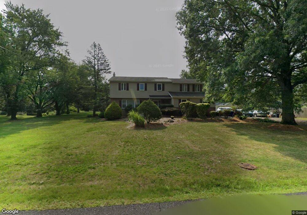
1710 Wagon Wheel Ln Lansdale, PA 19446
Estimated Value: $628,883 - $733,000
4
Beds
3
Baths
3,244
Sq Ft
$213/Sq Ft
Est. Value
About This Home
This home is located at 1710 Wagon Wheel Ln, Lansdale, PA 19446 and is currently estimated at $689,971, approximately $212 per square foot. 1710 Wagon Wheel Ln is a home located in Montgomery County with nearby schools including Gwynedd Square Elementary School, Penndale Middle School, and North Penn Senior High School.
Ownership History
Date
Name
Owned For
Owner Type
Purchase Details
Closed on
Aug 25, 2006
Sold by
Dowds Maureen
Bought by
Schwenk Carl E and Schwenk Joyce E
Current Estimated Value
Home Financials for this Owner
Home Financials are based on the most recent Mortgage that was taken out on this home.
Original Mortgage
$164,500
Outstanding Balance
$99,433
Interest Rate
6.79%
Estimated Equity
$590,538
Purchase Details
Closed on
Jul 30, 1999
Sold by
Dowds Jeffrey E and Brun Maureen A
Bought by
Dowds Maureen A
Create a Home Valuation Report for This Property
The Home Valuation Report is an in-depth analysis detailing your home's value as well as a comparison with similar homes in the area
Home Values in the Area
Average Home Value in this Area
Purchase History
| Date | Buyer | Sale Price | Title Company |
|---|---|---|---|
| Schwenk Carl E | $455,000 | None Available | |
| Dowds Maureen A | -- | -- |
Source: Public Records
Mortgage History
| Date | Status | Borrower | Loan Amount |
|---|---|---|---|
| Open | Schwenk Carl E | $164,500 | |
| Open | Schwenk Carl E | $245,000 |
Source: Public Records
Tax History Compared to Growth
Tax History
| Year | Tax Paid | Tax Assessment Tax Assessment Total Assessment is a certain percentage of the fair market value that is determined by local assessors to be the total taxable value of land and additions on the property. | Land | Improvement |
|---|---|---|---|---|
| 2025 | $7,737 | $191,000 | $51,240 | $139,760 |
| 2024 | $7,737 | $191,000 | $51,240 | $139,760 |
| 2023 | $7,408 | $191,000 | $51,240 | $139,760 |
| 2022 | $6,954 | $191,000 | $51,240 | $139,760 |
| 2021 | $6,753 | $191,000 | $51,240 | $139,760 |
| 2020 | $6,447 | $191,000 | $51,240 | $139,760 |
| 2019 | $6,335 | $191,000 | $51,240 | $139,760 |
| 2018 | $1,462 | $191,000 | $51,240 | $139,760 |
| 2017 | $6,083 | $191,000 | $51,240 | $139,760 |
| 2016 | $6,008 | $191,000 | $51,240 | $139,760 |
| 2015 | $5,757 | $191,000 | $51,240 | $139,760 |
| 2014 | $5,757 | $191,000 | $51,240 | $139,760 |
Source: Public Records
Map
Nearby Homes
- 1653 Bridle Path Dr
- 172 Oberlin Terrace
- 144 Oberlin Terrace Unit 15-B
- 177 Oberlin Terrace Unit 18-L
- 210 Berwick Place Unit 20E
- 1040 Hunter Hill Dr
- 1808 Beth Ln
- 108 Hickory Ct
- 1627 Clearbrook Rd
- 980 Jacks Ln
- 1381 Village Way
- 911 Tricorn Dr
- 1959 Supplee Rd
- 2272 Locust Dr
- 2234 Locust Dr
- 1622 Samantha Ct
- 846 Fulton Ave
- 1231 Meadowview Cir
- 109 Durham Ct
- 1131 Walnut Ln
- 1700 Wagon Wheel Ln
- 1311 Anders Rd
- 1297 Anders Rd
- 1740 Wagon Wheel Ln
- 1333 Anders Rd
- 1290 Bridle Path Dr
- 1310 Bridle Path Dr
- 1275 Anders Rd
- 1720 Wagon Wheel Ln
- 1355 Anders Rd
- 1310 Anders Rd
- 1270 Bridle Path Dr
- 1280 Anders Rd
- 1320 Anders Rd
- 1270 Anders Rd
- 1340 Anders Rd
- 1260 Anders Rd
- 1255 Anders Rd
- 1297 Bridle Path Dr
- 1885 Flintlock Cir