
Seller's Agent in 2025
Cindi Leslie
RE/MAX
(330) 205-1126
117 Total Sales
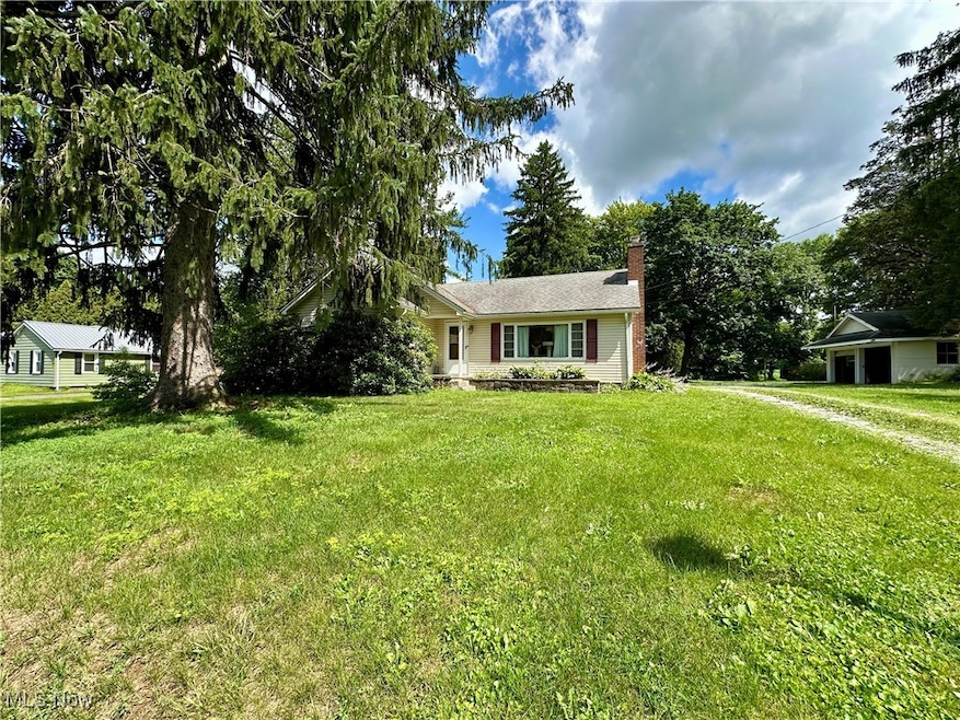


Ranch home with great potential situated on nearly 2 peaceful acres! This solid property features major updates including: Roof, Gutters, and Siding (2010), Furnace and A/C (2019), Jet Pump (2020), Hot Water Tank (2018), and Professional Basement Waterproofing (2017). The full basement is partially finished, dry, and offers additional living space. Some ceilings have cosmetic damage from before the roof was replaced. The home sits well back from the road and includes a rear walk-out patio for enjoying the outdoors. Inside, the kitchen steps down to a cozy breakfast nook—ideal as a future mudroom. The fireplace in the living room has been used, but buyers should inspect the chimney before use. Septic is on the Mahoning County yearly health check ($90/year). Home is being sold as-is. The seller will make no repairs. No appliances convey. Mineral rights do transfer and are currently leased. Roof has been Inspected and is good. Mahoning County Point of Sale has been scheduled. House has appraised over list price. With some updating, this home could truly shine!
Last Agent to Sell the Property
RE/MAX Edge Realty Brokerage Email: cwsellsohio@gmail.com, 330-205-1126 License #2018001943 Listed on: 08/12/2025
| Date | Type | Sale Price | Title Company |
|---|---|---|---|
| Warranty Deed | $125,000 | American Title Solutions | |
| Deed | $65,000 | -- | |
| Deed | -- | -- |
| Date | Status | Loan Amount | Loan Type |
|---|---|---|---|
| Previous Owner | $55,000 | New Conventional |
| Date | Event | Price | List to Sale | Price per Sq Ft |
|---|---|---|---|---|
| 09/10/2025 09/10/25 | Sold | $125,000 | -13.8% | $60 / Sq Ft |
| 08/15/2025 08/15/25 | Pending | -- | -- | -- |
| 08/12/2025 08/12/25 | For Sale | $145,000 | -- | $70 / Sq Ft |
| Year | Tax Paid | Tax Assessment Tax Assessment Total Assessment is a certain percentage of the fair market value that is determined by local assessors to be the total taxable value of land and additions on the property. | Land | Improvement |
|---|---|---|---|---|
| 2025 | $1,475 | $40,730 | $8,310 | $32,420 |
| 2024 | $1,476 | $40,730 | $8,310 | $32,420 |
| 2023 | $1,560 | $40,730 | $8,310 | $32,420 |
| 2022 | $1,132 | $28,610 | $6,640 | $21,970 |
| 2021 | $1,133 | $28,610 | $6,640 | $21,970 |
| 2020 | $1,138 | $28,610 | $6,640 | $21,970 |
| 2019 | $1,045 | $24,950 | $6,640 | $18,310 |
| 2018 | $1,092 | $24,950 | $6,640 | $18,310 |
| 2017 | $1,126 | $24,950 | $6,640 | $18,310 |
| 2016 | $1,214 | $29,370 | $7,930 | $21,440 |
| 2015 | $1,178 | $29,370 | $7,930 | $21,440 |
| 2014 | $1,184 | $29,370 | $7,930 | $21,440 |
| 2013 | $1,171 | $29,370 | $7,930 | $21,440 |
Seller's Agent in 2025
Cindi Leslie
RE/MAX
(330) 205-1126
117 Total Sales
Buyer's Agent in 2025
Jaime Wolfe
High Point Real Estate Group
(330) 354-9121
77 Total Sales
Source: MLS Now
MLS Number: 5147280
APN: 16-064-0-031.00-0
Disclaimer: Certain information contained herein is derived from information provided by parties other than Homes.com. All information provided is deemed reliable, but is not guaranteed to be accurate and should be independently verified.
![]() IDX information is provided exclusively for personal, non-commercial use, and may not be used for any purpose other than to identify prospective properties consumers may be interested in purchasing. Information is deemed reliable but not guaranteed.
IDX information is provided exclusively for personal, non-commercial use, and may not be used for any purpose other than to identify prospective properties consumers may be interested in purchasing. Information is deemed reliable but not guaranteed.
Ask me questions while you tour the home.