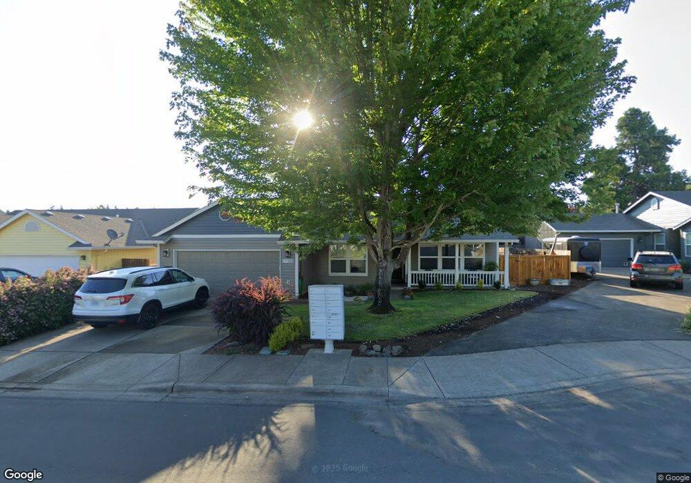
17108 SW King Richard Ct Sherwood, OR 97140
Estimated Value: $495,000 - $551,000
3
Beds
2
Baths
1,419
Sq Ft
$374/Sq Ft
Est. Value
About This Home
This home is located at 17108 SW King Richard Ct, Sherwood, OR 97140 and is currently estimated at $530,985, approximately $374 per square foot. 17108 SW King Richard Ct is a home located in Washington County with nearby schools including Hawks View Elementary School, Sherwood Middle School, and Sherwood High School.
Ownership History
Date
Name
Owned For
Owner Type
Purchase Details
Closed on
Jun 25, 2002
Sold by
R P Grahn Inc
Bought by
Chisholm William R and Chisholm Courtney A
Current Estimated Value
Home Financials for this Owner
Home Financials are based on the most recent Mortgage that was taken out on this home.
Original Mortgage
$164,700
Outstanding Balance
$69,885
Interest Rate
6.86%
Estimated Equity
$461,100
Create a Home Valuation Report for This Property
The Home Valuation Report is an in-depth analysis detailing your home's value as well as a comparison with similar homes in the area
Home Values in the Area
Average Home Value in this Area
Purchase History
| Date | Buyer | Sale Price | Title Company |
|---|---|---|---|
| Chisholm William R | $169,800 | Oregon Title Insurance Co |
Source: Public Records
Mortgage History
| Date | Status | Borrower | Loan Amount |
|---|---|---|---|
| Open | Chisholm William R | $164,700 |
Source: Public Records
Tax History Compared to Growth
Tax History
| Year | Tax Paid | Tax Assessment Tax Assessment Total Assessment is a certain percentage of the fair market value that is determined by local assessors to be the total taxable value of land and additions on the property. | Land | Improvement |
|---|---|---|---|---|
| 2025 | $4,924 | $258,350 | -- | -- |
| 2024 | $4,807 | $250,830 | -- | -- |
| 2023 | $4,807 | $243,530 | $0 | $0 |
| 2022 | $4,301 | $243,530 | $0 | $0 |
| 2021 | $4,245 | $229,560 | $0 | $0 |
| 2020 | $4,175 | $222,880 | $0 | $0 |
| 2019 | $4,095 | $216,390 | $0 | $0 |
| 2018 | $3,971 | $210,090 | $0 | $0 |
| 2017 | $3,867 | $203,980 | $0 | $0 |
| 2016 | $3,745 | $198,040 | $0 | $0 |
| 2015 | $3,558 | $192,280 | $0 | $0 |
| 2014 | $3,519 | $186,680 | $0 | $0 |
Source: Public Records
Map
Nearby Homes
- 21886 SW Vintner Ln
- 17241 SW Meinecke Rd
- 22146 SW Little John Terrace
- 16738 SW Gleneagle Dr Unit 44
- 16718 SW Gleneagle Dr Unit H57
- 16718 SW Gleneagle Dr Unit 60 H
- 16735 SW Gleneagle Dr
- 17562 SW Devonshire Way
- 21698 SW Berkshire Terrace
- 21897 SW Cedar Brook Way
- 22491 SW Dewey Dr
- 21889 SW Cedar Brook Way
- 22086 SW Hines Place
- 22370 SW Pacific Hwy
- 17011 SW Red Leaf Place
- 16033 SW 2nd St
- 21069 SW Madeira Terrace
- 0 SW Pine St
- 23427 SW Greengate Place
- 22184 SW Fisk Terrace
- 17100 SW King Richard Ct
- 17114 SW King Richard Ct
- 22143 SW Sir Lancelot Ln
- 22175 SW Sir Lancelot Ln
- 17120 SW King Richard Ct
- 17060 SW King Richard Ct
- 17126 SW King Richard Ct
- 17103 SW King Richard Ct
- 22207 SW Sir Lancelot Ln
- 22111 SW Sir Lancelot Ln
- 17097 SW King Richard Ct
- 17132 SW King Richard Ct
- 17007 SW Meinecke Rd
- 17141 SW King Richard Ct
- 17091 SW King Richard Ct
- 22239 SW Sir Lancelot Ln
- 17144 SW King Richard Ct
- 16970 SW King Richard Ct
- 22154 SW Sir Lancelot Ln
- 22186 SW Sir Lancelot Ln