Estimated Value: $179,000 - $225,402
3
Beds
2
Baths
1,600
Sq Ft
$130/Sq Ft
Est. Value
About This Home
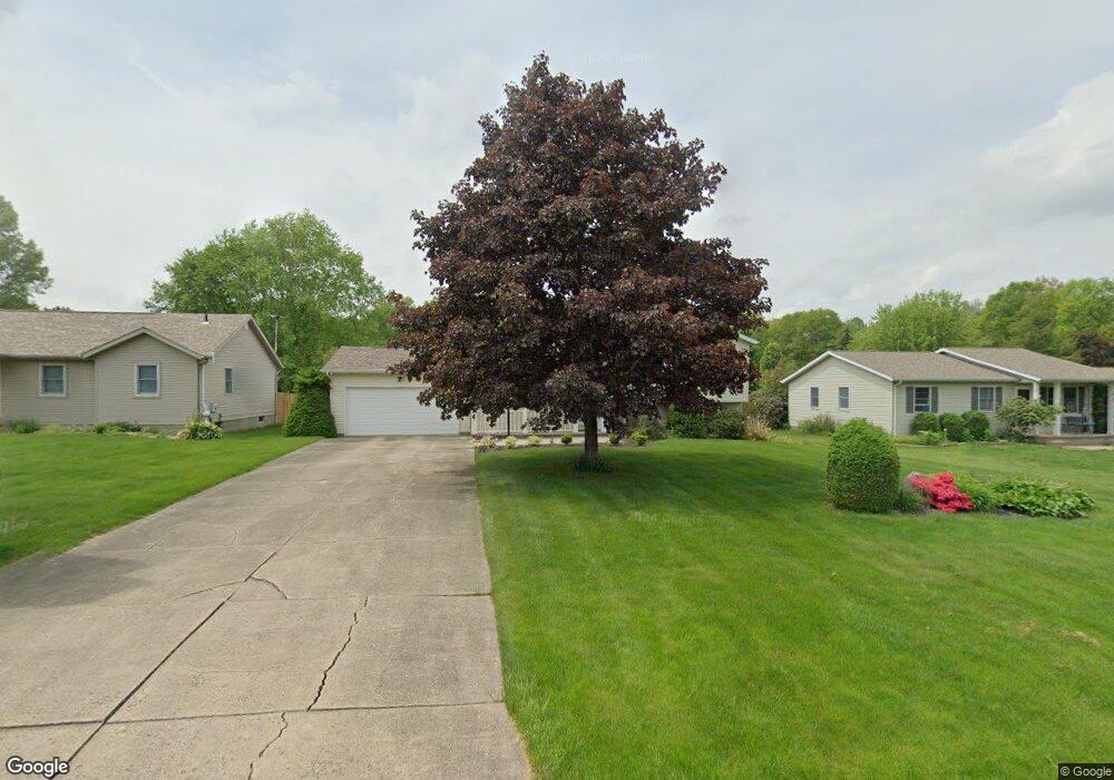
This home is located at 1711 Devonshire Dr, Salem, OH 44460 and is currently estimated at $207,851, approximately $129 per square foot. 1711 Devonshire Dr is a home located in Columbiana County with nearby schools including Reilly Elementary School, Buckeye Elementary School, and Salem Junior High School.
Ownership History
Date
Name
Owned For
Owner Type
Purchase Details
Closed on
Mar 8, 2002
Sold by
Dundon Dundon Joseph J Joseph J and Dundon Christine T
Bought by
West William M and West Claire E
Current Estimated Value
Home Financials for this Owner
Home Financials are based on the most recent Mortgage that was taken out on this home.
Original Mortgage
$135,150
Outstanding Balance
$56,336
Interest Rate
7.03%
Mortgage Type
VA
Estimated Equity
$151,515
Purchase Details
Closed on
Nov 15, 1996
Sold by
Secrest James W
Bought by
Dunden Joseph J and Dunden Christine T
Create a Home Valuation Report for This Property
The Home Valuation Report is an in-depth analysis detailing your home's value as well as a comparison with similar homes in the area
Home Values in the Area
Average Home Value in this Area
Purchase History
| Date | Buyer | Sale Price | Title Company |
|---|---|---|---|
| West William M | $132,500 | Union Title Company | |
| Dunden Joseph J | $103,000 | -- |
Source: Public Records
Mortgage History
| Date | Status | Borrower | Loan Amount |
|---|---|---|---|
| Open | West William M | $135,150 | |
| Closed | Dunden Joseph J | -- |
Source: Public Records
Tax History
| Year | Tax Paid | Tax Assessment Tax Assessment Total Assessment is a certain percentage of the fair market value that is determined by local assessors to be the total taxable value of land and additions on the property. | Land | Improvement |
|---|---|---|---|---|
| 2024 | $2,398 | $57,580 | $7,740 | $49,840 |
| 2023 | $2,404 | $57,580 | $7,740 | $49,840 |
| 2022 | $2,235 | $57,580 | $7,740 | $49,840 |
| 2021 | $2,066 | $49,430 | $7,740 | $41,690 |
| 2020 | $2,082 | $49,430 | $7,740 | $41,690 |
| 2019 | $2,081 | $49,430 | $7,740 | $41,690 |
| 2018 | $1,988 | $44,950 | $7,040 | $37,910 |
| 2017 | $1,987 | $44,950 | $7,040 | $37,910 |
| 2016 | $1,985 | $42,320 | $6,550 | $35,770 |
| 2015 | $1,902 | $42,320 | $6,550 | $35,770 |
| 2014 | $1,847 | $42,320 | $6,550 | $35,770 |
Source: Public Records
Map
Nearby Homes
- 840 Carriage Hill Dr
- 1759 Depot Rd
- 1881 Cliff Dr
- 469 E Euclid Ave
- 755 Prospect St
- 996 Prospect St
- 559 E Perry St
- 652 E Euclid Ave
- 1175 S Lincoln Ave
- 861 S Lincoln Ave
- 264 W Wilson St
- 854 S Lincoln Ave
- 845 Summit St
- 921 Homewood Ave
- 884 Summit St
- 1286 Pembrooke Dr Unit D
- 1026 Franklin Ave
- 1603 Chestnut Grove Rd
- 281 Idaho Ave
- 2454 Woodsdale Rd
- 1713 Devonshire Dr
- 1707 Devonshire Dr
- 1717 Devonshire Dr
- 1710 Hearthside Dr
- 1714 Hearthside Dr
- 1708 Devonshire Dr
- 636 Brittany Ln
- 1712 Devonshire Dr
- 1714 Devonshire Dr
- 1721 Devonshire Dr
- 658 Brittany Ln
- 1720 Hearthside Dr
- 6099 Britton
- 1706 Hearthside Dr
- 680 Brittany Ln
- 1716 Devonshire Dr
- 620 Brittany Ln
- 570 Brittany Ln
- 1728 Hearthside Dr
- 1722 Devonshire Dr
Your Personal Tour Guide
Ask me questions while you tour the home.