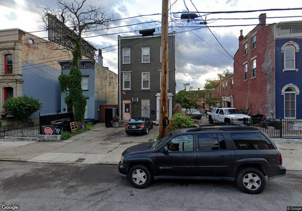
1711 Freeman Ave Cincinnati, OH 45214
West End NeighborhoodEstimated Value: $290,192 - $528,000
3
Beds
3
Baths
4,254
Sq Ft
$93/Sq Ft
Est. Value
About This Home
This home is located at 1711 Freeman Ave, Cincinnati, OH 45214 and is currently estimated at $395,048, approximately $92 per square foot. 1711 Freeman Ave is a home located in Hamilton County with nearby schools including Hays-Porter School, Robert A. Taft Information Technology High School, and Gilbert A. Dater High School.
Ownership History
Date
Name
Owned For
Owner Type
Purchase Details
Closed on
Jul 10, 2019
Sold by
Elgon Llc
Bought by
Mukasa Godfrey S
Current Estimated Value
Purchase Details
Closed on
Jan 18, 2006
Sold by
Saleh Omran Y and Saleh Sawsan
Bought by
Elgon Llc
Home Financials for this Owner
Home Financials are based on the most recent Mortgage that was taken out on this home.
Original Mortgage
$16,800
Interest Rate
6.37%
Mortgage Type
Seller Take Back
Purchase Details
Closed on
Mar 12, 2002
Sold by
Murrell Timothy A
Bought by
Saleh Omran Y
Purchase Details
Closed on
Feb 5, 2002
Sold by
Murrell Minnie P
Bought by
Murrell Timothy A
Purchase Details
Closed on
Dec 22, 1988
Sold by
Johnson Melvin C
Bought by
Wilkins Dwight
Create a Home Valuation Report for This Property
The Home Valuation Report is an in-depth analysis detailing your home's value as well as a comparison with similar homes in the area
Home Values in the Area
Average Home Value in this Area
Purchase History
| Date | Buyer | Sale Price | Title Company |
|---|---|---|---|
| Mukasa Godfrey S | -- | None Available | |
| Elgon Llc | -- | None Available | |
| Saleh Omran Y | $10,000 | -- | |
| Murrell Timothy A | -- | -- | |
| Wilkins Dwight | -- | -- |
Source: Public Records
Mortgage History
| Date | Status | Borrower | Loan Amount |
|---|---|---|---|
| Previous Owner | Elgon Llc | $16,800 |
Source: Public Records
Tax History Compared to Growth
Tax History
| Year | Tax Paid | Tax Assessment Tax Assessment Total Assessment is a certain percentage of the fair market value that is determined by local assessors to be the total taxable value of land and additions on the property. | Land | Improvement |
|---|---|---|---|---|
| 2024 | $4,340 | $72,486 | $8,313 | $64,173 |
| 2023 | $4,438 | $72,486 | $8,313 | $64,173 |
| 2022 | $1,339 | $19,394 | $4,582 | $14,812 |
| 2021 | $1,283 | $19,394 | $4,582 | $14,812 |
| 2020 | $1,321 | $19,394 | $4,582 | $14,812 |
| 2019 | $1,359 | $17,630 | $4,165 | $13,465 |
| 2018 | $1,360 | $17,630 | $4,165 | $13,465 |
| 2017 | $1,309 | $17,630 | $4,165 | $13,465 |
| 2016 | $1,128 | $14,784 | $5,166 | $9,618 |
| 2015 | $1,009 | $14,784 | $5,166 | $9,618 |
| 2014 | $1,015 | $14,784 | $5,166 | $9,618 |
| 2013 | $1,073 | $15,404 | $5,383 | $10,021 |
Source: Public Records
Map
Nearby Homes
- 1722 Freeman Ave
- 1728 Freeman Ave
- 923 Findlay St
- 924 Findlay St
- 912 Livingston St
- 931 York St
- 913 Charlotte St
- 1816 Baymiller St
- 845 Charlotte St
- 832 Livingston St
- 830 Livingston St
- 830 Poplar St
- 1115 Dayton St
- 815 Livingston St
- 1026 Dayton St
- 818 Livingston St
- 819 Findlay St
- 2008 Colerain Ave
- 830 York St
- 1142 Dayton St
- 1709 Freeman Ave
- 1707 Freeman Ave
- 1717 Freeman Ave
- 1701 Freeman Ave
- 1009 Findlay St
- 1705 Freeman Ave
- 1011 Findlay St
- 1718 Freeman Ave
- 1720 Freeman Ave
- 1730 Freeman Ave
- 945 Findlay St
- 1815 Freeman Ave
- 941 Findlay St
- 1800 Freeman Ave
- 1800 Freeman Ave Unit 2
- 1802 Freeman Ave
- 939 Findlay St
- 1626 Freeman Ave
- 1804 Freeman Ave
- 1806 Freeman Ave