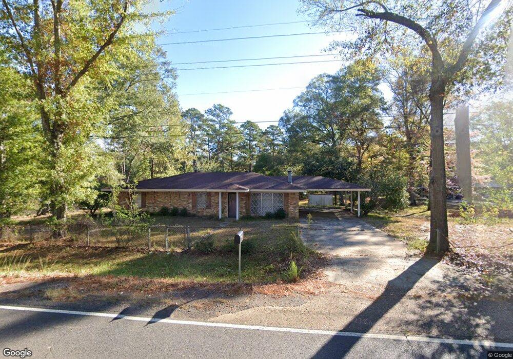
1711 Highway 557 West Monroe, LA 71292
Estimated Value: $147,202 - $193,000
3
Beds
1
Bath
1,472
Sq Ft
$119/Sq Ft
Est. Value
About This Home
This home is located at 1711 Highway 557, West Monroe, LA 71292 and is currently estimated at $174,551, approximately $118 per square foot. 1711 Highway 557 is a home located in Ouachita Parish with nearby schools including Woodlawn Elementary School, Woodlawn Middle School, and West Ouachita High School.
Ownership History
Date
Name
Owned For
Owner Type
Purchase Details
Closed on
Aug 22, 2025
Sold by
Young Shirley and Kinman Jo Nita
Bought by
Kinman Gavyn
Current Estimated Value
Home Financials for this Owner
Home Financials are based on the most recent Mortgage that was taken out on this home.
Original Mortgage
$113,600
Outstanding Balance
$113,502
Interest Rate
6.72%
Mortgage Type
New Conventional
Estimated Equity
$61,049
Purchase Details
Closed on
Jul 28, 2025
Sold by
Mathus Kyle Brandon
Bought by
Kinman Jo Nita and Kinman Jimmy
Home Financials for this Owner
Home Financials are based on the most recent Mortgage that was taken out on this home.
Original Mortgage
$113,600
Outstanding Balance
$113,502
Interest Rate
6.72%
Mortgage Type
New Conventional
Estimated Equity
$61,049
Create a Home Valuation Report for This Property
The Home Valuation Report is an in-depth analysis detailing your home's value as well as a comparison with similar homes in the area
Home Values in the Area
Average Home Value in this Area
Purchase History
| Date | Buyer | Sale Price | Title Company |
|---|---|---|---|
| Kinman Gavyn | $142,000 | Wfg National Title | |
| Kinman Jo Nita | -- | None Listed On Document |
Source: Public Records
Mortgage History
| Date | Status | Borrower | Loan Amount |
|---|---|---|---|
| Open | Kinman Gavyn | $113,600 |
Source: Public Records
Tax History Compared to Growth
Tax History
| Year | Tax Paid | Tax Assessment Tax Assessment Total Assessment is a certain percentage of the fair market value that is determined by local assessors to be the total taxable value of land and additions on the property. | Land | Improvement |
|---|---|---|---|---|
| 2024 | $322 | $6,245 | $525 | $5,720 |
| 2023 | $560 | $6,245 | $525 | $5,720 |
| 2022 | $554 | $6,245 | $525 | $5,720 |
| 2021 | $561 | $6,245 | $525 | $5,720 |
| 2020 | $561 | $6,245 | $525 | $5,720 |
| 2019 | $559 | $6,245 | $525 | $5,720 |
| 2018 | $0 | $6,245 | $525 | $5,720 |
| 2017 | $559 | $6,245 | $525 | $5,720 |
| 2016 | $831 | $6,245 | $525 | $5,720 |
| 2015 | -- | $6,245 | $525 | $5,720 |
| 2014 | -- | $6,245 | $525 | $5,720 |
| 2013 | -- | $6,245 | $525 | $5,720 |
Source: Public Records
Map
Nearby Homes
- 00 Bay Leaf Dr
- 146 S Leo Ln
- 175 S Leo Ln
- 2164 Louisiana 557
- 184 S Leo Ln
- 212 S Leo Ln
- 111 Frost Tower Rd
- 000 Jimmy Graham Loop
- 000 William Harris Rd Unit 1.365 Acres
- 0 Roberson Rd Unit 206166
- 112 Bill Dr
- 2104 Red Cut Rd
- 0 Ed Rutledge Rd Unit 215652
- 1147 Frost Tower Rd
- 6347 Jonesboro Rd
- Red Cut Road Lot Unit Wp001
- 1198 Philpot Rd Unit 1196 Philpot Road
- 494 Lapine Rd
- 850 Lapine Rd
- 2017 Philpot Rd
- 1725 Highway 557
- 1661 Highway 557
- 1739 Highway 557
- 1739 La-557
- 133 Elliott Rd
- 133 Elliott Rd
- 1641 Highway 557
- 1641 Highway 557
- 1751 Highway 557
- 150 Elliott Rd
- 1628 Highway 557
- 147 Elliott Rd
- 1765 Highway 557
- 1779 Highway 557
- 106 Silverleaf Dr
- 104 Silverleaf Trail
- 1774 Highway 557
- 108 Silverleaf Dr
- 1598 Highway 557
- 110 Silverleaf Trail