Estimated Value: $574,000 - $615,000
6
Beds
3
Baths
3,104
Sq Ft
$192/Sq Ft
Est. Value
About This Home
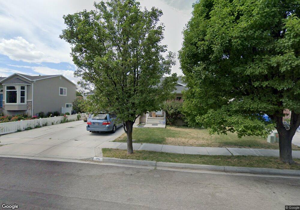
This home is located at 1711 N 2520 W, Lehi, UT 84043 and is currently estimated at $595,261, approximately $191 per square foot. 1711 N 2520 W is a home located in Utah County with nearby schools including North Point Elementary School, Willowcreek Middle School, and Lehi High School.
Ownership History
Date
Name
Owned For
Owner Type
Purchase Details
Closed on
Dec 5, 2019
Sold by
Wilks S Jaron S and Wilks Jennifer L
Bought by
Adams Jennifer
Current Estimated Value
Home Financials for this Owner
Home Financials are based on the most recent Mortgage that was taken out on this home.
Original Mortgage
$183,000
Outstanding Balance
$161,812
Interest Rate
3.75%
Mortgage Type
New Conventional
Estimated Equity
$433,449
Purchase Details
Closed on
Mar 14, 2013
Sold by
Wilks S Jaron
Bought by
Wilks S Jaron and Wilks Jennifer L
Home Financials for this Owner
Home Financials are based on the most recent Mortgage that was taken out on this home.
Original Mortgage
$208,124
Interest Rate
3.53%
Mortgage Type
New Conventional
Purchase Details
Closed on
May 18, 2009
Sold by
Wilks Samuel J and Wilks Jennifer L
Bought by
Wilks S Jaron and Wilks Jennifer L
Home Financials for this Owner
Home Financials are based on the most recent Mortgage that was taken out on this home.
Original Mortgage
$216,000
Interest Rate
4.82%
Mortgage Type
New Conventional
Purchase Details
Closed on
Aug 15, 2006
Sold by
Prudential Relocation Inc
Bought by
Wilks Samuel J and Wilks Jennifer L
Purchase Details
Closed on
Aug 11, 2006
Sold by
King Roland B and King Ramie Jo
Bought by
Prudential Relocation Inc
Purchase Details
Closed on
Sep 3, 2002
Sold by
Woodside Homes Corp
Bought by
King Roland B and King Ramie Jo
Home Financials for this Owner
Home Financials are based on the most recent Mortgage that was taken out on this home.
Original Mortgage
$137,200
Interest Rate
6.24%
Create a Home Valuation Report for This Property
The Home Valuation Report is an in-depth analysis detailing your home's value as well as a comparison with similar homes in the area
Home Values in the Area
Average Home Value in this Area
Purchase History
| Date | Buyer | Sale Price | Title Company |
|---|---|---|---|
| Adams Jennifer | -- | Backman Orem | |
| Wilks S Jaron | -- | Gateway Title Insurance Age | |
| Wilks S Jaron | -- | Gateway Title Ins Agency Ll | |
| Wilks S Jaron | -- | Eagle Pointe Title Insuranc | |
| Wilks Samuel J | -- | Guardian Title Company Of U | |
| Prudential Relocation Inc | -- | Guardian Title Company Of U | |
| King Roland B | -- | First American Title Co |
Source: Public Records
Mortgage History
| Date | Status | Borrower | Loan Amount |
|---|---|---|---|
| Open | Adams Jennifer | $183,000 | |
| Previous Owner | Wilks S Jaron | $208,124 | |
| Previous Owner | Wilks S Jaron | $216,000 | |
| Previous Owner | King Roland B | $137,200 |
Source: Public Records
Tax History Compared to Growth
Tax History
| Year | Tax Paid | Tax Assessment Tax Assessment Total Assessment is a certain percentage of the fair market value that is determined by local assessors to be the total taxable value of land and additions on the property. | Land | Improvement |
|---|---|---|---|---|
| 2025 | $2,324 | $289,300 | $181,700 | $344,300 |
| 2024 | $2,324 | $271,975 | $0 | $0 |
| 2023 | $2,211 | $280,940 | $0 | $0 |
| 2022 | $2,335 | $287,595 | $0 | $0 |
| 2021 | $2,117 | $394,200 | $105,200 | $289,000 |
| 2020 | $1,996 | $367,500 | $97,400 | $270,100 |
| 2019 | $1,754 | $335,600 | $97,400 | $238,200 |
| 2018 | $1,779 | $321,900 | $86,800 | $235,100 |
| 2017 | $1,738 | $167,145 | $0 | $0 |
| 2016 | $1,741 | $155,375 | $0 | $0 |
| 2015 | $1,612 | $136,565 | $0 | $0 |
| 2014 | $1,579 | $132,990 | $0 | $0 |
Source: Public Records
Map
Nearby Homes
- 2587 W 1540 N
- Huntington Plan at Pioneer Meadows
- Silver Lake Plan at Pioneer Meadows
- Summit Plan at Pioneer Meadows
- Palisade Plan at Pioneer Meadows
- 1832 N 2230 W
- 1842 N 2230 W
- 1854 N 2230 W
- 1870 N 2230 W
- 1870 N 2230 W Unit 23
- 1896 N 2230 W
- 1908 N 2230 W
- 1970 N 2090 St W
- 1302 N 2450 W
- 2189 N 2600 W
- 2196 N 2350 W
- 2464 W 2250 N
- 1185 N 2650 W
- 1648 N 1900 W
- 1971 W 1400 N