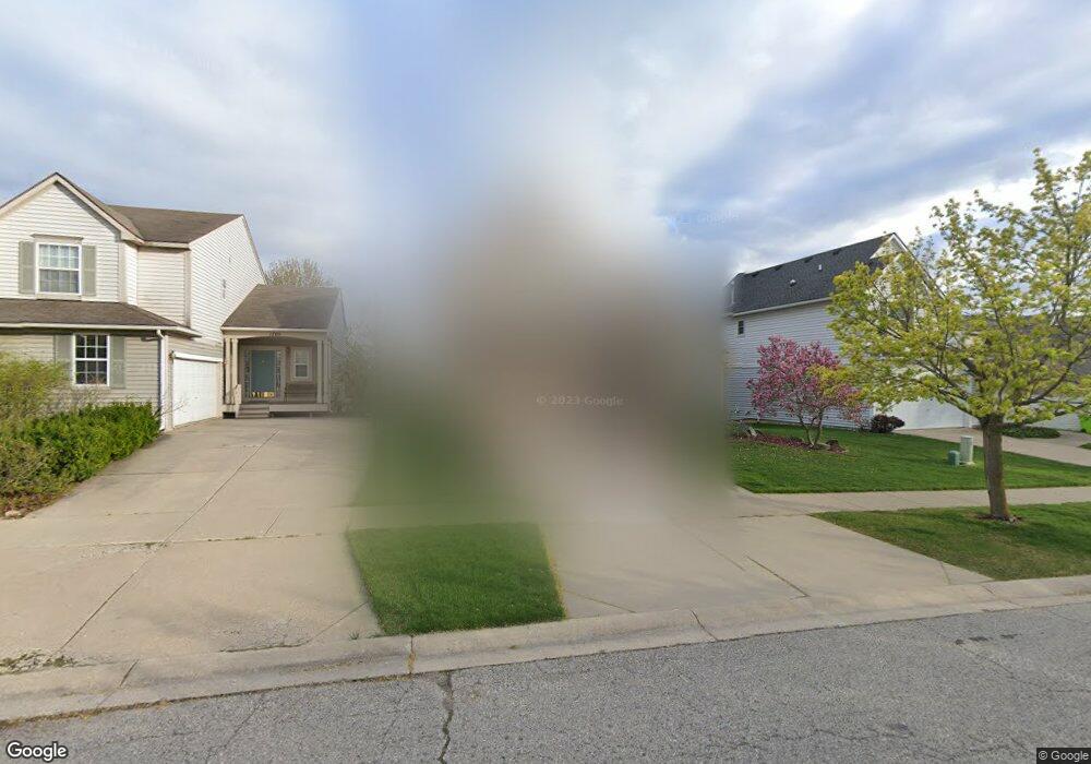
1711 Scio Ridge Rd Ann Arbor, MI 48103
Estimated Value: $518,011 - $558,000
3
Beds
4
Baths
2,117
Sq Ft
$255/Sq Ft
Est. Value
About This Home
This home is located at 1711 Scio Ridge Rd, Ann Arbor, MI 48103 and is currently estimated at $540,753, approximately $255 per square foot. 1711 Scio Ridge Rd is a home located in Washtenaw County with nearby schools including Dicken Elementary School, Slauson Middle School, and Pioneer High School.
Ownership History
Date
Name
Owned For
Owner Type
Purchase Details
Closed on
Aug 12, 2002
Sold by
Su Lyndon D
Bought by
Su Lyndon D
Current Estimated Value
Purchase Details
Closed on
Jun 22, 1998
Sold by
Ho John Richards Wexford
Bought by
Su Lyndon D
Home Financials for this Owner
Home Financials are based on the most recent Mortgage that was taken out on this home.
Original Mortgage
$234,600
Interest Rate
7.27%
Mortgage Type
New Conventional
Purchase Details
Closed on
Mar 17, 1997
Sold by
Chase Co
Bought by
Building Co John Richards Homes/Wexford Homes
Create a Home Valuation Report for This Property
The Home Valuation Report is an in-depth analysis detailing your home's value as well as a comparison with similar homes in the area
Home Values in the Area
Average Home Value in this Area
Purchase History
| Date | Buyer | Sale Price | Title Company |
|---|---|---|---|
| Su Lyndon D | -- | -- | |
| Su Lyndon D | $260,798 | -- | |
| Building Co John Richards Homes/Wexford Homes | $45,500 | -- |
Source: Public Records
Mortgage History
| Date | Status | Borrower | Loan Amount |
|---|---|---|---|
| Previous Owner | Su Lyndon D | $234,600 |
Source: Public Records
Tax History Compared to Growth
Tax History
| Year | Tax Paid | Tax Assessment Tax Assessment Total Assessment is a certain percentage of the fair market value that is determined by local assessors to be the total taxable value of land and additions on the property. | Land | Improvement |
|---|---|---|---|---|
| 2025 | -- | $231,100 | $0 | $0 |
| 2024 | $4,228 | $235,500 | $0 | $0 |
| 2023 | $4,062 | $224,100 | $0 | $0 |
| 2022 | $5,698 | $200,000 | $0 | $0 |
| 2021 | $5,419 | $195,900 | $0 | $0 |
| 2020 | $5,548 | $189,900 | $0 | $0 |
| 2019 | $5,126 | $179,900 | $179,900 | $0 |
| 2018 | $4,991 | $171,500 | $0 | $0 |
| 2017 | $4,812 | $172,800 | $0 | $0 |
| 2016 | $3,377 | $132,767 | $0 | $0 |
| 2015 | -- | $132,370 | $0 | $0 |
| 2014 | -- | $128,235 | $0 | $0 |
| 2013 | -- | $128,235 | $0 | $0 |
Source: Public Records
Map
Nearby Homes
- 1770 Harley Dr
- 1599 Scio Ridge Rd
- 1929 Harley Dr
- 1860 Chicory Ridge
- 2512 Jade Ct Unit 18
- 1740 S Maple Rd Unit 2
- 1419 N Bay Dr Unit 73
- 1366 N Bay Dr Unit 144
- 2126 Pauline Blvd Unit 104
- 1225 S Maple Rd Unit 307
- 2165 Pauline Ct Unit 14
- 1235 S Maple Rd Unit 202
- 2120 Pauline Blvd Unit 305
- 1265 S Maple Rd Unit 207
- 2147 Pauline Ct Unit 17
- 2104 Pauline Blvd Unit 305
- 2033 Pauline Ct
- 813 E Summerfield Glen Cir
- 1021 Bluestem Ln Unit 29
- 1720 Avondale Ave
- 1705 Scio Ridge Rd
- 1717 Scio Ridge Rd
- 1699 Scio Ridge Rd
- 2879 Windside Ct
- 1733 Scio Ridge Rd
- 1693 Scio Ridge Rd
- 2873 Windside Ct
- 1706 Scio Ridge Rd
- 2870 Windside Ct
- 1718 Scio Ridge Rd
- 1700 Scio Ridge Rd
- 1739 Scio Ridge Rd
- 1687 Scio Ridge Rd
- 1692 Scio Ridge Rd
- 1730 Scio Ridge Rd
- 2865 Windside Ct
- 1745 Scio Ridge Rd
- 1681 Scio Ridge Rd
- 2862 Windside Ct
- 1686 Scio Ridge