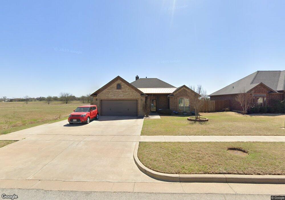
1711 Shawnee Dr Cleburne, TX 76033
Osage-North Fisk NeighborhoodEstimated Value: $283,841 - $321,000
3
Beds
2
Baths
1,820
Sq Ft
$166/Sq Ft
Est. Value
About This Home
This home is located at 1711 Shawnee Dr, Cleburne, TX 76033 and is currently estimated at $302,210, approximately $166 per square foot. 1711 Shawnee Dr is a home located in Johnson County with nearby schools including Marti Elementary School, A.D. Wheat Middle School, and Cleburne High School.
Ownership History
Date
Name
Owned For
Owner Type
Purchase Details
Closed on
Oct 30, 2015
Sold by
Ralph Littlejohn Homes & Const Inc
Bought by
Meyer Ronald C and Meyer Peggy Joyce
Current Estimated Value
Home Financials for this Owner
Home Financials are based on the most recent Mortgage that was taken out on this home.
Original Mortgage
$179,900
Outstanding Balance
$142,027
Interest Rate
3.9%
Mortgage Type
VA
Estimated Equity
$160,183
Create a Home Valuation Report for This Property
The Home Valuation Report is an in-depth analysis detailing your home's value as well as a comparison with similar homes in the area
Home Values in the Area
Average Home Value in this Area
Purchase History
| Date | Buyer | Sale Price | Title Company |
|---|---|---|---|
| Meyer Ronald C | -- | Providence Title Co |
Source: Public Records
Mortgage History
| Date | Status | Borrower | Loan Amount |
|---|---|---|---|
| Open | Meyer Ronald C | $179,900 |
Source: Public Records
Tax History Compared to Growth
Tax History
| Year | Tax Paid | Tax Assessment Tax Assessment Total Assessment is a certain percentage of the fair market value that is determined by local assessors to be the total taxable value of land and additions on the property. | Land | Improvement |
|---|---|---|---|---|
| 2025 | -- | $282,859 | $40,000 | $242,859 |
| 2024 | $5,331 | $239,109 | $40,000 | $199,109 |
| 2023 | $5,321 | $239,109 | $40,000 | $199,109 |
| 2022 | $5,581 | $239,109 | $40,000 | $199,109 |
| 2021 | $5,289 | $239,109 | $40,000 | $199,109 |
| 2020 | $5,107 | $184,287 | $25,000 | $159,287 |
| 2019 | $5,445 | $184,287 | $25,000 | $159,287 |
| 2018 | $5,533 | $187,176 | $25,000 | $162,176 |
| 2017 | $5,403 | $187,176 | $25,000 | $162,176 |
| 2016 | $4,912 | $166,848 | $19,750 | $147,098 |
| 2015 | $226 | $8,493 | $8,493 | $0 |
| 2014 | $226 | $8,493 | $8,493 | $0 |
Source: Public Records
Map
Nearby Homes
- 1901 Seminole Dr
- 310 Shoshone Dr
- 706 Hill Ln
- 724 Remington Dr
- 716 Park Ridge Dr
- 301 Comanche Dr
- 1903 Seminole Dr
- 1905 Seminole Dr
- 1907 Seminole Dr
- 1908 Seminole Dr
- Austin Plan at Baker Farms
- Lincoln Plan at Baker Farms
- Atlanta Plan at Baker Farms
- Cheyenne Plan at Baker Farms
- Boston Plan at Baker Farms
- Raleigh Plan at Baker Farms
- Lexington Plan at Baker Farms
- 1724 W Henderson St
- 1910 Seminole Dr
- 1912 Seminole Dr
- 1713 Shawnee Dr
- 1715 Shawnee Dr
- 1712 Shawnee Dr
- 1714 Shawnee Dr
- 1710 Shawnee Dr
- 1716 Shawnee Dr
- 1718 Shawnee Dr
- 1701 Blackfoot Dr
- 1703 Blackfoot Dr
- 1720 Shawnee Dr
- 501 N Nolan River Rd
- 1705 Blackfoot Dr
- 1721 Shawnee Dr
- 1707 Blackfoot Dr
- 1722 Shawnee Dr
- 1709 Blackfoot Dr
- 1723 Shawnee Dr
- 1724 Shawnee Dr
- 1711 Blackfoot Dr
- 1725 Shawnee Dr