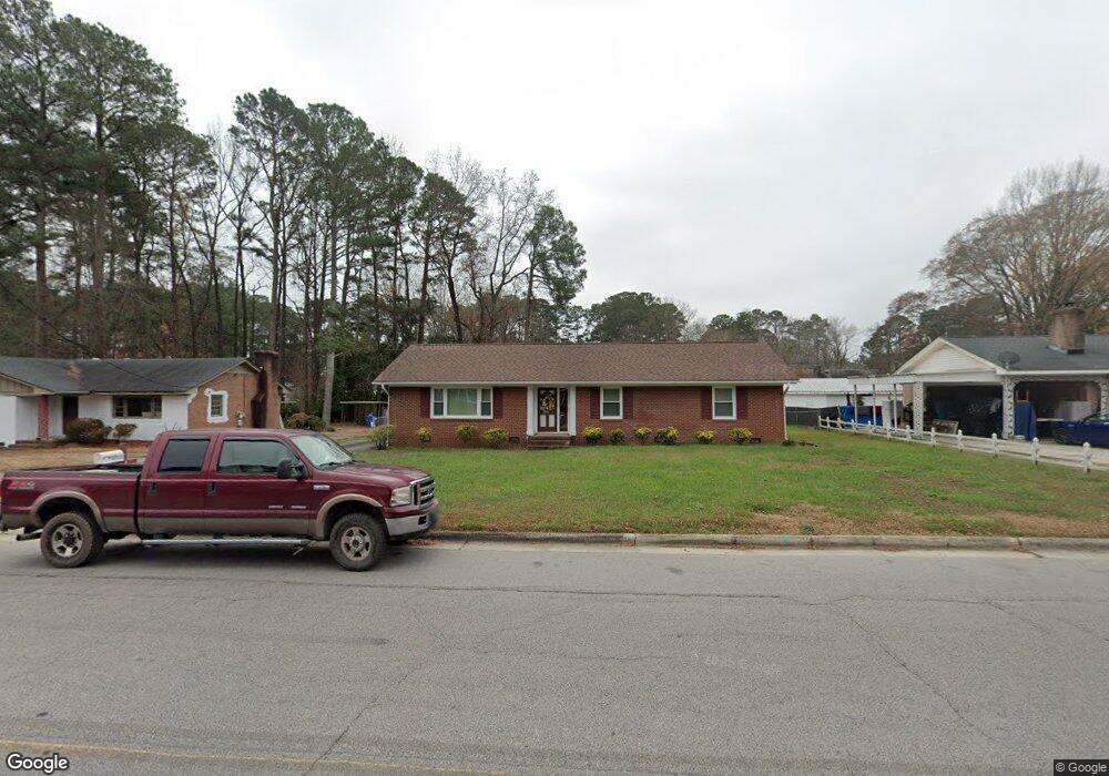
1711 Westwood Ave W Wilson, NC 27893
Estimated Value: $209,401 - $236,000
3
Beds
2
Baths
1,527
Sq Ft
$146/Sq Ft
Est. Value
About This Home
This home is located at 1711 Westwood Ave W, Wilson, NC 27893 and is currently estimated at $223,350, approximately $146 per square foot. 1711 Westwood Ave W is a home located in Wilson County with nearby schools including James Hunt High School, Vinson-Bynum Elementary School, and Forest Hills Middle School.
Ownership History
Date
Name
Owned For
Owner Type
Purchase Details
Closed on
May 1, 2007
Sold by
Brewer Gordon A and Brewer Michael J
Bought by
Williams Lessie Simon
Current Estimated Value
Home Financials for this Owner
Home Financials are based on the most recent Mortgage that was taken out on this home.
Original Mortgage
$104,900
Outstanding Balance
$63,633
Interest Rate
6.12%
Mortgage Type
New Conventional
Estimated Equity
$159,717
Create a Home Valuation Report for This Property
The Home Valuation Report is an in-depth analysis detailing your home's value as well as a comparison with similar homes in the area
Home Values in the Area
Average Home Value in this Area
Purchase History
| Date | Buyer | Sale Price | Title Company |
|---|---|---|---|
| Williams Lessie Simon | $105,000 | None Available |
Source: Public Records
Mortgage History
| Date | Status | Borrower | Loan Amount |
|---|---|---|---|
| Open | Williams Lessie Simon | $104,900 |
Source: Public Records
Tax History Compared to Growth
Tax History
| Year | Tax Paid | Tax Assessment Tax Assessment Total Assessment is a certain percentage of the fair market value that is determined by local assessors to be the total taxable value of land and additions on the property. | Land | Improvement |
|---|---|---|---|---|
| 2025 | $1,701 | $151,866 | $30,000 | $121,866 |
| 2024 | $1,701 | $151,866 | $30,000 | $121,866 |
| 2023 | $1,206 | $92,410 | $14,000 | $78,410 |
| 2022 | $1,206 | $92,410 | $14,000 | $78,410 |
| 2021 | $1,206 | $92,410 | $14,000 | $78,410 |
| 2020 | $1,206 | $92,410 | $14,000 | $78,410 |
| 2019 | $1,206 | $92,410 | $14,000 | $78,410 |
| 2018 | $1,206 | $92,410 | $14,000 | $78,410 |
| 2017 | $1,187 | $92,410 | $14,000 | $78,410 |
| 2016 | $1,187 | $92,410 | $14,000 | $78,410 |
| 2014 | $1,331 | $106,922 | $18,000 | $88,922 |
Source: Public Records
Map
Nearby Homes
- 1709 Westwood Ave W
- 1720 Westwood Ave W
- 606 Hawthorne Ln W
- 1705 Parkway St W
- 1403 Westwood Ave W
- 1102 Raleigh Road Pkwy W
- 1305 Westwood Ave W
- 1824 Oakdale Dr W
- 1216 Elizabeth Rd W
- 907 Lakeside Dr NW
- 1108 Robert Rd W
- 1011 Oak Forest Dr NW
- 1013 Oak Forest Dr NW
- 1203 Elizabeth Rd W
- 1914 Rand Rd W
- 2015 Westwood Ave W
- 304 Lillian Rd W
- 1124 Azalea Ln NW
- 1103 Peachtree Rd NW
- 915 Timberlake Dr NW
- 1713 W Westwood Ave
- 1713 Westwood Ave W
- 1716 Meadowbrook Ln W
- 1714 Meadowbrook Ln W
- 1718 Meadowbrook Ln W
- 1707 Westwood Ave W
- 1715 Westwood Ave W
- 1710 Westwood Ave W
- 1712 Westwood Ave W
- 1712 Meadowbrook Ln W
- 1708 Westwood Ave W
- 1720 Meadowbrook Ln W
- 1714 Westwood Ave W
- 1717 Westwood Ave W
- 1705 Westwood Ave W
- 1710 Meadowbrook Ln W
- 1706 Westwood Ave W
- 1722 Meadowbrook Ln W
- 1716 Westwood Ave W
- 1715 Meadowbrook Ln W