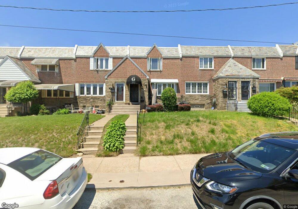
1711 Wynsam St Philadelphia, PA 19138
West Oak Lane NeighborhoodEstimated Value: $229,000 - $289,000
3
Beds
1
Bath
1,416
Sq Ft
$182/Sq Ft
Est. Value
About This Home
This home is located at 1711 Wynsam St, Philadelphia, PA 19138 and is currently estimated at $257,004, approximately $181 per square foot. 1711 Wynsam St is a home located in Philadelphia County with nearby schools including Pennypacker Samuel School, Martin Luther King High School, and West Oak Lane Charter School.
Ownership History
Date
Name
Owned For
Owner Type
Purchase Details
Closed on
Mar 7, 2006
Sold by
Mccoy Fred and Mccoy Dolores
Bought by
Graham Ronald A and Graham Kyesha S
Current Estimated Value
Home Financials for this Owner
Home Financials are based on the most recent Mortgage that was taken out on this home.
Original Mortgage
$138,902
Outstanding Balance
$79,011
Interest Rate
6.28%
Mortgage Type
FHA
Estimated Equity
$177,993
Create a Home Valuation Report for This Property
The Home Valuation Report is an in-depth analysis detailing your home's value as well as a comparison with similar homes in the area
Home Values in the Area
Average Home Value in this Area
Purchase History
| Date | Buyer | Sale Price | Title Company |
|---|---|---|---|
| Graham Ronald A | $140,000 | T A Title Insurance Co |
Source: Public Records
Mortgage History
| Date | Status | Borrower | Loan Amount |
|---|---|---|---|
| Open | Graham Ronald A | $138,902 |
Source: Public Records
Tax History Compared to Growth
Tax History
| Year | Tax Paid | Tax Assessment Tax Assessment Total Assessment is a certain percentage of the fair market value that is determined by local assessors to be the total taxable value of land and additions on the property. | Land | Improvement |
|---|---|---|---|---|
| 2025 | $2,632 | $231,400 | $46,280 | $185,120 |
| 2024 | $2,632 | $231,400 | $46,280 | $185,120 |
| 2023 | $2,632 | $188,000 | $37,600 | $150,400 |
| 2022 | $1,323 | $143,000 | $37,600 | $105,400 |
| 2021 | $1,953 | $0 | $0 | $0 |
| 2020 | $1,953 | $0 | $0 | $0 |
| 2019 | $2,038 | $0 | $0 | $0 |
| 2018 | $1,828 | $0 | $0 | $0 |
| 2017 | $1,828 | $0 | $0 | $0 |
| 2016 | $1,408 | $0 | $0 | $0 |
| 2015 | $1,348 | $0 | $0 | $0 |
| 2014 | -- | $130,600 | $12,830 | $117,770 |
| 2012 | -- | $18,368 | $2,452 | $15,916 |
Source: Public Records
Map
Nearby Homes
- 1559 E Pastorius St
- 1762 Mohican St
- 7349 E Walnut Ln
- 7277 E Walnut Ln
- 1821 E Tulpehocken St
- 1827 E Pastorius St
- 1544 E Tulpehocken St
- 1822 Nolan St
- 1544 Beverly Rd
- 1839 E Pastorius St
- 1759 E Mayland St
- 1537 Beverly Rd
- 1521 E Walnut Ln
- 7243 Mansfield Ave
- 1602 E Duval St
- 6635 Hollis St
- 1505 Beverly Rd
- 7206 Forrest Ave
- 7258 Mansfield Ave
- 1416-20 E Tulpehocken St
- 1709 Wynsam St
- 1713 Wynsam St
- 1707 Wynsam St
- 1715 Wynsam St
- 1705 Wynsam St
- 1717 Wynsam St
- 1703 Wynsam St
- 1719 Wynsam St
- 1714 E Tulpehocken St
- 1712 E Tulpehocken St
- 1701 Wynsam St
- 1710 E Tulpehocken St
- 1716 E Tulpehocken St
- 1708 E Tulpehocken St
- 1721 Wynsam St
- 1718 E Tulpehocken St
- 1706 E Tulpehocken St
- 1720 E Tulpehocken St
- 1704 E Tulpehocken St
- 1722 E Tulpehocken St