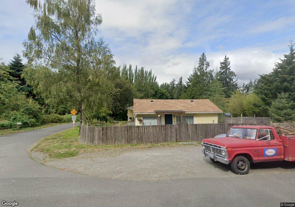
17119 Westside Hwy SW Vashon, WA 98070
Estimated Value: $627,491 - $735,000
2
Beds
1
Bath
1,220
Sq Ft
$568/Sq Ft
Est. Value
About This Home
This home is located at 17119 Westside Hwy SW, Vashon, WA 98070 and is currently estimated at $692,623, approximately $567 per square foot. 17119 Westside Hwy SW is a home located in King County with nearby schools including Chautauqua Elementary School, Mcmurray Middle School, and Vashon Island High School.
Ownership History
Date
Name
Owned For
Owner Type
Purchase Details
Closed on
Dec 10, 2008
Sold by
Lacina Mark J
Bought by
Hendricks Paula A and Hendricks Lacina Paula A
Current Estimated Value
Purchase Details
Closed on
Aug 1, 2008
Sold by
Laver Ian
Bought by
Zercher Edward and Zercher Kari
Purchase Details
Closed on
Sep 28, 1998
Sold by
Zike David W and Zike Carolyn N
Bought by
Lacina Mark J and Hendricks Paula A
Home Financials for this Owner
Home Financials are based on the most recent Mortgage that was taken out on this home.
Original Mortgage
$139,500
Interest Rate
6.88%
Purchase Details
Closed on
Jun 19, 1996
Sold by
Brice Laura L and Sherman Laura L
Bought by
Zike David W and Zike Carolyn N
Home Financials for this Owner
Home Financials are based on the most recent Mortgage that was taken out on this home.
Original Mortgage
$79,900
Interest Rate
8.25%
Create a Home Valuation Report for This Property
The Home Valuation Report is an in-depth analysis detailing your home's value as well as a comparison with similar homes in the area
Home Values in the Area
Average Home Value in this Area
Purchase History
| Date | Buyer | Sale Price | Title Company |
|---|---|---|---|
| Hendricks Paula A | -- | Chicago Title | |
| Zercher Edward | $470,100 | None Available | |
| Lacina Mark J | $155,000 | Pacific Northwest Title | |
| Zike David W | $82,400 | Commonwealth Land Title |
Source: Public Records
Mortgage History
| Date | Status | Borrower | Loan Amount |
|---|---|---|---|
| Previous Owner | Lacina Mark J | $139,500 | |
| Previous Owner | Zike David W | $79,900 |
Source: Public Records
Tax History Compared to Growth
Tax History
| Year | Tax Paid | Tax Assessment Tax Assessment Total Assessment is a certain percentage of the fair market value that is determined by local assessors to be the total taxable value of land and additions on the property. | Land | Improvement |
|---|---|---|---|---|
| 2024 | $1,742 | $523,000 | $119,000 | $404,000 |
| 2023 | $5,765 | $519,000 | $116,000 | $403,000 |
| 2022 | $5,470 | $591,000 | $128,000 | $463,000 |
| 2021 | $5,056 | $458,000 | $101,000 | $357,000 |
| 2020 | $4,434 | $383,000 | $92,000 | $291,000 |
| 2018 | $4,120 | $352,000 | $85,000 | $267,000 |
| 2017 | $3,369 | $313,000 | $81,000 | $232,000 |
| 2016 | $3,297 | $268,000 | $70,000 | $198,000 |
| 2015 | $2,691 | $257,000 | $70,000 | $187,000 |
| 2014 | -- | $202,000 | $58,000 | $144,000 |
| 2013 | -- | $182,000 | $58,000 | $124,000 |
Source: Public Records
Map
Nearby Homes
- 16832 Mcintyre Rd SW
- 16114 121st Ave SW
- 14511 Westside Hwy SW
- 12423 SW 151st St
- 9221 SW Bank Rd
- 13277 Shoreline Dr SE
- 12747 Fetters Ln SE
- 7776 SE Fragaria Rd
- 9904 Banner Rd SE
- 8865 SE Prospect Dr
- 9415 SE Goat Trail Rd
- 10320 SW Cove Rd
- 10211 SW Bank Rd Unit A & B
- 10312 SW 156th St
- 137 xx SW Madrona Rd
- 9045 SE Fragaria Rd
- 0 SE Banner Rd Unit NWM2438053
- 17400 (Lot 25) 97th Ave SW
- 6928 SE View Park Rd
- 20825 Old Mill Rd SW
- 17105 Westside Hwy SW
- 13515 SW 171st St
- 13530 SW 172nd St
- 17109 135th Place SW
- 17101 135th Place SW
- 17017 135th Ln SW
- 13533 SW 171st St
- 17012 135th Place SW
- 17008 135th Place SW
- 17005 135th Ln SW
- 13536 SW 171st St
- 13513 SW 170th St
- 17007 135th Place SW
- 13510 SW 170th St
- 13504 SW 170th St
- 17118 Tabor Ave SW
- 13522 SW 170th St
- 13518 SW 170th St
- 17133 Tabor Ave SW
- 17228 Westside Hwy SW