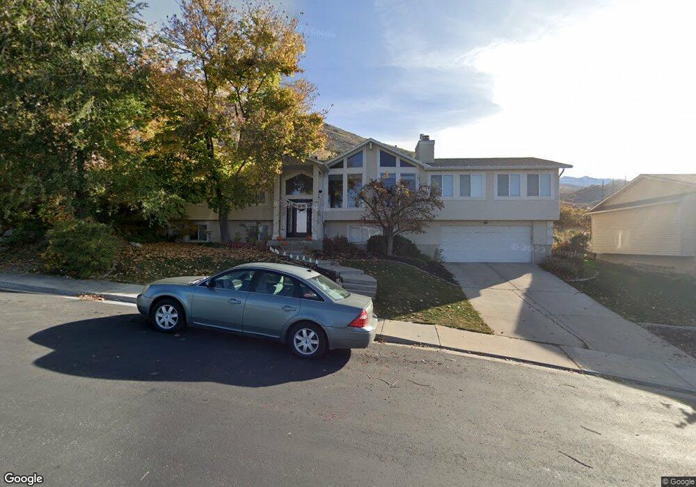
1712 Blackhawk Cir Pleasant Grove, UT 84062
Estimated Value: $608,000 - $660,662
6
Beds
3
Baths
2,448
Sq Ft
$259/Sq Ft
Est. Value
About This Home
This home is located at 1712 Blackhawk Cir, Pleasant Grove, UT 84062 and is currently estimated at $633,916, approximately $258 per square foot. 1712 Blackhawk Cir is a home located in Utah County with nearby schools including Valley View Elementary, Central Elementary School, and Oak Canyon Junior High School.
Ownership History
Date
Name
Owned For
Owner Type
Purchase Details
Closed on
Feb 24, 2022
Sold by
Christine Brown
Bought by
Brown Christine
Current Estimated Value
Home Financials for this Owner
Home Financials are based on the most recent Mortgage that was taken out on this home.
Original Mortgage
$25,000
Outstanding Balance
$23,297
Interest Rate
3.69%
Mortgage Type
Credit Line Revolving
Estimated Equity
$610,619
Purchase Details
Closed on
Jul 15, 2020
Sold by
Palmer Jason and Palmer Christine
Bought by
Palmer Christine
Purchase Details
Closed on
Jul 13, 2010
Sold by
Salgy Ricard R and Salgy Susan Leihana
Bought by
Palmer Jason and Palmer Christine
Home Financials for this Owner
Home Financials are based on the most recent Mortgage that was taken out on this home.
Original Mortgage
$322,555
Interest Rate
4.5%
Mortgage Type
FHA
Create a Home Valuation Report for This Property
The Home Valuation Report is an in-depth analysis detailing your home's value as well as a comparison with similar homes in the area
Home Values in the Area
Average Home Value in this Area
Purchase History
| Date | Buyer | Sale Price | Title Company |
|---|---|---|---|
| Brown Christine | -- | First American Title | |
| Palmer Christine | -- | Vanguard Title Ins Agcy Llc | |
| Palmer Jason | -- | First American Orem |
Source: Public Records
Mortgage History
| Date | Status | Borrower | Loan Amount |
|---|---|---|---|
| Open | Brown Christine | $25,000 | |
| Previous Owner | Palmer Jason | $322,555 |
Source: Public Records
Tax History Compared to Growth
Tax History
| Year | Tax Paid | Tax Assessment Tax Assessment Total Assessment is a certain percentage of the fair market value that is determined by local assessors to be the total taxable value of land and additions on the property. | Land | Improvement |
|---|---|---|---|---|
| 2025 | $2,574 | $328,790 | $229,800 | $368,000 |
| 2024 | $2,574 | $307,395 | $0 | $0 |
| 2023 | $2,568 | $313,775 | $0 | $0 |
| 2022 | $2,439 | $296,450 | $0 | $0 |
| 2021 | $2,144 | $396,800 | $144,300 | $252,500 |
| 2020 | $1,964 | $356,300 | $128,800 | $227,500 |
| 2019 | $1,818 | $341,200 | $113,700 | $227,500 |
| 2018 | $1,831 | $324,800 | $106,100 | $218,700 |
| 2017 | $1,822 | $160,930 | $0 | $0 |
| 2016 | $1,765 | $160,930 | $0 | $0 |
| 2015 | $1,635 | $141,185 | $0 | $0 |
| 2014 | $1,631 | $139,535 | $0 | $0 |
Source: Public Records
Map
Nearby Homes
- 521 S 1660 E
- 650 S 1600 E
- 897 Cherokee Dr
- 1515 E 720 S
- 745 S 1500 St E
- 935 S 1500 E
- 1172 E Murdock Dr
- 10 S 1400 E
- 177 S 1150 E
- 286 S 1150 E
- Prelude Plan at Blossom Hill
- Treble Plan at Blossom Hill
- Browning Plan at Blossom Hill
- Cantata Plan at Blossom Hill
- 176 S 1150 E
- Accord Plan at Blossom Hill
- Canon Plan at Blossom Hill
- Trio Plan at Blossom Hill
- Harrison Plan at Blossom Hill
- Adagio Plan at Blossom Hill
- 1712 E Blackhawk Cir
- 1710 Blackhawk Cir
- 1714 Blackhawk Cir
- 1692 Blackhawk Cir
- 1719 Blackhawk Dr
- 1708 Blackhawk Cir
- 1708 E Blackhawk Cir
- 1696 E Blackhawk Cir
- 1696 Blackhawk Cir
- 1725 Blackhawk Dr
- 1685 Blackhawk Dr
- 1685 Blackhawk Dr Unit 4
- 1685 E Blackhawk Dr
- 1500 E 200 S
- 1704 E Blackhawk Cir
- 1704 Blackhawk Cir
- 1708 Blackhawk Dr
- 1708 E Blackhawk Dr
- 1718 Blackhawk Dr
- 1694 Blackhawk Dr